
사용자:배우는사람/틀:지역 둘러보기/문서:히말라야 산맥
히말라야 산맥[편집]
| 히말라야 산맥 | |
| (지리 유형: 산맥) | |
 | |
| 나라 | 네팔 · 미얀마 · 부탄 · 아프가니스탄 · 인도 · 중화인민공화국 · 파키스탄 |
|---|---|
| 최고점 | 에베레스트 산 |
| - 높이 | 8,848 m (29,029 ft) |
| - 좌표 | 북위 27° 59′ 17″ 동경 86° 55′ 31″ / 북위 27.98806° 동경 86.92528° |


한영병기판[편집]
| Himalayas | |
| Range | |
The north face of 에베레스트 산(Mount Everest) as seen from the path to the base camp in 티베트 자치구(Tibet Autonomous Region), 중화인민공화국(People's Republic of China).
| |
| 나라 | Bhutan · 중화인민공화국(People's Republic of China) · India · Nepal · Pakistan · Burma · Afghanistan |
|---|---|
| 최고점 | Mount Everest |
| - 높이 | 8,848 m (29,029 ft) |
| - 좌표 | 북위 27° 59′ 17″ 동경 86° 55′ 31″ / 북위 27.98806° 동경 86.92528° |
The Himalaya Range (산스크리트어(Sanskrit): literally, "abode of snow", Hindi/Sanskrit: हिमालय(हिमालय), IPA: /hɪˈmɑːləj(ə)/), the Himalayas or Himalaya for short, is a 산맥(mountain range) in 아시아(Asia), separating the 인도아대륙(Indian subcontinent) from the Tibetan Plateau(Tibetan Plateau). By extension, it is also the name of a massive mountain system that includes the 카라코람 산맥(Karakoram), the 힌두쿠시 산맥(Hindu Kush), and other, lesser, ranges that extend out from the 파미르 고원(Pamir Knot).
Together, the Himalayan mountain system is the planet's highest, and home to the world's highest peaks, the 8000미터 봉우리(Eight-thousander)s, which include 에베레스트 산(Mount Everest) and K2(K2). To comprehend the enormous scale of this mountain range, consider that 아콩카과 산(Aconcagua), in the 안데스 산맥(Andes), at 6,962 미터 (22,841 ft) is the highest peak outside Asia, whereas the Himalayan system includes over 100 mountains(over 100 mountains) exceeding 틀:M to ft.[1]
Some of the world's major 강(river)s, 갠지스 강(Ganges), Indus(Indus), Brahmaputra(Brahmaputra), Yangtze(Yangtze), 메콩 강(Mekong), Salween(Salween), 홍 강(Red River (Asia)), Xunjiang(Xunjiang), Chao Phraya(Chao Phraya), 이라와디 강(Irrawaddy River), 아무다리야 강(Amu Darya), 시르다리야 강(Syr Darya), 타림 강(Tarim River) and 황하(Yellow River), rise in the Himalayas, and their combined 유역(drainage basin) is home to some 3 billion people (almost half of Earth's population) in countries which includes 아프가니스탄(Afghanistan), 방글라데시(Bangladesh), 부탄(Bhutan), 중화인민공화국(People's Republic of China), 인도(India), 네팔(Nepal), 미얀마(Burma), 캄보디아(Cambodia), 타지키스탄(Tajikistan), 우즈베키스탄(Uzbekistan), 투르크메니스탄(Turkmenistan), 카자흐스탄(Kazakhstan), 키르기스스탄(Kyrgyzstan), 타이(Thailand), 라오스(Laos), 베트남(Vietnam), 말레이시아(Malaysia) and 파키스탄(Pakistan).
The Himalayas have profoundly shaped the cultures of 남아시아(South Asia); many Himalayan peaks are sacred in 힌두교(Hinduism), 불교(Buddhism) and 시크교(Sikhism). The main Himalaya range runs, west to east, from the Indus river valley to the Brahmaputra river valley, forming an arc 틀:Km to mi long, which varies in width from 틀:Km to mi in the western Kashmir|카슈미르(Kashmir)-신장 위구르 자치구(Xinjiang) region to 틀:Km to mi in the eastern 티베트(Tibet)-아루나찰프라데시 주(Arunachal Pradesh) region. The range consists of three coextensive sub-ranges, with the northern-most, and highest, known as the Great or Inner Himalayas.
Ecology[편집]
 |
 |
 |
 |
The flora and fauna of the Himalayas varies with climate, rainfall, altitude, and soils. The climate ranges from tropical at the base of the mountains to permanent ice and snow at the highest elevations. The amount of yearly rainfall increases from west to east along the front of the range. This diversity of climate, altitude, rainfall and soil conditions generates a variety of distinct plant and animal communities.
Lowland forests[편집]
On the Indo-Gangetic plain(Indo-Gangetic plain) at the base of the mountains, an 충적 평야(alluvial plain) drained by the Indus and Ganga-Brahmaputra river systems, vegetation varies from west to east with rainfall. The xeric(xeric) Northwestern thorn scrub forests(Northwestern thorn scrub forests) occupy the plains of Pakistan and the 펀자브 주 (인도)(Indian Punjab). Further east lie the Upper Gangetic plains moist deciduous forests(Upper Gangetic plains moist deciduous forests) of 우타라칸드 주(Uttarakhand) and 우타르프라데시 주(Uttar Pradesh) and Lower Gangetic plains moist deciduous forests(Lower Gangetic plains moist deciduous forests) of 비하르 주(Bihar) and 웨스트벵골 주(West Bengal). These are monsoon forests, with drought-deciduous trees that lose their leaves during the dry season. The moister Brahmaputra Valley semi-evergreen forests(Brahmaputra Valley semi-evergreen forests) occupy the plains of 아삼 주(Assam).
The Terai belt[편집]
Above the alluvial plain lies the Terai(Terai) strip, a seasonally marshy zone of sand and clay soils. The Terai has higher rainfall than the plains, and the downward-rushing rivers of the Himalaya slow down and spread out in the flatter Terai zone, depositing fertile silt during the monsoon season, and receding in the dry season. The Terai has a high water table due to groundwater percolating down from the adjacent zone. The central part of the Terai belt is occupied by the Terai-Duar savanna and grasslands(Terai-Duar savanna and grasslands), a mosaic of grasslands, savannas, deciduous and evergreen forests that includes some of the world's tallest grasslands. The grasslands of the Terai belt are home to the Indian rhinoceros(Indian rhinoceros) (Rhinoceros unicornis).
Bhabhar belt[편집]
Above the Terai belt is an upland zone known as the Bhabhar(Bhabhar), a zone of porous and rocky soils, made up of debris washed down from the higher ranges. The Bhabhar and the lower Shiwalik ranges have a subtropical climate. The Himalayan subtropical pine forests(Himalayan subtropical pine forests) occupy the western end of the subtropical belt, with forests dominated by Chir Pine(Chir Pine) (Pinus roxburghii). The central part of the range is home to the Himalayan subtropical broadleaf forests(Himalayan subtropical broadleaf forests), dominated by the sal tree(sal tree) (Shorea robusta). They are at the foot of the Himalayas where the Himalayan streams descend on to the plains.
Shiwalik Hills[편집]
Also called Churia or Margalla Hills, Sivalik Hills(Sivalik Hills) is an intermittent outermost range of foothills extending across the Himalayan region through 파키스탄(Pakistan), 인도(India), 네팔(Nepal) and 부탄(Bhutan). This region consists of many sub-ranges. Summits are generally 600 to 1,200 미터 (2,000 to 3,900 ft). Steeper southern slopes form along a fault zone called Himalayan Frontal Thrust (HFT); northern slopes are gentler. Permeable conglomerates and other rocks allow rainwater to percolate downslope into the Bhabhar and Terai, supporting only scrubby forests upslope. The Himalayan subtropical pine and broadleaf forests continue here.
Inner Terai or Dun Valleys[편집]
The Inner Terai valleys(Inner Terai valleys) are open valleys north of Shiwalik Hills or nestled between Shiwalik subranges. Examples include Dehra Dun(Dehra Dun) in India and Chitwan(Chitwan) in Nepal. Himalayan subtropical broadleaf forests grow here.
Lesser Himalaya[편집]
Also called Mahabharat Range(Mahabharat Range), the Lesser Himalayas is a prominent range 2,000 to 3,000 미터 (6,600 to 9,800 ft) high formed along the Main Boundary Thrust fault zone, with a steep southern face and gentler northern slopes. They are nearly continuous except for river gorges, where rivers from to the north gather like candelabra in a handful of places to break through the range.
At these elevations and above the 생물지리학(biogeography) of the Himalayas is generally divided by the Kali Gandaki Gorge(Kali Gandaki Gorge) in central Nepal, one of the deepest canyons in the world.
At the middle elevations of the range, the subtropical forests yield to a belt of temperate broadleaf and mixed forests(temperate broadleaf and mixed forests) growing between 1,500 and 3,000 미터 (4,900 and 9,800 ft), with the western Himalayan broadleaf forests(western Himalayan broadleaf forests) to the west of the Gandaki River, and the eastern Himalayan broadleaf forests(eastern Himalayan broadleaf forests) to the east. The western broadleaf forests stretch from the Kashmir Valley(Kashmir Valley), across Himachal Pradesh and Uttarakhand, and through western Nepal. The eastern broadleaf forests stretch across eastern Nepal, through Sikkim and Bhutan, and through much of Arunachal Pradesh.
Midlands[편집]
This 'hilly' region (Pahad), averaging about 1,000 미터 (3,300 ft) immediately north of the Mahabharat Range, rises over about 100 킬로미터 (330,000 ft) to about 4,000 미터 (13,000 ft) at the Main Central Thrust fault zone, where the Greater Himalaya begin.
Above the broadleaf forests, between 3,000 and 4,000 미터 (9,800 and 13,100 ft), are temperate coniferous forests(temperate coniferous forests), likewise split by the Gandaki River. The western Himalayan subalpine conifer forests(western Himalayan subalpine conifer forests) are found below treeline in northern Pakistan, Jammu and Kashmir, Himachal Pradesh, Uttarakhand, and western Nepal. The eastern Himalayan subalpine conifer forests(eastern Himalayan subalpine conifer forests) are found in eastern Nepal, Sikkim, Bhutan, and Arunachal Pradesh. Along the border between Arunachal Pradesh and Tibet, the eastern subalpine conifer forests mix with the northeastern Himalayan subalpine conifer forests(northeastern Himalayan subalpine conifer forests). East Himalayan Fir(East Himalayan Fir), West Himalayan Spruce(West Himalayan Spruce), and Himalayan Hemlock(Himalayan Hemlock) are some important trees of these forests. 진달래속(Rhododendron)s are exceptionally diverse here, with over 60 species recorded in the northeastern Himalayan subalpine conifer forests.
Greater Himalaya[편집]
North of the Main Central Thrust, the highest ranges rise abruptly as much as 4,000 미터 (13,000 ft) into the realm of perpetual snow and ice. As the Himalayan system becomes wider from east to west, the number of parallel high ranges increases. For example, Kagmara and Kanjiroba ranges both reach well over 6,000 미터 (20,000 ft) north of the 다울라기리(Dhaulagiri) Himalaya in central 네팔(Nepal).
Montane grasslands and shrublands(Montane grasslands and shrublands) grow above treeline. The northwestern Himalayan alpine shrub and meadows(northwestern Himalayan alpine shrub and meadows) are found in the high elevations of northern Pakistan, Jammu and Kashmir, and Himachal Pradesh. To the east, the western Himalayan alpine shrub and meadows(western Himalayan alpine shrub and meadows) cover extensive areas along the Tibetan border with Uttarakhand and western Nepal. The eastern Himalayan alpine shrub and meadows(eastern Himalayan alpine shrub and meadows) grow above the eastern and northeastern subalpine conifer forests, along the Tibetan border with eastern Nepal, Sikkim, Bhutan, and Arunachal Pradesh. The shrublands are composed of 노간주나무속(juniper)s as well as a wide variety of 진달래속(rhododendron)s. They also possess a remarkable variety of wildflowers: Valley of Flowers National Park(Valley of Flowers National Park) in the western Himalayan alpine shrub and meadows contains hundreds of species. The upper limit of the grasslands increases from west to east, rising from 3,500 미터 (11,500 ft) to 5,500 미터 (18,000 ft). The grasslands are the summer habitat of the endangered snow leopard(snow leopard) (Uncia uncia).
Trans-Himalaya[편집]
The watershed between rivers flowing south into the Ganges or Indus and rivers flowing north into the Brahmaputra or mainstem Indus that flow around the ends of the entire range often follows somewhat lower, less rugged mountains tens of kilometers north of the highest ranges. South-flowing rivers form valleys in this region, often semi-arid due to rainshadow effects. These valleys hold some of the highest permanent villages on earth.
Origins and growth[편집]

The Himalayas are among the youngest mountain ranges on the planet, and consist mostly of uplifted sedimentary(sedimentary) and 변성암(metamorphic rock). According to the modern theory of 판 구조론(plate tectonics), their formation is a result of a continental collision(continental collision) or 조산 운동(orogeny) along the convergent boundary(convergent boundary) between the Indo-Australian Plate(Indo-Australian Plate) and the 유라시아판(Eurasian Plate). This is referred to as a fold mountain(fold mountain).
The collision began in the 백악기(Upper Cretaceous) period about 70 million years ago, when the north-moving Indo-Australian Plate(Indo-Australian Plate), moving at about 15 cm per year, collided with the 유라시아판(Eurasian Plate). About 50 million years ago, this fast moving Indo-Australian plate had completely closed the 테티스 해(Tethys Ocean), the existence of which has been determined by 퇴적암(sedimentary rock)s settled on the ocean floor, and the 화산(volcano)es that fringed its edges. Since these sediments were light, they crumpled into mountain ranges rather than sinking to the floor. The Indo-Australian plate continues to be driven horizontally below the Tibetan plateau(Tibetan plateau), which forces the plateau to move upwards. The 아라칸 산맥(Arakan Yoma) highlands in Myanmar(Myanmar) and the 안다만 니코바르 제도(Andaman and Nicobar Islands) in the 벵골 만(Bay of Bengal) were also formed as a result of this collision.
The Indo-Australian plate is still moving at 67 mm per year, and over the next 10 million years it will travel about 1,500 km into Asia. About 20 mm per year of the India-Asia convergence is absorbed by thrusting(thrusting) along the Himalaya southern front. This leads to the Himalayas rising by about 5 mm per year, making them geologically active. The movement of the Indian plate into the Asian plate also makes this region seismic(seismic)ally active, leading to 지진(earthquake)s from time to time.
Glaciers and river systems[편집]
The Himalayan range encompasses about 15,000 빙하(glacier)s, which store about 12,000 km3 of freshwater. The 70 km-long Siachen Glacier(Siachen Glacier) at the India-Pakistan border is the second longest glacier in the world outside the polar region. Some of the other more famous glaciers include the Gangotri(Gangotri) and Yamunotri(Yamunotri) (우타라칸드 주(Uttarakhand)), Nubra, Biafo and Baltoro (카라코람 산맥(Karakoram) region), Zemu (시킴 주(Sikkim)) and Khumbu(Khumbu) glaciers (에베레스트 산(Mount Everest) region).
The higher regions of the Himalayas are snowbound throughout the year, in spite of their proximity to the 열대(tropics), and they form the sources for several large perennial rivers(perennial rivers), most of which combine into two large river systems:
- The western rivers combine into the Indus Basin, of which the 인더스 강(Indus River) is the largest. The Indus begins in Tibet at the confluence of Sengge and Gar rivers and flows southwest through 인도(India) and then through 파키스탄(Pakistan) to the 아라비아 해(Arabian Sea). It is fed by the 젤룸 강(Jhelum), the Chenab(Chenab), the 라비 강(Ravi), the 베아스 강(Beas), and the Sutlej(Sutlej) rivers, among others.
- Most of the other Himalayan rivers drain the Ganga-Brahmaputra Basin. Its two main rivers are the Ganga(Ganga) and the Brahmaputra(Brahmaputra) and the 야무나 강(Yamuna), among other tributaries. The Brahmaputra originates as the Yarlung Tsangpo River(Yarlung Tsangpo River) in western Tibet, and flows east through 티베트(Tibet) and west through the plains of 아삼 주(Assam). The Ganga and the Brahmaputra meet in 방글라데시(Bangladesh), and drain into the 벵골 만(Bay of Bengal) through the world's largest 삼각주(river delta).[2]
The eastern-most Himalayan rivers feed the Ayeyarwady River(Ayeyarwady River), which originates in eastern Tibet and flows south through Myanmar(Myanmar) to drain into the 안다만 해(Andaman Sea).
The Salween(Salween), 메콩 강(Mekong), 창 강(Yangtze) and the Huang He(Huang He) (Yellow River) all originate from parts of the Tibetan plateau(Tibetan plateau) that are geologically distinct from the Himalaya mountains, and are therefore not considered true Himalayan rivers. Some geologists refer to all the rivers collectively as the circum-Himalayan rivers.[3] In recent years, scientists have monitored a notable increase in the rate of glacier retreat(glacier retreat) across the region as a result of global 기후 변화(climate change).[4] Although the effect of this will not be known for many years, it potentially could mean disaster for the hundreds of millions of people who rely on the 빙하(glacier)s to feed the rivers of northern 인도(India) during the dry seasons.[5]
-

-
 This image shows the termini of the glaciers in the Bhutan-Himalaya. Glacial lakes have been forming rapidly on the surface of the debris-covered glaciers in this region during the last few decades.
 -
 Snow-capped peaks and ridges of the eastern Himalaya Mountains create an irregular white-on-red patchwork between major rivers in south-western China.


Lakes[편집]

The Himalaya region is dotted with hundreds of lakes. Most lakes are found at altitudes of less than 5,000 m, with the size of the lakes diminishing with altitude. The largest lake is the Pangong Tso(Pangong Tso), which is spread across the border between India and China. It is situated at an altitude of 4,600 m, and is 8 km wide and nearly 134 km long. A notable high (but not the highest) lake is the Gurudogmar(Gurudogmar) in North Sikkim(North Sikkim), at an altitude of 5,148 m (17,100 ft) (altitude source: SRTM(SRTM)). Other major lakes include the Tsongmo lake(Tsongmo lake), near the Indo-China border in Sikkim, and Tilicho lake(Tilicho lake) in Nepal in the Annapurna massif, a large lake in an area that was closed to tourists until recently.
The mountain lakes are known to geographers as tarns(tarns) if they are caused by glacial activity. Tarns are found mostly in the upper reaches of the Himalaya, above 5,500 metres. For more information about these, see here.[6]
Impact on climate[편집]

The Himalayas have a profound effect on the 기후(climate) of the 인도아대륙(Indian subcontinent) and the Tibetan plateau(Tibetan plateau). They prevent frigid, dry 북극(Arctic) winds blowing south into the subcontinent, which keeps 남아시아(South Asia) much warmer than corresponding temperate(temperate) regions in the other continents. It also forms a barrier for the 계절풍(monsoon) winds, keeping them from traveling northwards, and causing heavy rainfall in the Terai(Terai) region. The Himalayas are also believed to play an important part in the formation of 중앙아시아(Central Asia)n deserts(deserts), such as the Taklamakan(Taklamakan) and Gobi(Gobi).
The mountain ranges also prevent western winter disturbances in 이란(Iran) from traveling further, resulting in snow in 카슈미르(Kashmir) and rainfall for parts of 펀자브 (동음이의)(Punjab) and northern India. Despite being a barrier to the cold, northernly winter winds, the Brahmaputra valley receives part of the frigid winds, thus lowering the temperature in the North East India(North East India) and 방글라데시(Bangladesh).
The Himalayas, which are often called "The Roof of the World", contain the greatest area of glaciers and permafrost outside of the poles. Ten of Asia’s largest rivers flow from here, and more than a billion people’s livelihoods depend on them. To complicate matters, temperatures are rising more rapidly here than the global average. In Nepal, the temperature has risen 0.6 degree C over the last decade, whereas the global warming has been around 0.7 degree C over the last hundred years.[7]
Mountain passes[편집]

The rugged terrain makes few routes through the mountains possible. Some of these routes include:
- Banihal(Banihal) is an important pass connecting the hill areas of Jammu to the Kashmir Valley(Kashmir Valley).
- Zoji La(Zoji La) lies between the vale of Kashmir and the Kargil district(Kargil district), and is the only Western entrance to the highlands of 라다크(Ladakh).
- Rohtang Pass(Rohtang Pass) in 히마찰프라데시 주(Himachal Pradesh), India.
- Mohan Pass(Mohan Pass) is the principal pass in the Siwalik Hills(Siwalik Hills), the southern most and geologically youngest foothills running parallel to the main Himalayas in Sikkim.
- Kora La(Kora La) at 4,594 미터 (15,072 ft) elevation on the 네팔(Nepal)-티베트(Tibet) border at the upper end of Mustang|머스탱(Mustang). The Kali Gandaki Gorge(Kali Gandaki Gorge) (a 지구 (지질학)(graben)),[8] transects the main Himalaya and Transhimalayan ranges. Kora La is the lowest pass through both ranges between K2(K2) and Everest(Everest), but some 300 미터 (980 ft) higher than Nathula and Jelepla passes further east between Sikkim and Tibet.
- Arniko Rajmarg(Arniko Rajmarg)/Friendship Highway(Friendship Highway) route from 카트만두(Kathmandu), 네팔(Nepal) crossing into 티베트(Tibet) at Kodari/Zhangmu(Zhangmu), to Nyalam(Nyalam), Lalung-La pass (5,050m/16,570'), Tingri(Tingri), Xêgar(Xêgar), Lakpa La pass (5,250m/17,225'), to Lhatse(Lhatse) on the Yarlung Tsangpo(Yarlung Tsangpo)/Brahmaputra(Brahmaputra) River about 460 road kilometers west of 라싸 시(Lhasa).
- 강토크(Gangtok) in 시킴 주(Sikkim) to 라싸 시(Lhasa) in Tibet, via the Nathula Pass(Nathula Pass) and Jelepla Pass(Jelepla Pass)es (offshoots of the ancient 비단길(Silk Road)).
Impact on politics and culture[편집]

It should be noted that almost half of the humans and 가축(livestock) of India live on one-third of the landscape within 500 km of the Himalayan range.(pdf, 3mb)
The Himalayas, due to their large size and expanse, have been a natural barrier to the movement of people for tens of thousands of years. In particular, this has prevented intermingling of people from the 인도아대륙(Indian subcontinent) with people from China and 몽골(Mongolia), causing significantly different languages and customs between these regions. The Himalayas have also hindered trade routes and prevented military expeditions across its expanse. For instance, 칭기즈 칸(Genghis Khan) could not expand his empire south of the Himalayas into the subcontinent.
Notable peaks of the Himalayan system (includes outlying ranges)[편집]
| Peak Name | Other names and meaning | Elevation (m) | Elevation (ft) | First Western ascent | Notes |
|---|---|---|---|---|---|
| 에베레스트 산(Everest) | Sagarmatha (Nepali), "Head of the World",[9] Chomolangma (Tibetan), "Goddess mother of the snows"[9] |
8,848 | 29,035.44 | 1953 | Highest mountain on Earth, on the border between 네팔(Nepal) and 티베트 자치구(Tibet Autonomous Region), 중화인민공화국(People's Republic of China). |
| K2(K2) | Chogo Gangri | 8,611 | 28,251 | 1954 | 2nd highest mountain on Earth. Located on the border between the Taxkorgan Tajik Autonomous County(Taxkorgan Tajik Autonomous County) of 신장 위구르 자치구(Xinjiang), 중화인민공화국(People's Republic of China) and the Northern Areas(Northern Areas) of 파키스탄(Pakistan). |
| 칸첸중가(Kangchenjunga) | Kangchen Dzö-nga, "Five Treasures of the Great Snow" | 8,586 | 28,169 | 1955 | 3rd highest mountain on Earth. Located on the border between 네팔(Nepal) and 시킴 주(Sikkim), 인도(India). |
| 로체(Lhotse) | "South Peak" | 8,516 | 27,940 | 1956 | 4th highest mountain on Earth. Situated between 티베트 자치구(Tibet Autonomous Region), 중화인민공화국(People's Republic of China), and 네팔(Nepal), in the shadow of Mount Everest. |
| 마칼루(Makalu) | "The Great Black" | 8,462 | 27,765 | 1955 | 5th highest mountain on Earth. Situated on the border between, 티베트 자치구(Tibet Autonomous Region), 중화인민공화국(People's Republic of China) and 네팔(Nepal). |
| 초오유(Cho Oyu) | Qowowuyag, "Turquoise Goddess" | 8,201 | 26,905 | 1954 | 6th highest mountain on Earth. Situated on the border between Tibet Autonomous Region, People's Republic of China, and Nepal |
| 다울라기리(Dhaulagiri) | "White Mountain" | 8,167 | 26,764 | 1960 | 7th highest mountain on Earth. Situated in Nepal. |
| 마나슬루(Manaslu) | Kutang, "Mountain of the Spirit" | 8,156 | 26,758 | 1956 | 8th highest mountain on Earth. Located in the Gurkha Himal, Nepal. |
| 낭가파르바트(Nanga Parbat) | Diamir, "Naked Mountain" | 8,126 | 26,660 | 1953 | 9th highest mountain on Earth. Located in the Northern Areas(Northern Areas) of 파키스탄(Pakistan). |
| 안나푸르나(Annapurna) | "Goddess of the Harvests" | 8,091 | 26,545 | 1950 | 10th highest mountain on Earth. Situated in Nepal. |
| 가셔브룸 1봉(Gasherbrum I) | "Beautiful Mountain" | 8,080 | 26,509 | 1958 | 11th highest mountain on Earth. Located in the 카라코람 산맥(Karakoram) of 파키스탄(Pakistan) |
| 브로드피크(Broad Peak) | Faichan Kangri | 8,047 | 26,401 | 1957 | 12th highest mountain on Earth. Located in the 카라코람 산맥(Karakoram) of 파키스탄(Pakistan). |
| 가셔브룸 2봉(Gasherbrum II) | - | 8,035 | 26,362 | 1956 | 13th highest mountain on Earth. Located in the 카라코람 산맥(Karakoram) of 파키스탄(Pakistan). |
| 시샤팡마(Shishapangma) | Xixiabangma, "Crest Above The Grassy Plains" | 8,013 | 26,289 | 1964 | 14th highest mountain on Earth. Located in Tibet Autonomous Region, People's Republic of China. |
| 갸충캉(Gyachung Kang) | unknown | 7,952 | 26,089 | 1964 | 15th highest mountain on Earth. Located on the border between Tibet Autonomous Region, People's Republic of China, and Nepal, it is the highest mountain under 8,000 meters. |
| Gasherbrum IV(Gasherbrum IV) | - | 7,925 | 26,001 | 1958 | 17th highest mountain on Earth. Located in the 카라코람 산맥(Karakoram) of 파키스탄(Pakistan). |
| 마셔브룸(Masherbrum) | unknown | 7,821 | 25,660 | 1960 | 22nd highest mountain on Earth. Located in the 카라코람 산맥(Karakoram) of 파키스탄(Pakistan). |
| Nanda Devi(Nanda Devi) | "Bliss-giving Goddess" | 7,817 | 25,645 | 1936 | 23rd highest mountain on Earth. Located in 우타라칸드 주(Uttarakhand), 인도(India). It is the highest peak entirely within India. |
| Rakaposhi(Rakaposhi) | "Shining Wall" | 7,788 | 25,551 | 1958 | A massive peak that towers above local terrain. Located in the Pakistani 카라코람 산맥(Karakoram). |
| 강카르 푼섬(Gangkhar Puensum) | Gankar Punzum, "Three Mountain Siblings" | 7,570 | 24,836 | Unclimbed | World's highest unclimbed peak remains off limits to mountaineers. Located in the Kingdom of Bhutan. |
| Ama Dablam(Ama Dablam) | "Mother And Her Necklace" | 6,848 | 22,467 | 1961 | Considered by some[누가?] to be one of the most beautiful peaks in the Himalayas. Located in the Khumbu(Khumbu), Nepal. |
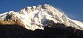
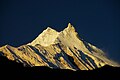
Panorama[편집]


Notable Himalayan mountaineers[편집]
- George Mallory(George Mallory) (1886–1924) Attempted first ascent(first ascent) of 에베레스트 산(Mount Everest) in 1922 and 1924; died on North Face along with Sandy Irvine(Sandy Irvine).
- Noel Odell(Noel Odell) (1890–1987) British. First ascent, in 1936, of Nanda Devi(Nanda Devi), which remained the highest summitted peak until 1950. Last person to see Mallory and Irvine high up on Everest in 1924.
- Bill Tilman(Bill Tilman) (1898–1977) British. First ascent of Nanda Devi in 1936. In 1934, first person to penetrate Nanda Devi(Nanda Devi) sanctuary
- Frank Smythe(Frank Smythe) (1900–1949) British. Kamet(Kamet), and early attempt on Kangchenjunga.
- Eric Shipton(Eric Shipton) (1907–1977) British. With Bill Tilman, first to penetrate Nanda Devi sanctuary. Discovered route to Everest over Khumbu Glacier(Khumbu Glacier).
- John Hunt(John Hunt) (1910–1998) British. Leader of 1953 expedition of Mount Everest.
- 텐징 노르가이(Tenzing Norgay) (1914–1986) Nepalese 셰르파족(Sherpa) mountaineer. First man on Everest's summit along with Edmund Hillary.
- Maurice Herzog(Maurice Herzog) (b. 1919) First person to summit an Eight-thousander, 안나푸르나(Annapurna), in 1950. Lost all toes and most fingers due to frostbite. Peak not climbed again until 1970.
- Sir 에드먼드 힐러리(Edmund Hillary) (1919–2008) New Zealand mountaineer and explorer, the first man on Everest's summit along with Tenzing Norgay.
- Tom Bourdillon(Tom Bourdillon) (1924–1956) member of British Everest expeditions 1951, 1952, and 1953, reached 300 피트 (90 m) from summit of 에베레스트 산(Everest) three days before 에드먼드 힐러리(Edmund Hillary) and 텐징 노르가이(Tenzing Norgay) finally conquered it.
- Hermann Buhl(Hermann Buhl) (1924–1957) First ascent of 낭가파르바트(Nanga Parbat) in 1953 (feat accomplished solo and without oxygen). First ascent of 브로드피크(Broad Peak). Died in fall on 초골리사(Chogolisa), body never found.
- Willi Unsoeld(Willi Unsoeld) (1926–1979) United States. First ascent of Everest from West Face and first major traverse(traverse) of a Himalayan peak, with Tom Hornbein(Tom Hornbein) 1963. Daughter Nanda Devi Unsoeld killed during Nanda Devi(Nanda Devi) expedition 1976. Died during avalanche on Mount Rainier(Mount Rainier), 1979.
- Chris Bonington(Chris Bonington) (b. 1934) First ascent of 안나푸르나(Annapurna) (South Face), 4 ascents of Everest.
- Nawang Gombu(Nawang Gombu) (b. 1936) Indian mountaineer. First person to climb Everest twice: 1963 and 1965.
- Jim Whittaker(Jim Whittaker) (b. 1936) United States. First American to summit Everest.
- 라인홀트 메스너(Reinhold Messner) (born 1944) Italian mountaineer. First man to climb all fourteen mountains over 8000 metres (collectively known as the eight-thousanders(eight-thousanders)).
- 예지 쿠쿠츠카(Jerzy Kukuczka) (1948–1989) Polish mountaineer. Ascended all fourteen eight-thousanders(eight-thousanders) faster than anybody else, establishing ten new routes.
- Nazir Sabir(Nazir Sabir) Pakistani mountaineer. First ascent of two eight thousanders (Broad Peak & Gasherbrum II) in a single attempt.
- Swami Sundaranand(Swami Sundaranand) (b. 1926 India) Climbed 25 mountains with little or no equipment from 1950-1990 to experience open eyed Samādhi(Samādhi) using the ancient techniques of the Himalayan yogis. Noted also for his extensive photography of the Indian Himalayas.[10][11][12]
- Casey Mackins An English mountaineer who climbed Mt Everest by a new route without oxygen from Tibet in 1984 and then again from Nepal in 1990 during his famous Sea to Summit expedition where he became the first person to climb Everest starting from sea level
- José Antonio Delgado Sucre(José Antonio Delgado Sucre)(1965–2006) was the first Venezuelan mountaineer to reach the summit of five eight-thousanders. He was one of the most experienced climbers in Latin America.
- Ed Viesturs(Ed Viesturs) (b. June 22, 1959) is the first American, and 12th person overall, to summit all fourteen eight-thousanders(eight-thousanders), and the sixth climber to do it without bottled oxygen.
- Pemba Dorjie(Pemba Dorjie) (born c. 1977) a Sherpa who currently holds the world record for the quickest climb to the summit of Mount Everest from camp. On May 21, 2004 Dorjie set that record, with a total time of 8 hours and 10 minutes.
- Apa Sherpa(Apa Sherpa) (born c. 1960) On May 21, 2009, successfully summited Mt. Everest for the 19th time, breaking his own record for most successful ascents.
- 크리스토프 비엘리키(Krzysztof Wielicki) (born 1950) Polish mountaineer, the fifth man to climb all fourteen eight-thousanders. Three of them (Mount Everest, Kangchenjunga and Lhotse) he ascended as the first man ever to do it in winter.
Religion[편집]


Several places in the Himalaya are of religious significance in 힌두교(Hinduism) and 불교(Buddhism). In Hinduism, the Himalaya have also been personified as the god Himavat(Himavat), the father of 시바(Shiva)'s consort, Parvati(Parvati).
Some of the important religious places in the Himalayas are:-
- Haridwar(Haridwar), the place where the river Ganga(Ganga) enters the 평야(plain)s.
- Badrinath(Badrinath), a temple|사원(temple) dedicated to 비슈누(Vishnu).
- Kedarnath(Kedarnath), where one of the 12 Jyotirlinga(Jyotirlinga)s is located.
- Gaumukh(Gaumukh), the source of the Bhagirathi(Bhagirathi) (and hence, by extension, the Ganga(Ganga)), located a few miles above the town of Gangotri(Gangotri).
- Devprayag(Devprayag), where the Alaknanda(Alaknanda) and Bhagirathi(Bhagirathi) merge to form the Ganga(Ganga).
- Rishikesh(Rishikesh), has a temple of Lakshmana(Lakshmana).
- Mount Kailash(Mount Kailash), a 6,638 m high peak which is the abode of the Hindu(Hindu) Gods 시바(Shiva) and Uma and is also venerated by Buddhist(Buddhist)s. The peak is forbidden to climb, it is so sacred it is circled at its base. Lake Manasarowar(Lake Manasarowar) lies at the base of Mount Kailash, and is the source of the Brahmaputra(Brahmaputra).
- Amarnath(Amarnath), has a natural 시바(Shiva) linga(linga) of ice which forms for a few weeks each year. Thousands of people visit this cave during these few weeks.
- The Vaishno Devi(Vaishno Devi) is a popular shrine among Durga(Durga) devotees.
- Sri Hemkund Sahib(Sri Hemkund Sahib) - Sikh gurudwara where Guru Gobind Singh is claimed to have meditated and achieved enlightenment in a previous incarnation.
In addition to the above, a number of 티베트 불교(Tibetan Buddhist) sites are situated in the Himalaya, including the residence of the 달라이 라마(Dalai Lama). There were over 6,000 monasteries(monasteries) in Tibet.[13] The Tibetan Muslims(Tibetan Muslims) had their own mosques in 라싸 시(Lhasa) and 르카쩌 시(Shigatse).[14]
The following mystic entities are associated with the Himalayas:
- The 예티(Yeti) is one of the most famous creatures in 미확인동물학(cryptozoology). It is a large 영장류(primate)-like creature that is supposed to live in the Himalaya. Most mainstream scientists and experts consider current evidence of the Yeti's existence unpersuasive, and the result of hoaxes, legend or misidentification of mundane creatures.
- Shambhala(Shambhala) is a mystical city with various legends associated with it, it is one of twenty-four Himalayan hidden realms, or beyul(beyul), in 밀교(Vajrayana) Buddhism.[15] While some legends consider it to be a real city where secret Buddhist doctrines are being preserved, other legends believe that the city does not physically exist, and can only be reached in the mental realm.
The Himalayas in art, literature, and film[편집]
- Kim|킴(Kim), by 러디어드 키플링(Rudyard Kipling), is the signature account of life in 19th century 인도(India) as seen through British eyes and is based on the exploits of a young boy in the Himalayas and plains of India while engaged in the Great Game(Great Game).
- 샹그릴라(Shangri-La) is a fictional 유토피아(utopia) situated somewhere in the Himalayas, based on the legendary Shambhala(Shambhala). It is described in the novel Lost Horizon|잃어버린 지평선(Lost Horizon), written by the 영국(British) writer 제임스 힐턴(James Hilton) in 1933.
- Tintin in Tibet(Tintin in Tibet) is one of the series of classic comic-strip albums, written and illustrated by Belgian(Belgian) writer and illustrator 에르제(Hergé), featuring the young reporter Tintin investigating a plane crash in the Gosain Than(Gosain Than) massif in the Himalayas. (1960)
- The 할리우드(Hollywood) movie Vertical Limit(Vertical Limit) (2000), is set in the K2(K2) peak of the Himalayas, in 파키스탄(Pakistan).
- Several levels of Tomb Raider II(Tomb Raider II) and one level in Tomb Raider: Legend(Tomb Raider: Legend) of the Tomb Raider series(Tomb Raider series) are situated in the Himalayas.
- The Inheritance of Loss written by Kiran Desai(Kiran Desai) is partly set in the Himalaya Mountains.
- Rumer Godden(Rumer Godden)'s novel Black Narcissus(Black Narcissus) (1939) is about an order of nuns who set up a convent in the Himalayas. The film, released in 1947 by Powell and Pressburger(Powell and Pressburger) and starring 데버러 커(Deborah Kerr), was not actually shot in the Himalayas and relied primarily on matte paintings(matte paintings) to evoke the mountains.
- 이사벨 아옌데(Isabel Allende)'s novel, Kingdom of the Golden Dragon(Kingdom of the Golden Dragon) takes place mostly in the Forbidden Kingdom, a fictional country in the Himalayas.
- Dragon Rider(Dragon Rider) is authored by Cornelia Funke(Cornelia Funke) and tells the story of an epic journey that a small boy, a brownie(brownie), and a dragon take to the "Rim of Heaven," a place in the Himalayas where dragons reside.
- Expedition Everest(Expedition Everest) - Legend of the Forbidden Mountain is an elaborately themed roller coaster located at Disney's Animal Kingdom(Disney's Animal Kingdom) at Walt Disney World(Walt Disney World) that takes riders through a yeti-guarded Mount Everest.
- 티베트에서의 7년(Seven Years in Tibet) is an autobiographical travel book written by Austrian mountaineer 하인리히 하러(Heinrich Harrer) based on his real life experiences in 티베트(Tibet) between 1944 and 1951 during the Second World War and the interim period before the Communist Chinese People's Liberation Army invaded Tibet in 1950. Heinrich Harrer took part in a German mountaineering expedition to the Himalayas, intending to climb 낭가파르바트(Nanga Parbat), the ninth-highest mountain in the world.
- Seven Years in Tibet (1997 film)(Seven Years in Tibet (1997 film)) is a 1997|1997년(1997) film based on 티베트에서의 7년(the book of the same name) written by 오스트리아(Austria)n mountaineer(mountaineer) 하인리히 하러(Heinrich Harrer).
- Journey of a Red Fridge (2007), directed by Lucian and Natasa Muntean (Lunam Docs(Lunam Docs)), is an award-winning documentary that tells the story of child porters(porters) working in the Himalayan mountains of 네팔(Nepal).
See also[편집]
- American Himalayan Foundation(American Himalayan Foundation)
- Baltistan(Baltistan)
- Mountain ranges of Pakistan(Mountain ranges of Pakistan)
- Eastern Himalaya(Eastern Himalaya)
- Indian Himalayan Region(Indian Himalayan Region)
- 8000미터 봉우리(Eight-thousander) - a list of peaks over 8,000 metres
- Geography of China(Geography of China)
- Geography of India(Geography of India)
- Himalayan Towers(Himalayan Towers)
- 카라코람 산맥(Karakoram) (mountain range)
- 카라코람 고속도로(Karakoram Highway)
- 라다크(Ladakh)
- List of highest mountains(List of highest mountains) - all mountains over 7,200 metres
- List of mountains in Pakistan(List of mountains in Pakistan)
- Himalayan Peaks of Uttarakhand(Himalayan Peaks of Uttarakhand)
- Trekking peak(Trekking peak)
- 길기트발티스탄(Gilgit-Baltistan), 파키스탄(Pakistan)
- 티베트에서의 7년(Seven years in Tibet (film))
- Indian Network on Climate Change Assessment(Indian Network on Climate Change Assessment)
References[편집]
- ↑ Yang, Qinye (2004). 《Himalayan Mountain System》. ISBN 9787508506654. 2007년 8월 7일에 확인함.
- ↑ “Sunderbans the world’s largest delta”. gits4u.com.
- ↑ Gaillardet, J; Métivier, Lemarchand, Dupré, Allégre, Li, Zhao (2003). “Geochemistry of the Suspended Sediments of Circum-Himalayan Rivers and Weathering Budgets over the Last 50 Myrs” (PDF). 《Geophysical Research Abstracts》 5 (13617). 2006년 11월 4일에 확인함.
- ↑ “Vanishing Himalayan Glaciers Threaten a Billion”. Planet Ark. 2007년 6월 5일. 2009년 4월 17일에 확인함.
- ↑ “Glaciers melting at alarming speed”. People's Daily Online. 2007년 7월 24일. 2009년 4월 17일에 확인함.
- ↑ http://www.highestlake.com/highest-lake-world.html
- ↑ http://pulitzercenter.typepad.com/untold_stories/south-asias-troubled-waters/page/2/
- ↑ http://www.searchanddiscovery.com/documents/muehlberger/images/30.htm
- ↑ 가 나 “Edelweiss trekking, mountaineering, rafting, safari cultural and pilgrimage tours in Nepal”. 2009년 4월 23일에 확인함. [깨진 링크]
- ↑ United Nations, May 2007, Our Planet magazine
- ↑ Personal Time with Swami-ji, 157 mins Film, The Center for Healing Arts [1]
- ↑ Himalaya: Through the Lens of a Sudu Published August 2001 ISBN 81-901326-0-1
- ↑ Tibetan monks: A controlled life. BBC News. March 20, 2008.
- ↑ Mosques in Lhasa, Tibet. People's Daily Online. October 27, 2005.
- ↑ Levine, Norma (1993). 《Blessing Power of the Buddhas: Sacred Objects, Secret Lands》. Element Books. 132쪽. ISBN 1-85230-305-0.
Further reading[편집]
- Aitken, Bill(Aitken, Bill), Footloose in the Himalaya, Delhi, Permanent Black, 2003. ISBN 81-7824-052-1
- Berreman, Gerald Duane, Hindus of the Himalayas: Ethnography and Change, 2nd rev. ed., Delhi, Oxford University Press, 1997.
- Bisht, Ramesh Chandra, Encyclopedia of the Himalayas, New Delhi, Mittal Publications, c2008.
- Everest, the IMAX movie (1998). ISBN 0-7888-1493-1
- Fisher, James F., Sherpas: Reflections on Change in Himalayan Nepal, 1990. Berkeley, University of California Press, 1990. ISBN 0-520-06941-2
- Gansser, Augusto, Gruschke, Andreas(Gruschke, Andreas), Olschak, Blanche C., Himalayas. Growing Mountains, Living Myths, Migrating Peoples, New York, Oxford: Facts On File, 1987. ISBN 0-8160-1994-0 and New Delhi: Bookwise, 1987.
- Gupta, Raj Kumar, Bibliography of the Himalayas, Gurgaon, Indian Documentation Service, 1981
- Hunt, John(Hunt, John), Ascent of Everest, London, Hodder & Stoughton, 1956. ISBN 0-89886-361-9
- Isserman, Maurice(Isserman, Maurice) and Weaver, Stewart, Fallen Giants: The History of Himalayan Mountaineering from the Age of Empire to the Age of Extremes. Yale University Press, 2008. ISBN 978-0-300-11501-7
- Ives, Jack D. and Messerli, Bruno, The Himalayan Dilemma: Reconciling Development and Conservation. London / New York, Routledge, 1989. ISBN 0-415-01157-4
- Lall, J.S. (ed.) in association with Moddie, A.D., The Himalaya, Aspects of Change. Delhi, Oxford University Press, 1981. ISBN 0-19-561254-X
- Nandy, S.N., Dhyani, P.P. and Samal, P.K., Resource Information Database of the Indian Himalaya, Almora, GBPIHED, 2006.
- Palin, Michael(Palin, Michael), Himalaya, London, Weidenfeld & Nicolson Illustrated, 2004. ISBN 0-297-84371-0
- Swami Sundaranand(Swami Sundaranand), Himalaya: Through the Lens of a Sadhu. Published by Tapovan Kuti Prakashan (August 2001). ISBN 81-901326-0-1
- Swami Tapovan Maharaj(Tapovan Maharaj), Wanderings in the Himalayas, English Edition, Madras, Chinmaya Publication Trust, 1960. Translated by T.N. Kesava Pillai.
- Tilman, H. W.(Tilman, H. W.), Mount Everest, 1938, Cambridge University Press, 1948.
- ‘The Mighty Himalaya: A Fragile Heritage,’ 내셔널 지오그래픽(National Geographic), 174:624-631(November 1988).
External links[편집]
- The making of the Himalaya and major tectonic subdivisions
- Geology of the Himalayan mountains
- Birth of the Himalaya
- Some notes on the formation of the Himalaya
- Pictures from a trek in Annapurna (film by Ori Liber)
- Geology of Nepal Himalaya
- South Asia's Troubled Waters Journalistic project at the Pulitzer Center for Crisis Reporting
Image gallery[편집]
-
 Mount Everest north face from Rongbuk in Tibet
 -
-

-
-


틀:Geography topics 틀:Physical geography topics
영한병기판[편집]
| Himalayas | |
| Range | |
The north face of Mount Everest(에베레스트 산) as seen from the path to the base camp in Tibet Autonomous Region(티베트 자치구), People's Republic of China(중화인민공화국).
| |
| 나라 | Bhutan · People's Republic of China(중화인민공화국) · India · Nepal · Pakistan · Burma · Afghanistan |
|---|---|
| 최고점 | Mount Everest |
| - 높이 | 8,848 m (29,029 ft) |
| - 좌표 | 북위 27° 59′ 17″ 동경 86° 55′ 31″ / 북위 27.98806° 동경 86.92528° |
The Himalaya Range (Sanskrit(산스크리트어): literally, "abode of snow", Hindi/Sanskrit: हिमालय(हिमालय), IPA: /hɪˈmɑːləj(ə)/), the Himalayas or Himalaya for short, is a mountain range(산맥) in Asia(아시아), separating the Indian subcontinent(인도아대륙) from the Tibetan Plateau(Tibetan Plateau). By extension, it is also the name of a massive mountain system that includes the Karakoram(카라코람 산맥), the Hindu Kush(힌두쿠시 산맥), and other, lesser, ranges that extend out from the Pamir Knot(파미르 고원).
Together, the Himalayan mountain system is the planet's highest, and home to the world's highest peaks, the Eight-thousander(8000미터 봉우리)s, which include Mount Everest(에베레스트 산) and K2(K2). To comprehend the enormous scale of this mountain range, consider that Aconcagua(아콩카과 산), in the Andes(안데스 산맥), at 6,962 미터 (22,841 ft) is the highest peak outside Asia, whereas the Himalayan system includes over 100 mountains(over 100 mountains) exceeding 틀:M to ft.[1]
Some of the world's major river(강)s, Ganges(갠지스 강), Indus(Indus), Brahmaputra(Brahmaputra), Yangtze(Yangtze), Mekong(메콩 강), Salween(Salween), Red River (Asia)(홍 강), Xunjiang(Xunjiang), Chao Phraya(Chao Phraya), Irrawaddy River(이라와디 강), Amu Darya(아무다리야 강), Syr Darya(시르다리야 강), Tarim River(타림 강) and Yellow River(황하), rise in the Himalayas, and their combined drainage basin(유역) is home to some 3 billion people (almost half of Earth's population) in countries which includes Afghanistan(아프가니스탄), Bangladesh(방글라데시), Bhutan(부탄), People's Republic of China(중화인민공화국), India(인도), Nepal(네팔), Burma(미얀마), Cambodia(캄보디아), Tajikistan(타지키스탄), Uzbekistan(우즈베키스탄), Turkmenistan(투르크메니스탄), Kazakhstan(카자흐스탄), Kyrgyzstan(키르기스스탄), Thailand(타이), Laos(라오스), Vietnam(베트남), Malaysia(말레이시아) and Pakistan(파키스탄).
The Himalayas have profoundly shaped the cultures of South Asia(남아시아); many Himalayan peaks are sacred in Hinduism(힌두교), Buddhism(불교) and Sikhism(시크교). The main Himalaya range runs, west to east, from the Indus river valley to the Brahmaputra river valley, forming an arc 틀:Km to mi long, which varies in width from 틀:Km to mi in the western Kashmir(Kashmir|카슈미르)-Xinjiang(신장 위구르 자치구) region to 틀:Km to mi in the eastern Tibet(티베트)-Arunachal Pradesh(아루나찰프라데시 주) region. The range consists of three coextensive sub-ranges, with the northern-most, and highest, known as the Great or Inner Himalayas.
Ecology[편집]
|
|
|
|
The flora and fauna of the Himalayas varies with climate, rainfall, altitude, and soils. The climate ranges from tropical at the base of the mountains to permanent ice and snow at the highest elevations. The amount of yearly rainfall increases from west to east along the front of the range. This diversity of climate, altitude, rainfall and soil conditions generates a variety of distinct plant and animal communities.
Lowland forests[편집]
On the Indo-Gangetic plain(Indo-Gangetic plain) at the base of the mountains, an alluvial plain(충적 평야) drained by the Indus and Ganga-Brahmaputra river systems, vegetation varies from west to east with rainfall. The xeric(xeric) Northwestern thorn scrub forests(Northwestern thorn scrub forests) occupy the plains of Pakistan and the Indian Punjab(펀자브 주 (인도)). Further east lie the Upper Gangetic plains moist deciduous forests(Upper Gangetic plains moist deciduous forests) of Uttarakhand(우타라칸드 주) and Uttar Pradesh(우타르프라데시 주) and Lower Gangetic plains moist deciduous forests(Lower Gangetic plains moist deciduous forests) of Bihar(비하르 주) and West Bengal(웨스트벵골 주). These are monsoon forests, with drought-deciduous trees that lose their leaves during the dry season. The moister Brahmaputra Valley semi-evergreen forests(Brahmaputra Valley semi-evergreen forests) occupy the plains of Assam(아삼 주).
The Terai belt[편집]
Above the alluvial plain lies the Terai(Terai) strip, a seasonally marshy zone of sand and clay soils. The Terai has higher rainfall than the plains, and the downward-rushing rivers of the Himalaya slow down and spread out in the flatter Terai zone, depositing fertile silt during the monsoon season, and receding in the dry season. The Terai has a high water table due to groundwater percolating down from the adjacent zone. The central part of the Terai belt is occupied by the Terai-Duar savanna and grasslands(Terai-Duar savanna and grasslands), a mosaic of grasslands, savannas, deciduous and evergreen forests that includes some of the world's tallest grasslands. The grasslands of the Terai belt are home to the Indian rhinoceros(Indian rhinoceros) (Rhinoceros unicornis).
Bhabhar belt[편집]
Above the Terai belt is an upland zone known as the Bhabhar(Bhabhar), a zone of porous and rocky soils, made up of debris washed down from the higher ranges. The Bhabhar and the lower Shiwalik ranges have a subtropical climate. The Himalayan subtropical pine forests(Himalayan subtropical pine forests) occupy the western end of the subtropical belt, with forests dominated by Chir Pine(Chir Pine) (Pinus roxburghii). The central part of the range is home to the Himalayan subtropical broadleaf forests(Himalayan subtropical broadleaf forests), dominated by the sal tree(sal tree) (Shorea robusta). They are at the foot of the Himalayas where the Himalayan streams descend on to the plains.
Shiwalik Hills[편집]
Also called Churia or Margalla Hills, Sivalik Hills(Sivalik Hills) is an intermittent outermost range of foothills extending across the Himalayan region through Pakistan(파키스탄), India(인도), Nepal(네팔) and Bhutan(부탄). This region consists of many sub-ranges. Summits are generally 600 to 1,200 미터 (2,000 to 3,900 ft). Steeper southern slopes form along a fault zone called Himalayan Frontal Thrust (HFT); northern slopes are gentler. Permeable conglomerates and other rocks allow rainwater to percolate downslope into the Bhabhar and Terai, supporting only scrubby forests upslope. The Himalayan subtropical pine and broadleaf forests continue here.
Inner Terai or Dun Valleys[편집]
The Inner Terai valleys(Inner Terai valleys) are open valleys north of Shiwalik Hills or nestled between Shiwalik subranges. Examples include Dehra Dun(Dehra Dun) in India and Chitwan(Chitwan) in Nepal. Himalayan subtropical broadleaf forests grow here.
Lesser Himalaya[편집]
Also called Mahabharat Range(Mahabharat Range), the Lesser Himalayas is a prominent range 2,000 to 3,000 미터 (6,600 to 9,800 ft) high formed along the Main Boundary Thrust fault zone, with a steep southern face and gentler northern slopes. They are nearly continuous except for river gorges, where rivers from to the north gather like candelabra in a handful of places to break through the range.
At these elevations and above the biogeography(생물지리학) of the Himalayas is generally divided by the Kali Gandaki Gorge(Kali Gandaki Gorge) in central Nepal, one of the deepest canyons in the world.
At the middle elevations of the range, the subtropical forests yield to a belt of temperate broadleaf and mixed forests(temperate broadleaf and mixed forests) growing between 1,500 and 3,000 미터 (4,900 and 9,800 ft), with the western Himalayan broadleaf forests(western Himalayan broadleaf forests) to the west of the Gandaki River, and the eastern Himalayan broadleaf forests(eastern Himalayan broadleaf forests) to the east. The western broadleaf forests stretch from the Kashmir Valley(Kashmir Valley), across Himachal Pradesh and Uttarakhand, and through western Nepal. The eastern broadleaf forests stretch across eastern Nepal, through Sikkim and Bhutan, and through much of Arunachal Pradesh.
Midlands[편집]
This 'hilly' region (Pahad), averaging about 1,000 미터 (3,300 ft) immediately north of the Mahabharat Range, rises over about 100 킬로미터 (330,000 ft) to about 4,000 미터 (13,000 ft) at the Main Central Thrust fault zone, where the Greater Himalaya begin.
Above the broadleaf forests, between 3,000 and 4,000 미터 (9,800 and 13,100 ft), are temperate coniferous forests(temperate coniferous forests), likewise split by the Gandaki River. The western Himalayan subalpine conifer forests(western Himalayan subalpine conifer forests) are found below treeline in northern Pakistan, Jammu and Kashmir, Himachal Pradesh, Uttarakhand, and western Nepal. The eastern Himalayan subalpine conifer forests(eastern Himalayan subalpine conifer forests) are found in eastern Nepal, Sikkim, Bhutan, and Arunachal Pradesh. Along the border between Arunachal Pradesh and Tibet, the eastern subalpine conifer forests mix with the northeastern Himalayan subalpine conifer forests(northeastern Himalayan subalpine conifer forests). East Himalayan Fir(East Himalayan Fir), West Himalayan Spruce(West Himalayan Spruce), and Himalayan Hemlock(Himalayan Hemlock) are some important trees of these forests. Rhododendron(진달래속)s are exceptionally diverse here, with over 60 species recorded in the northeastern Himalayan subalpine conifer forests.
Greater Himalaya[편집]
North of the Main Central Thrust, the highest ranges rise abruptly as much as 4,000 미터 (13,000 ft) into the realm of perpetual snow and ice. As the Himalayan system becomes wider from east to west, the number of parallel high ranges increases. For example, Kagmara and Kanjiroba ranges both reach well over 6,000 미터 (20,000 ft) north of the Dhaulagiri(다울라기리) Himalaya in central Nepal(네팔).
Montane grasslands and shrublands(Montane grasslands and shrublands) grow above treeline. The northwestern Himalayan alpine shrub and meadows(northwestern Himalayan alpine shrub and meadows) are found in the high elevations of northern Pakistan, Jammu and Kashmir, and Himachal Pradesh. To the east, the western Himalayan alpine shrub and meadows(western Himalayan alpine shrub and meadows) cover extensive areas along the Tibetan border with Uttarakhand and western Nepal. The eastern Himalayan alpine shrub and meadows(eastern Himalayan alpine shrub and meadows) grow above the eastern and northeastern subalpine conifer forests, along the Tibetan border with eastern Nepal, Sikkim, Bhutan, and Arunachal Pradesh. The shrublands are composed of juniper(노간주나무속)s as well as a wide variety of rhododendron(진달래속)s. They also possess a remarkable variety of wildflowers: Valley of Flowers National Park(Valley of Flowers National Park) in the western Himalayan alpine shrub and meadows contains hundreds of species. The upper limit of the grasslands increases from west to east, rising from 3,500 미터 (11,500 ft) to 5,500 미터 (18,000 ft). The grasslands are the summer habitat of the endangered snow leopard(snow leopard) (Uncia uncia).
Trans-Himalaya[편집]
The watershed between rivers flowing south into the Ganges or Indus and rivers flowing north into the Brahmaputra or mainstem Indus that flow around the ends of the entire range often follows somewhat lower, less rugged mountains tens of kilometers north of the highest ranges. South-flowing rivers form valleys in this region, often semi-arid due to rainshadow effects. These valleys hold some of the highest permanent villages on earth.
Origins and growth[편집]
The Himalayas are among the youngest mountain ranges on the planet, and consist mostly of uplifted sedimentary(sedimentary) and metamorphic rock(변성암). According to the modern theory of plate tectonics(판 구조론), their formation is a result of a continental collision(continental collision) or orogeny(조산 운동) along the convergent boundary(convergent boundary) between the Indo-Australian Plate(Indo-Australian Plate) and the Eurasian Plate(유라시아판). This is referred to as a fold mountain(fold mountain).
The collision began in the Upper Cretaceous(백악기) period about 70 million years ago, when the north-moving Indo-Australian Plate(Indo-Australian Plate), moving at about 15 cm per year, collided with the Eurasian Plate(유라시아판). About 50 million years ago, this fast moving Indo-Australian plate had completely closed the Tethys Ocean(테티스 해), the existence of which has been determined by sedimentary rock(퇴적암)s settled on the ocean floor, and the volcano(화산)es that fringed its edges. Since these sediments were light, they crumpled into mountain ranges rather than sinking to the floor. The Indo-Australian plate continues to be driven horizontally below the Tibetan plateau(Tibetan plateau), which forces the plateau to move upwards. The Arakan Yoma(아라칸 산맥) highlands in Myanmar(Myanmar) and the Andaman and Nicobar Islands(안다만 니코바르 제도) in the Bay of Bengal(벵골 만) were also formed as a result of this collision.
The Indo-Australian plate is still moving at 67 mm per year, and over the next 10 million years it will travel about 1,500 km into Asia. About 20 mm per year of the India-Asia convergence is absorbed by thrusting(thrusting) along the Himalaya southern front. This leads to the Himalayas rising by about 5 mm per year, making them geologically active. The movement of the Indian plate into the Asian plate also makes this region seismic(seismic)ally active, leading to earthquake(지진)s from time to time.
Glaciers and river systems[편집]
The Himalayan range encompasses about 15,000 glacier(빙하)s, which store about 12,000 km3 of freshwater. The 70 km-long Siachen Glacier(Siachen Glacier) at the India-Pakistan border is the second longest glacier in the world outside the polar region. Some of the other more famous glaciers include the Gangotri(Gangotri) and Yamunotri(Yamunotri) (Uttarakhand(우타라칸드 주)), Nubra, Biafo and Baltoro (Karakoram(카라코람 산맥) region), Zemu (Sikkim(시킴 주)) and Khumbu(Khumbu) glaciers (Mount Everest(에베레스트 산) region).
The higher regions of the Himalayas are snowbound throughout the year, in spite of their proximity to the tropics(열대), and they form the sources for several large perennial rivers(perennial rivers), most of which combine into two large river systems:
- The western rivers combine into the Indus Basin, of which the Indus River(인더스 강) is the largest. The Indus begins in Tibet at the confluence of Sengge and Gar rivers and flows southwest through India(인도) and then through Pakistan(파키스탄) to the Arabian Sea(아라비아 해). It is fed by the Jhelum(젤룸 강), the Chenab(Chenab), the Ravi(라비 강), the Beas(베아스 강), and the Sutlej(Sutlej) rivers, among others.
- Most of the other Himalayan rivers drain the Ganga-Brahmaputra Basin. Its two main rivers are the Ganga(Ganga) and the Brahmaputra(Brahmaputra) and the Yamuna(야무나 강), among other tributaries. The Brahmaputra originates as the Yarlung Tsangpo River(Yarlung Tsangpo River) in western Tibet, and flows east through Tibet(티베트) and west through the plains of Assam(아삼 주). The Ganga and the Brahmaputra meet in Bangladesh(방글라데시), and drain into the Bay of Bengal(벵골 만) through the world's largest river delta(삼각주).[2]
The eastern-most Himalayan rivers feed the Ayeyarwady River(Ayeyarwady River), which originates in eastern Tibet and flows south through Myanmar(Myanmar) to drain into the Andaman Sea(안다만 해).
The Salween(Salween), Mekong(메콩 강), Yangtze(창 강) and the Huang He(Huang He) (Yellow River) all originate from parts of the Tibetan plateau(Tibetan plateau) that are geologically distinct from the Himalaya mountains, and are therefore not considered true Himalayan rivers. Some geologists refer to all the rivers collectively as the circum-Himalayan rivers.[3] In recent years, scientists have monitored a notable increase in the rate of glacier retreat(glacier retreat) across the region as a result of global climate change(기후 변화).[4] Although the effect of this will not be known for many years, it potentially could mean disaster for the hundreds of millions of people who rely on the glacier(빙하)s to feed the rivers of northern India(인도) during the dry seasons.[5]
-
-
This image shows the termini of the glaciers in the Bhutan-Himalaya. Glacial lakes have been forming rapidly on the surface of the debris-covered glaciers in this region during the last few decades.
-
Snow-capped peaks and ridges of the eastern Himalaya Mountains create an irregular white-on-red patchwork between major rivers in south-western China.
Lakes[편집]
The Himalaya region is dotted with hundreds of lakes. Most lakes are found at altitudes of less than 5,000 m, with the size of the lakes diminishing with altitude. The largest lake is the Pangong Tso(Pangong Tso), which is spread across the border between India and China. It is situated at an altitude of 4,600 m, and is 8 km wide and nearly 134 km long. A notable high (but not the highest) lake is the Gurudogmar(Gurudogmar) in North Sikkim(North Sikkim), at an altitude of 5,148 m (17,100 ft) (altitude source: SRTM(SRTM)). Other major lakes include the Tsongmo lake(Tsongmo lake), near the Indo-China border in Sikkim, and Tilicho lake(Tilicho lake) in Nepal in the Annapurna massif, a large lake in an area that was closed to tourists until recently.
The mountain lakes are known to geographers as tarns(tarns) if they are caused by glacial activity. Tarns are found mostly in the upper reaches of the Himalaya, above 5,500 metres. For more information about these, see here.[6]
Impact on climate[편집]
The Himalayas have a profound effect on the climate(기후) of the Indian subcontinent(인도아대륙) and the Tibetan plateau(Tibetan plateau). They prevent frigid, dry Arctic(북극) winds blowing south into the subcontinent, which keeps South Asia(남아시아) much warmer than corresponding temperate(temperate) regions in the other continents. It also forms a barrier for the monsoon(계절풍) winds, keeping them from traveling northwards, and causing heavy rainfall in the Terai(Terai) region. The Himalayas are also believed to play an important part in the formation of Central Asia(중앙아시아)n deserts(deserts), such as the Taklamakan(Taklamakan) and Gobi(Gobi).
The mountain ranges also prevent western winter disturbances in Iran(이란) from traveling further, resulting in snow in Kashmir(카슈미르) and rainfall for parts of Punjab(펀자브 (동음이의)) and northern India. Despite being a barrier to the cold, northernly winter winds, the Brahmaputra valley receives part of the frigid winds, thus lowering the temperature in the North East India(North East India) and Bangladesh(방글라데시).
The Himalayas, which are often called "The Roof of the World", contain the greatest area of glaciers and permafrost outside of the poles. Ten of Asia’s largest rivers flow from here, and more than a billion people’s livelihoods depend on them. To complicate matters, temperatures are rising more rapidly here than the global average. In Nepal, the temperature has risen 0.6 degree C over the last decade, whereas the global warming has been around 0.7 degree C over the last hundred years.[7]
Mountain passes[편집]
The rugged terrain makes few routes through the mountains possible. Some of these routes include:
- Banihal(Banihal) is an important pass connecting the hill areas of Jammu to the Kashmir Valley(Kashmir Valley).
- Zoji La(Zoji La) lies between the vale of Kashmir and the Kargil district(Kargil district), and is the only Western entrance to the highlands of Ladakh(라다크).
- Rohtang Pass(Rohtang Pass) in Himachal Pradesh(히마찰프라데시 주), India.
- Mohan Pass(Mohan Pass) is the principal pass in the Siwalik Hills(Siwalik Hills), the southern most and geologically youngest foothills running parallel to the main Himalayas in Sikkim.
- Kora La(Kora La) at 4,594 미터 (15,072 ft) elevation on the Nepal(네팔)-Tibet(티베트) border at the upper end of Mustang(Mustang|머스탱). The Kali Gandaki Gorge(Kali Gandaki Gorge) (a graben(지구 (지질학))),[8] transects the main Himalaya and Transhimalayan ranges. Kora La is the lowest pass through both ranges between K2(K2) and Everest(Everest), but some 300 미터 (980 ft) higher than Nathula and Jelepla passes further east between Sikkim and Tibet.
- Arniko Rajmarg(Arniko Rajmarg)/Friendship Highway(Friendship Highway) route from Kathmandu(카트만두), Nepal(네팔) crossing into Tibet(티베트) at Kodari/Zhangmu(Zhangmu), to Nyalam(Nyalam), Lalung-La pass (5,050m/16,570'), Tingri(Tingri), Xêgar(Xêgar), Lakpa La pass (5,250m/17,225'), to Lhatse(Lhatse) on the Yarlung Tsangpo(Yarlung Tsangpo)/Brahmaputra(Brahmaputra) River about 460 road kilometers west of Lhasa(라싸 시).
- Gangtok(강토크) in Sikkim(시킴 주) to Lhasa(라싸 시) in Tibet, via the Nathula Pass(Nathula Pass) and Jelepla Pass(Jelepla Pass)es (offshoots of the ancient Silk Road(비단길)).
Impact on politics and culture[편집]
It should be noted that almost half of the humans and livestock(가축) of India live on one-third of the landscape within 500 km of the Himalayan range.(pdf, 3mb)
The Himalayas, due to their large size and expanse, have been a natural barrier to the movement of people for tens of thousands of years. In particular, this has prevented intermingling of people from the Indian subcontinent(인도아대륙) with people from China and Mongolia(몽골), causing significantly different languages and customs between these regions. The Himalayas have also hindered trade routes and prevented military expeditions across its expanse. For instance, Genghis Khan(칭기즈 칸) could not expand his empire south of the Himalayas into the subcontinent.
Notable peaks of the Himalayan system (includes outlying ranges)[편집]
| Peak Name | Other names and meaning | Elevation (m) | Elevation (ft) | First Western ascent | Notes |
|---|---|---|---|---|---|
| Everest(에베레스트 산) | Sagarmatha (Nepali), "Head of the World",[9] Chomolangma (Tibetan), "Goddess mother of the snows"[9] |
8,848 | 29,035.44 | 1953 | Highest mountain on Earth, on the border between Nepal(네팔) and Tibet Autonomous Region(티베트 자치구), People's Republic of China(중화인민공화국). |
| K2(K2) | Chogo Gangri | 8,611 | 28,251 | 1954 | 2nd highest mountain on Earth. Located on the border between the Taxkorgan Tajik Autonomous County(Taxkorgan Tajik Autonomous County) of Xinjiang(신장 위구르 자치구), People's Republic of China(중화인민공화국) and the Northern Areas(Northern Areas) of Pakistan(파키스탄). |
| Kangchenjunga(칸첸중가) | Kangchen Dzö-nga, "Five Treasures of the Great Snow" | 8,586 | 28,169 | 1955 | 3rd highest mountain on Earth. Located on the border between Nepal(네팔) and Sikkim(시킴 주), India(인도). |
| Lhotse(로체) | "South Peak" | 8,516 | 27,940 | 1956 | 4th highest mountain on Earth. Situated between Tibet Autonomous Region(티베트 자치구), People's Republic of China(중화인민공화국), and Nepal(네팔), in the shadow of Mount Everest. |
| Makalu(마칼루) | "The Great Black" | 8,462 | 27,765 | 1955 | 5th highest mountain on Earth. Situated on the border between, Tibet Autonomous Region(티베트 자치구), People's Republic of China(중화인민공화국) and Nepal(네팔). |
| Cho Oyu(초오유) | Qowowuyag, "Turquoise Goddess" | 8,201 | 26,905 | 1954 | 6th highest mountain on Earth. Situated on the border between Tibet Autonomous Region, People's Republic of China, and Nepal |
| Dhaulagiri(다울라기리) | "White Mountain" | 8,167 | 26,764 | 1960 | 7th highest mountain on Earth. Situated in Nepal. |
| Manaslu(마나슬루) | Kutang, "Mountain of the Spirit" | 8,156 | 26,758 | 1956 | 8th highest mountain on Earth. Located in the Gurkha Himal, Nepal. |
| Nanga Parbat(낭가파르바트) | Diamir, "Naked Mountain" | 8,126 | 26,660 | 1953 | 9th highest mountain on Earth. Located in the Northern Areas(Northern Areas) of Pakistan(파키스탄). |
| Annapurna(안나푸르나) | "Goddess of the Harvests" | 8,091 | 26,545 | 1950 | 10th highest mountain on Earth. Situated in Nepal. |
| Gasherbrum I(가셔브룸 1봉) | "Beautiful Mountain" | 8,080 | 26,509 | 1958 | 11th highest mountain on Earth. Located in the Karakoram(카라코람 산맥) of Pakistan(파키스탄) |
| Broad Peak(브로드피크) | Faichan Kangri | 8,047 | 26,401 | 1957 | 12th highest mountain on Earth. Located in the Karakoram(카라코람 산맥) of Pakistan(파키스탄). |
| Gasherbrum II(가셔브룸 2봉) | - | 8,035 | 26,362 | 1956 | 13th highest mountain on Earth. Located in the Karakoram(카라코람 산맥) of Pakistan(파키스탄). |
| Shishapangma(시샤팡마) | Xixiabangma, "Crest Above The Grassy Plains" | 8,013 | 26,289 | 1964 | 14th highest mountain on Earth. Located in Tibet Autonomous Region, People's Republic of China. |
| Gyachung Kang(갸충캉) | unknown | 7,952 | 26,089 | 1964 | 15th highest mountain on Earth. Located on the border between Tibet Autonomous Region, People's Republic of China, and Nepal, it is the highest mountain under 8,000 meters. |
| Gasherbrum IV(Gasherbrum IV) | - | 7,925 | 26,001 | 1958 | 17th highest mountain on Earth. Located in the Karakoram(카라코람 산맥) of Pakistan(파키스탄). |
| Masherbrum(마셔브룸) | unknown | 7,821 | 25,660 | 1960 | 22nd highest mountain on Earth. Located in the Karakoram(카라코람 산맥) of Pakistan(파키스탄). |
| Nanda Devi(Nanda Devi) | "Bliss-giving Goddess" | 7,817 | 25,645 | 1936 | 23rd highest mountain on Earth. Located in Uttarakhand(우타라칸드 주), India(인도). It is the highest peak entirely within India. |
| Rakaposhi(Rakaposhi) | "Shining Wall" | 7,788 | 25,551 | 1958 | A massive peak that towers above local terrain. Located in the Pakistani Karakoram(카라코람 산맥). |
| Gangkhar Puensum(강카르 푼섬) | Gankar Punzum, "Three Mountain Siblings" | 7,570 | 24,836 | Unclimbed | World's highest unclimbed peak remains off limits to mountaineers. Located in the Kingdom of Bhutan. |
| Ama Dablam(Ama Dablam) | "Mother And Her Necklace" | 6,848 | 22,467 | 1961 | Considered by some[누가?] to be one of the most beautiful peaks in the Himalayas. Located in the Khumbu(Khumbu), Nepal. |
Panorama[편집]
Notable Himalayan mountaineers[편집]
- George Mallory(George Mallory) (1886–1924) Attempted first ascent(first ascent) of Mount Everest(에베레스트 산) in 1922 and 1924; died on North Face along with Sandy Irvine(Sandy Irvine).
- Noel Odell(Noel Odell) (1890–1987) British. First ascent, in 1936, of Nanda Devi(Nanda Devi), which remained the highest summitted peak until 1950. Last person to see Mallory and Irvine high up on Everest in 1924.
- Bill Tilman(Bill Tilman) (1898–1977) British. First ascent of Nanda Devi in 1936. In 1934, first person to penetrate Nanda Devi(Nanda Devi) sanctuary
- Frank Smythe(Frank Smythe) (1900–1949) British. Kamet(Kamet), and early attempt on Kangchenjunga.
- Eric Shipton(Eric Shipton) (1907–1977) British. With Bill Tilman, first to penetrate Nanda Devi sanctuary. Discovered route to Everest over Khumbu Glacier(Khumbu Glacier).
- John Hunt(John Hunt) (1910–1998) British. Leader of 1953 expedition of Mount Everest.
- Tenzing Norgay(텐징 노르가이) (1914–1986) Nepalese Sherpa(셰르파족) mountaineer. First man on Everest's summit along with Edmund Hillary.
- Maurice Herzog(Maurice Herzog) (b. 1919) First person to summit an Eight-thousander, Annapurna(안나푸르나), in 1950. Lost all toes and most fingers due to frostbite. Peak not climbed again until 1970.
- Sir Edmund Hillary(에드먼드 힐러리) (1919–2008) New Zealand mountaineer and explorer, the first man on Everest's summit along with Tenzing Norgay.
- Tom Bourdillon(Tom Bourdillon) (1924–1956) member of British Everest expeditions 1951, 1952, and 1953, reached 300 피트 (90 m) from summit of Everest(에베레스트 산) three days before Edmund Hillary(에드먼드 힐러리) and Tenzing Norgay(텐징 노르가이) finally conquered it.
- Hermann Buhl(Hermann Buhl) (1924–1957) First ascent of Nanga Parbat(낭가파르바트) in 1953 (feat accomplished solo and without oxygen). First ascent of Broad Peak(브로드피크). Died in fall on Chogolisa(초골리사), body never found.
- Willi Unsoeld(Willi Unsoeld) (1926–1979) United States. First ascent of Everest from West Face and first major traverse(traverse) of a Himalayan peak, with Tom Hornbein(Tom Hornbein) 1963. Daughter Nanda Devi Unsoeld killed during Nanda Devi(Nanda Devi) expedition 1976. Died during avalanche on Mount Rainier(Mount Rainier), 1979.
- Chris Bonington(Chris Bonington) (b. 1934) First ascent of Annapurna(안나푸르나) (South Face), 4 ascents of Everest.
- Nawang Gombu(Nawang Gombu) (b. 1936) Indian mountaineer. First person to climb Everest twice: 1963 and 1965.
- Jim Whittaker(Jim Whittaker) (b. 1936) United States. First American to summit Everest.
- Reinhold Messner(라인홀트 메스너) (born 1944) Italian mountaineer. First man to climb all fourteen mountains over 8000 metres (collectively known as the eight-thousanders(eight-thousanders)).
- Jerzy Kukuczka(예지 쿠쿠츠카) (1948–1989) Polish mountaineer. Ascended all fourteen eight-thousanders(eight-thousanders) faster than anybody else, establishing ten new routes.
- Nazir Sabir(Nazir Sabir) Pakistani mountaineer. First ascent of two eight thousanders (Broad Peak & Gasherbrum II) in a single attempt.
- Swami Sundaranand(Swami Sundaranand) (b. 1926 India) Climbed 25 mountains with little or no equipment from 1950-1990 to experience open eyed Samādhi(Samādhi) using the ancient techniques of the Himalayan yogis. Noted also for his extensive photography of the Indian Himalayas.[10][11][12]
- Casey Mackins An English mountaineer who climbed Mt Everest by a new route without oxygen from Tibet in 1984 and then again from Nepal in 1990 during his famous Sea to Summit expedition where he became the first person to climb Everest starting from sea level
- José Antonio Delgado Sucre(José Antonio Delgado Sucre)(1965–2006) was the first Venezuelan mountaineer to reach the summit of five eight-thousanders. He was one of the most experienced climbers in Latin America.
- Ed Viesturs(Ed Viesturs) (b. June 22, 1959) is the first American, and 12th person overall, to summit all fourteen eight-thousanders(eight-thousanders), and the sixth climber to do it without bottled oxygen.
- Pemba Dorjie(Pemba Dorjie) (born c. 1977) a Sherpa who currently holds the world record for the quickest climb to the summit of Mount Everest from camp. On May 21, 2004 Dorjie set that record, with a total time of 8 hours and 10 minutes.
- Apa Sherpa(Apa Sherpa) (born c. 1960) On May 21, 2009, successfully summited Mt. Everest for the 19th time, breaking his own record for most successful ascents.
- Krzysztof Wielicki(크리스토프 비엘리키) (born 1950) Polish mountaineer, the fifth man to climb all fourteen eight-thousanders. Three of them (Mount Everest, Kangchenjunga and Lhotse) he ascended as the first man ever to do it in winter.
Religion[편집]
Several places in the Himalaya are of religious significance in Hinduism(힌두교) and Buddhism(불교). In Hinduism, the Himalaya have also been personified as the god Himavat(Himavat), the father of Shiva(시바)'s consort, Parvati(Parvati).
Some of the important religious places in the Himalayas are:-
- Haridwar(Haridwar), the place where the river Ganga(Ganga) enters the plain(평야)s.
- Badrinath(Badrinath), a temple(temple|사원) dedicated to Vishnu(비슈누).
- Kedarnath(Kedarnath), where one of the 12 Jyotirlinga(Jyotirlinga)s is located.
- Gaumukh(Gaumukh), the source of the Bhagirathi(Bhagirathi) (and hence, by extension, the Ganga(Ganga)), located a few miles above the town of Gangotri(Gangotri).
- Devprayag(Devprayag), where the Alaknanda(Alaknanda) and Bhagirathi(Bhagirathi) merge to form the Ganga(Ganga).
- Rishikesh(Rishikesh), has a temple of Lakshmana(Lakshmana).
- Mount Kailash(Mount Kailash), a 6,638 m high peak which is the abode of the Hindu(Hindu) Gods Shiva(시바) and Uma and is also venerated by Buddhist(Buddhist)s. The peak is forbidden to climb, it is so sacred it is circled at its base. Lake Manasarowar(Lake Manasarowar) lies at the base of Mount Kailash, and is the source of the Brahmaputra(Brahmaputra).
- Amarnath(Amarnath), has a natural Shiva(시바) linga(linga) of ice which forms for a few weeks each year. Thousands of people visit this cave during these few weeks.
- The Vaishno Devi(Vaishno Devi) is a popular shrine among Durga(Durga) devotees.
- Sri Hemkund Sahib(Sri Hemkund Sahib) - Sikh gurudwara where Guru Gobind Singh is claimed to have meditated and achieved enlightenment in a previous incarnation.
In addition to the above, a number of Tibetan Buddhist(티베트 불교) sites are situated in the Himalaya, including the residence of the Dalai Lama(달라이 라마). There were over 6,000 monasteries(monasteries) in Tibet.[13] The Tibetan Muslims(Tibetan Muslims) had their own mosques in Lhasa(라싸 시) and Shigatse(르카쩌 시).[14]
The following mystic entities are associated with the Himalayas:
- The Yeti(예티) is one of the most famous creatures in cryptozoology(미확인동물학). It is a large primate(영장류)-like creature that is supposed to live in the Himalaya. Most mainstream scientists and experts consider current evidence of the Yeti's existence unpersuasive, and the result of hoaxes, legend or misidentification of mundane creatures.
- Shambhala(Shambhala) is a mystical city with various legends associated with it, it is one of twenty-four Himalayan hidden realms, or beyul(beyul), in Vajrayana(밀교) Buddhism.[15] While some legends consider it to be a real city where secret Buddhist doctrines are being preserved, other legends believe that the city does not physically exist, and can only be reached in the mental realm.
The Himalayas in art, literature, and film[편집]
- Kim(Kim|킴), by Rudyard Kipling(러디어드 키플링), is the signature account of life in 19th century India(인도) as seen through British eyes and is based on the exploits of a young boy in the Himalayas and plains of India while engaged in the Great Game(Great Game).
- Shangri-La(샹그릴라) is a fictional utopia(유토피아) situated somewhere in the Himalayas, based on the legendary Shambhala(Shambhala). It is described in the novel Lost Horizon(Lost Horizon|잃어버린 지평선), written by the British(영국) writer James Hilton(제임스 힐턴) in 1933.
- Tintin in Tibet(Tintin in Tibet) is one of the series of classic comic-strip albums, written and illustrated by Belgian(Belgian) writer and illustrator Hergé(에르제), featuring the young reporter Tintin investigating a plane crash in the Gosain Than(Gosain Than) massif in the Himalayas. (1960)
- The Hollywood(할리우드) movie Vertical Limit(Vertical Limit) (2000), is set in the K2(K2) peak of the Himalayas, in Pakistan(파키스탄).
- Several levels of Tomb Raider II(Tomb Raider II) and one level in Tomb Raider: Legend(Tomb Raider: Legend) of the Tomb Raider series(Tomb Raider series) are situated in the Himalayas.
- The Inheritance of Loss written by Kiran Desai(Kiran Desai) is partly set in the Himalaya Mountains.
- Rumer Godden(Rumer Godden)'s novel Black Narcissus(Black Narcissus) (1939) is about an order of nuns who set up a convent in the Himalayas. The film, released in 1947 by Powell and Pressburger(Powell and Pressburger) and starring Deborah Kerr(데버러 커), was not actually shot in the Himalayas and relied primarily on matte paintings(matte paintings) to evoke the mountains.
- Isabel Allende(이사벨 아옌데)'s novel, Kingdom of the Golden Dragon(Kingdom of the Golden Dragon) takes place mostly in the Forbidden Kingdom, a fictional country in the Himalayas.
- Dragon Rider(Dragon Rider) is authored by Cornelia Funke(Cornelia Funke) and tells the story of an epic journey that a small boy, a brownie(brownie), and a dragon take to the "Rim of Heaven," a place in the Himalayas where dragons reside.
- Expedition Everest(Expedition Everest) - Legend of the Forbidden Mountain is an elaborately themed roller coaster located at Disney's Animal Kingdom(Disney's Animal Kingdom) at Walt Disney World(Walt Disney World) that takes riders through a yeti-guarded Mount Everest.
- Seven Years in Tibet(티베트에서의 7년) is an autobiographical travel book written by Austrian mountaineer Heinrich Harrer(하인리히 하러) based on his real life experiences in Tibet(티베트) between 1944 and 1951 during the Second World War and the interim period before the Communist Chinese People's Liberation Army invaded Tibet in 1950. Heinrich Harrer took part in a German mountaineering expedition to the Himalayas, intending to climb Nanga Parbat(낭가파르바트), the ninth-highest mountain in the world.
- Seven Years in Tibet (1997 film)(Seven Years in Tibet (1997 film)) is a 1997(1997|1997년) film based on the book of the same name(티베트에서의 7년) written by Austria(오스트리아)n mountaineer(mountaineer) Heinrich Harrer(하인리히 하러).
- Journey of a Red Fridge (2007), directed by Lucian and Natasa Muntean (Lunam Docs(Lunam Docs)), is an award-winning documentary that tells the story of child porters(porters) working in the Himalayan mountains of Nepal(네팔).
See also[편집]
- American Himalayan Foundation(American Himalayan Foundation)
- Baltistan(Baltistan)
- Mountain ranges of Pakistan(Mountain ranges of Pakistan)
- Eastern Himalaya(Eastern Himalaya)
- Indian Himalayan Region(Indian Himalayan Region)
- Eight-thousander(8000미터 봉우리) - a list of peaks over 8,000 metres
- Geography of China(Geography of China)
- Geography of India(Geography of India)
- Himalayan Towers(Himalayan Towers)
- Karakoram(카라코람 산맥) (mountain range)
- Karakoram Highway(카라코람 고속도로)
- Ladakh(라다크)
- List of highest mountains(List of highest mountains) - all mountains over 7,200 metres
- List of mountains in Pakistan(List of mountains in Pakistan)
- Himalayan Peaks of Uttarakhand(Himalayan Peaks of Uttarakhand)
- Trekking peak(Trekking peak)
- Gilgit-Baltistan(길기트발티스탄), Pakistan(파키스탄)
- Seven years in Tibet (film)(티베트에서의 7년)
- Indian Network on Climate Change Assessment(Indian Network on Climate Change Assessment)
References[편집]
- ↑ Yang, Qinye (2004). 《Himalayan Mountain System》. ISBN 9787508506654. 2007년 8월 7일에 확인함.
- ↑ “Sunderbans the world’s largest delta”. gits4u.com.
- ↑ Gaillardet, J; Métivier, Lemarchand, Dupré, Allégre, Li, Zhao (2003). “Geochemistry of the Suspended Sediments of Circum-Himalayan Rivers and Weathering Budgets over the Last 50 Myrs” (PDF). 《Geophysical Research Abstracts》 5 (13617). 2006년 11월 4일에 확인함.
- ↑ “Vanishing Himalayan Glaciers Threaten a Billion”. Planet Ark. 2007년 6월 5일. 2009년 4월 17일에 확인함.
- ↑ “Glaciers melting at alarming speed”. People's Daily Online. 2007년 7월 24일. 2009년 4월 17일에 확인함.
- ↑ http://www.highestlake.com/highest-lake-world.html
- ↑ http://pulitzercenter.typepad.com/untold_stories/south-asias-troubled-waters/page/2/
- ↑ http://www.searchanddiscovery.com/documents/muehlberger/images/30.htm
- ↑ 가 나 “Edelweiss trekking, mountaineering, rafting, safari cultural and pilgrimage tours in Nepal”. 2009년 4월 23일에 확인함. [깨진 링크]
- ↑ United Nations, May 2007, Our Planet magazine
- ↑ Personal Time with Swami-ji, 157 mins Film, The Center for Healing Arts [2]
- ↑ Himalaya: Through the Lens of a Sudu Published August 2001 ISBN 81-901326-0-1
- ↑ Tibetan monks: A controlled life. BBC News. March 20, 2008.
- ↑ Mosques in Lhasa, Tibet. People's Daily Online. October 27, 2005.
- ↑ Levine, Norma (1993). 《Blessing Power of the Buddhas: Sacred Objects, Secret Lands》. Element Books. 132쪽. ISBN 1-85230-305-0.
Further reading[편집]
- Aitken, Bill(Aitken, Bill), Footloose in the Himalaya, Delhi, Permanent Black, 2003. ISBN 81-7824-052-1
- Berreman, Gerald Duane, Hindus of the Himalayas: Ethnography and Change, 2nd rev. ed., Delhi, Oxford University Press, 1997.
- Bisht, Ramesh Chandra, Encyclopedia of the Himalayas, New Delhi, Mittal Publications, c2008.
- Everest, the IMAX movie (1998). ISBN 0-7888-1493-1
- Fisher, James F., Sherpas: Reflections on Change in Himalayan Nepal, 1990. Berkeley, University of California Press, 1990. ISBN 0-520-06941-2
- Gansser, Augusto, Gruschke, Andreas(Gruschke, Andreas), Olschak, Blanche C., Himalayas. Growing Mountains, Living Myths, Migrating Peoples, New York, Oxford: Facts On File, 1987. ISBN 0-8160-1994-0 and New Delhi: Bookwise, 1987.
- Gupta, Raj Kumar, Bibliography of the Himalayas, Gurgaon, Indian Documentation Service, 1981
- Hunt, John(Hunt, John), Ascent of Everest, London, Hodder & Stoughton, 1956. ISBN 0-89886-361-9
- Isserman, Maurice(Isserman, Maurice) and Weaver, Stewart, Fallen Giants: The History of Himalayan Mountaineering from the Age of Empire to the Age of Extremes. Yale University Press, 2008. ISBN 978-0-300-11501-7
- Ives, Jack D. and Messerli, Bruno, The Himalayan Dilemma: Reconciling Development and Conservation. London / New York, Routledge, 1989. ISBN 0-415-01157-4
- Lall, J.S. (ed.) in association with Moddie, A.D., The Himalaya, Aspects of Change. Delhi, Oxford University Press, 1981. ISBN 0-19-561254-X
- Nandy, S.N., Dhyani, P.P. and Samal, P.K., Resource Information Database of the Indian Himalaya, Almora, GBPIHED, 2006.
- Palin, Michael(Palin, Michael), Himalaya, London, Weidenfeld & Nicolson Illustrated, 2004. ISBN 0-297-84371-0
- Swami Sundaranand(Swami Sundaranand), Himalaya: Through the Lens of a Sadhu. Published by Tapovan Kuti Prakashan (August 2001). ISBN 81-901326-0-1
- Swami Tapovan Maharaj(Tapovan Maharaj), Wanderings in the Himalayas, English Edition, Madras, Chinmaya Publication Trust, 1960. Translated by T.N. Kesava Pillai.
- Tilman, H. W.(Tilman, H. W.), Mount Everest, 1938, Cambridge University Press, 1948.
- ‘The Mighty Himalaya: A Fragile Heritage,’ National Geographic(내셔널 지오그래픽), 174:624-631(November 1988).
External links[편집]
- The making of the Himalaya and major tectonic subdivisions
- Geology of the Himalayan mountains
- Birth of the Himalaya
- Some notes on the formation of the Himalaya
- Pictures from a trek in Annapurna (film by Ori Liber)
- Geology of Nepal Himalaya
- South Asia's Troubled Waters Journalistic project at the Pulitzer Center for Crisis Reporting
Image gallery[편집]
-
Mount Everest north face from Rongbuk in Tibet
-
-
-
-
{{#coordinates:}}: 한 문서에 1개를 초과한 기본 태그를 가질 수 없습니다