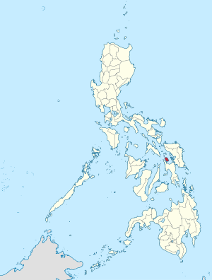
빌리란주

빌리란주(Biliran)는 필리핀 동비사야 지방에 속한 주로, 주도는 나발이며 인구는 171,612명(2015년 기준), 면적은 536.01km2이다. 1992년 5월 11일 레이테 주에서 분리되어 신설되었다. 빌리란은 레이테 섬의 북쪽으로 1km 미만 지역에 있다. 포로 섬과 연결하는 다리가 레이테 주와 이곳을 이어주고 있다.[1]
지리[편집]
빌리란의 전체 면적은 53,601 헥타아르이며, 필리핀에서 네번 째로 작은 주이다.[2]
인구[편집]
| 연도 | 인구 | ±% p.a. |
|---|---|---|
| 1903 | 21,661 | — |
| 1918 | 35,751 | +3.40% |
| 1939 | 54,367 | +2.02% |
| 1948 | 67,661 | +2.46% |
| 1960 | 87,285 | +2.14% |
| 1970 | 90,498 | +0.36% |
| 1975 | 103,270 | +2.68% |
| 1980 | 111,421 | +1.53% |
| 1990 | 118,012 | +0.58% |
| 1995 | 132,209 | +2.15% |
| 2000 | 140,274 | +1.28% |
| 2007 | 150,031 | +0.93% |
| 2010 | 161,760 | +2.78% |
| 2015 | 171,612 | +1.13% |
| 2020 | 179,312 | +0.87% |
| Source: Philippine Statistics Authority [3] [4] | ||
기후[편집]
| Biliran의 기후 | |||||||||||||
|---|---|---|---|---|---|---|---|---|---|---|---|---|---|
| 월 | 1월 | 2월 | 3월 | 4월 | 5월 | 6월 | 7월 | 8월 | 9월 | 10월 | 11월 | 12월 | 연간 |
| 평균 일 최고 기온 °C (°F) | 29.2 (84.6) |
30.3 (86.5) |
31.5 (88.7) |
32.4 (90.3) |
32.5 (90.5) |
32.3 (90.1) |
32 (90) |
32.1 (89.8) |
32 (90) |
31.6 (88.9) |
31 (88) |
30 (86) |
31.4 (88.6) |
| 평균 일 최저 기온 °C (°F) | 23.9 (75.0) |
24 (75) |
24.5 (76.1) |
25.2 (77.4) |
25.6 (78.1) |
25.4 (77.7) |
25.3 (77.5) |
25.3 (77.5) |
25.2 (77.4) |
25.1 (77.2) |
24.7 (76.5) |
24.1 (75.4) |
24.9 (76.7) |
| 평균 강수량 mm (인치) | 290.5 (11.44) |
241 (9.5) |
192.2 (7.57) |
118.2 (4.65) |
139.2 (5.48) |
189.5 (7.46) |
178.5 (7.03) |
184.4 (7.26) |
155 (6.1) |
215.2 (8.47) |
265.4 (10.45) |
385.5 (15.18) |
2,554.6 (100.59) |
| 평균 강우일수 | 21 | 17 | 16 | 14 | 13 | 15 | 16 | 16 | 15 | 18 | 20 | 21 | 202 |
| 출처 1: Storm247 (for average temperature and rainy days)[5] | |||||||||||||
| 출처 2: WorldWeatherOnline (for average precipitation)[6] | |||||||||||||
행정 구역[편집]

읍[편집]
- 알메리아 (Almeria)
- 빌리란 (Biliran)
- 카북가얀 (Cabucgayan)
- 카이비란 (Caibiran)
- 쿨라바 (Culaba)
- 카와얀 (Kawayan)
- 마리피피 (Maripipi)
- 나발 (Naval) - 주도(州都)
경제[편집]
빌리란주의 빈곤율
각주[편집]
- ↑ "Poro Island, Biliran, Eastern Visayas, Philippines". Google Maps. Retrieved on 2013-11-15.
- ↑ “List of Provinces”. 《PSGC Interactive》. Makati City, Philippines: National Statistical Coordination Board. 2013년 1월 21일에 원본 문서에서 보존된 문서. 2013년 1월 30일에 확인함.
- ↑ 인구 조사 (2015). 〈Region VIII (Eastern Visayas)〉. 《Total Population by Province, City, Municipality and Barangay》. PSA. 20 jun 2016에 확인함.
- ↑ 인구 및 가구 조사 (2010). 〈Region VIII (Eastern Visayas)〉. 《Total Population by Province, City, Municipality and Barangay》. NSO. 29 jun 2016에 확인함.
- ↑ “Weather forecast for Biliran, Philippines”. 《Storm247》. 2017년 11월 11일에 원본 문서에서 보존된 문서. 2016년 1월 30일에 확인함.
- ↑ “Biliran Monthly Climate Average, Philippines”. 《World Weather Online》. 2016년 1월 30일에 확인함.
- ↑ “Poverty incidence (PI):”. Philippine Statistics Authority. 2020년 12월 28일에 확인함.
- ↑ “Estimation of Local Poverty in the Philippines” (PDF). 2005년 11월 29일.
- ↑ “2009 Official Poverty Statistics of the Philippines” (PDF). 2011년 2월 8일.
- ↑ “Annual Per Capita Poverty Threshold, Poverty Incidence and Magnitude of Poor Population, by Region and Province: 1991, 2006, 2009, 2012 and 2015”. 2016년 8월 27일.
- ↑ “Annual Per Capita Poverty Threshold, Poverty Incidence and Magnitude of Poor Population, by Region and Province: 1991, 2006, 2009, 2012 and 2015”. 2016년 8월 27일.
- ↑ “Annual Per Capita Poverty Threshold, Poverty Incidence and Magnitude of Poor Population, by Region and Province: 1991, 2006, 2009, 2012 and 2015”. 2016년 8월 27일.
- ↑ “Updated Annual Per Capita Poverty Threshold, Poverty Incidence and Magnitude of Poor Population with Measures of Precision, by Region and Province: 2015 and 2018”. 2020년 6월 4일.
외부 링크[편집]
| 이 글은 필리핀에 관한 토막글입니다. 여러분의 지식으로 알차게 문서를 완성해 갑시다. |

