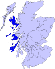
이너헤브리디스 제도

이너헤브리디스 제도(Inner Hebrides, 스코틀랜드 게일어: Na h-Eileanan a-staigh)는 스코틀랜드 본토의 서쪽 해안에서 벗어나 아우터헤브리디스 제도의 남동쪽까지 뻗친 군도이다.
기후[편집]
| Duntulm, Skye의 기후 | |||||||||||||
|---|---|---|---|---|---|---|---|---|---|---|---|---|---|
| 월 | 1월 | 2월 | 3월 | 4월 | 5월 | 6월 | 7월 | 8월 | 9월 | 10월 | 11월 | 12월 | 연간 |
| 평균 일 최고 기온 °C (°F) | 6.5 (43.7) |
6.6 (43.9) |
8.1 (46.6) |
9.6 (49.3) |
12.4 (54.3) |
14.3 (57.7) |
15.4 (59.7) |
15.7 (60.3) |
14.2 (57.6) |
11.5 (52.7) |
9.1 (48.4) |
7.6 (45.7) |
10.9 (51.6) |
| 평균 일 최저 기온 °C (°F) | 2.4 (36.3) |
2.2 (36.0) |
3.3 (37.9) |
4.3 (39.7) |
6.5 (43.7) |
8.7 (47.7) |
10.4 (50.7) |
10.7 (51.3) |
9.4 (48.9) |
7.2 (45.0) |
5.1 (41.2) |
3.6 (38.5) |
6.2 (43.2) |
| 평균 강수량 mm (인치) | 148 (5.84) |
100 (3.93) |
82 (3.24) |
86 (3.40) |
73 (2.87) |
85 (3.35) |
97 (3.83) |
112 (4.41) |
128 (5.05) |
152 (6.00) |
143 (5.63) |
142 (5.58) |
1,350 (53.13) |
| 출처: [1] | |||||||||||||
인구[편집]
| 연도 | 인구 | ±% |
|---|---|---|
| 2001 | 18,257 | — |
| 2011 | 18,948 | +3.8% |
| [2][3] | ||
같이 보기[편집]
각주[편집]
- ↑ Cooper (1983) pp. 33-5. Averages for rainfall are for 1916–50, temperature 1931–60.
- ↑ General Register Office for Scotland (28 November 2003) Scotland's Census 2001 – Occasional Paper No 10: Statistics for Inhabited Islands. Retrieved 26 February 2012.
- ↑ National Records of Scotland (2013년 8월 15일) (pdf) Statistical Bulletin: 2011 Census: First Results on Population and Household Estimates for Scotland - Release 1C (Part Two). "Appendix 2: Population and households on Scotland’s inhabited islands". 2013년 8월 17일 확인.
외부 링크[편집]
| 이 글은 지리에 관한 토막글입니다. 여러분의 지식으로 알차게 문서를 완성해 갑시다. |
