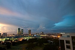
문틴루파


문틴루파(영어: City of Muntinlupa, 타갈로그어: Lungsod ng Muntinlupa)는 필리핀 메트로 마닐라(마닐라 수도권)에 위치한 도시로, 면적은 46.70km2, 인구는 379,310명(2000년 기준)이다. 북쪽으로는 타기그, 북서쪽으로는 파라냐케, 서쪽으로는 라스피냐스, 남서쪽으로는 카비테 주와 라구나 주, 동쪽으로는 라구나 데 베이와 접한다.
인구[편집]
| 연도 | 인구 | ±% p.a. |
|---|---|---|
| 1903 | 3,128 | — |
| 1918 | 4,712 | +2.77% |
| 1939 | 9,288 | +3.28% |
| 1948 | 18,444 | +7.92% |
| 1960 | 21,893 | +1.44% |
| 1970 | 65,057 | +11.49% |
| 1975 | 94,563 | +7.79% |
| 1980 | 136,679 | +7.64% |
| 1990 | 278,411 | +7.38% |
| 1995 | 399,846 | +7.02% |
| 2000 | 379,310 | −1.12% |
| 2007 | 452,943 | +2.48% |
| 2010 | 459,941 | +0.56% |
| 2015 | 504,509 | +1.78% |
| 2020 | 543,445 | +1.47% |
| Source: Philippine Statistics Authority [1] [2] [3][4] | ||
기후[편집]
| Muntinlupa, Metro Manila의 기후 | |||||||||||||
|---|---|---|---|---|---|---|---|---|---|---|---|---|---|
| 월 | 1월 | 2월 | 3월 | 4월 | 5월 | 6월 | 7월 | 8월 | 9월 | 10월 | 11월 | 12월 | 연간 |
| 평균 일 최고 기온 °C (°F) | 30 (86) |
31 (88) |
32 (90) |
34 (93) |
34 (93) |
33 (91) |
32 (90) |
31 (88) |
32 (90) |
32 (90) |
31 (88) |
30 (86) |
32 (89) |
| 평균 일 최저 기온 °C (°F) | 24 (75) |
24 (75) |
25 (77) |
27 (81) |
27 (81) |
26 (79) |
26 (79) |
25 (77) |
26 (79) |
26 (79) |
26 (79) |
25 (77) |
26 (78) |
| 평균 강수량 mm (인치) | 32.9 (1.30) |
31.7 (1.25) |
28.2 (1.11) |
26.9 (1.06) |
188.9 (7.44) |
225.7 (8.89) |
420.0 (16.54) |
377.9 (14.88) |
332.4 (13.09) |
145.1 (5.71) |
128.8 (5.07) |
76.3 (3.00) |
2,014.8 (79.34) |
| 평균 강우일수 | 6 | 6 | 4 | 4 | 12 | 18 | 21 | 23 | 21 | 17 | 14 | 10 | 156 |
| 출처 1: World Weather Online[5] | |||||||||||||
| 출처 2: World Weather Online[6] | |||||||||||||
각주[편집]
- ↑ 인구 조사 (2015). 〈National Capital Region (NCR)〉. 《Total Population by Province, City, Municipality and Barangay》. PSA. 20 jun 2016에 확인함.
- ↑ 인구 및 가구 조사 (2010). 〈National Capital Region (NCR)〉. 《Total Population by Province, City, Municipality and Barangay》. NSO. 29 jun 2016에 확인함.
- ↑ 인구 조사 (1903–2007). 〈National Capital Region (NCR)〉. 《Table 1. Population Enumerated in Various Censuses by Province/Highly Urbanized City: 1903 to 2007》. NSO.
- ↑ “Province of”. 《Municipality Population Data》. Local Water Utilities Administration Research Division. 2016년 12월 17일에 확인함.
- ↑ “Bacoor Average Temperatures and Rainfall”. World Weather Online. July 2015에 확인함.
- ↑ “San Pedro Average Temperatures and Rainfall”. World Weather Online. July 2015에 확인함.
외부 링크[편집]
| 이 글은 필리핀에 관한 토막글입니다. 여러분의 지식으로 알차게 문서를 완성해 갑시다. |
