
파일:LocationBritishVirginIslands.svg

SVG 파일의 PNG 형식의 미리보기 크기: 800 × 320 픽셀. 다른 해상도: 320 × 128 픽셀 | 640 × 256 픽셀 | 1,024 × 410 픽셀 | 1,280 × 512 픽셀 | 2,560 × 1,024 픽셀 | 1,750 × 700 픽셀
원본 파일 (SVG 파일, 실제 크기 1,750 × 700 픽셀, 파일 크기: 324 KB)

|
이 그림의 래스터판이 있습니다. 경우에 따라서는 이 벡터 이미지 대신 래스터 이미지를 사용하는 것이 더 바람직할 수 있습니다.
File:LocationBritishVirginIslands.svg → File:LocationBritishVirginIslands.png
대부분의 경우, 좋은 SVG 이미지를 쓰는 것이 낫습니다. |
파일 설명
| 설명 |
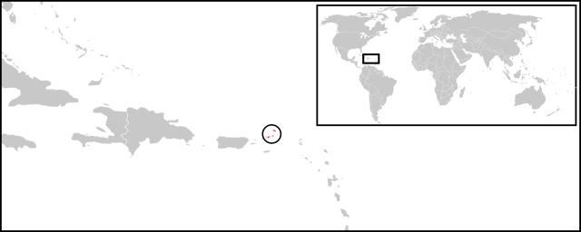
English: Location map for British Virgin Islands. Vectorised version of Image:LocationBritishVirginIslands.png |
| 날짜 | (UTC) |
| 출처 | |
| 저자 |
|
라이선스
| 이 그림은 수정된 그림으로, 원래 그림에서 디지털 변환이 이루어진 그림입니다. 수정 사항 : Combined two maps to form a newly vectorised version of the British Virgin Islands map. 원래의 그림 : BlankMap-Caribbean.svg:
|
| 나는 이 작품의 저작권자로서, 이 작품을 퍼블릭 도메인으로 모두에게 공개합니다. 이 공개 선언은 전 세계적으로 유효합니다. 만약 저작권의 포기가 법률적으로 가능하지 않은 경우, 나는 이 작품을 법적으로 허용되는 한도 내에서 누구나 자유롭게 어떤 목적으로도 제한없이 사용할 수 있도록 허용합니다. |
기존 올리기 기록
This image is a derivative work of the following images:
- File:BlankMap-World-v2.svg licensed with PD-self
- 2011-03-27T23:08:42Z Wayiran 1243x564 (209452 Bytes) Some correction on North-west border of Iran's map + south of Caspian sea
- 2008-12-03T18:02:36Z Harbin 1326x601 (192122 Bytes)
- 2008-12-02T19:55:14Z Harbin 1326x601 (197882 Bytes)
- 2008-12-02T19:04:59Z Harbin 1326x601 (176022 Bytes) {{Information |Description={{en|1=A blank map of the world as of 2005, with country outlines. Sovereign microstates less than 2 500 km² in area are depicted as circles (see Wikipedia:Image_talk:BlankMap-World-v2.png for list
- File:BlankMap-Caribbean.svg licensed with PD-self
- 2010-09-20T02:01:50Z NuclearVacuum 896x633 (274735 Bytes) new version
- 2010-02-23T15:29:09Z NuclearVacuum 2201x1507 (214283 Bytes) cleanup
- 2010-02-11T19:26:10Z NuclearVacuum 2201x1507 (211807 Bytes) I have started from scratch and made a completely new map of the Caribbean. This current version has an invalid code, but I will work on that later.
- 2009-09-22T00:08:34Z NuclearVacuum 940x477 (252618 Bytes) {{Information |Description={{en|1=Map of the [[:en:Caribbean|Caribbean nations]].}} |Source=[[:File:BlankMap-World6.svg]]{{Inkscape}} |Author=[[User:NuclearVacuum|NuclearVacuum]] |Date=2009-09-21 |Permission= |other_versions=
Uploaded with derivativeFX
파일 역사
날짜/시간 링크를 클릭하면 해당 시간의 파일을 볼 수 있습니다.
| 날짜/시간 | 섬네일 | 크기 | 사용자 | 설명 | |
|---|---|---|---|---|---|
| 현재 | 2011년 6월 30일 (목) 11:08 | 1,750 × 700 (324 KB) | Maky | {{Bitmap version available|LocationBritishVirginIslands.png}} {{Information |Description={{en|1=Location map for British Virgin Islands.<br> Vectorised version of Image:LocationBritishVirginIslands.png}} |Source=*File:BlankMap-World-v2.svg |
이 파일을 사용하는 문서
다음 문서 1개가 이 파일을 사용하고 있습니다:
이 파일을 사용하고 있는 모든 위키의 문서 목록
다음 위키에서 이 파일을 사용하고 있습니다:
- ceb.wikipedia.org에서 이 파일을 사용하고 있는 문서 목록
- el.wikipedia.org에서 이 파일을 사용하고 있는 문서 목록
- en.wikipedia.org에서 이 파일을 사용하고 있는 문서 목록
- es.wikinews.org에서 이 파일을 사용하고 있는 문서 목록
- eu.wikipedia.org에서 이 파일을 사용하고 있는 문서 목록
- fr.wikipedia.org에서 이 파일을 사용하고 있는 문서 목록
- fr.wiktionary.org에서 이 파일을 사용하고 있는 문서 목록
- gcr.wikipedia.org에서 이 파일을 사용하고 있는 문서 목록
- mk.wikipedia.org에서 이 파일을 사용하고 있는 문서 목록
- pnb.wikipedia.org에서 이 파일을 사용하고 있는 문서 목록
- ro.wikipedia.org에서 이 파일을 사용하고 있는 문서 목록
- su.wikipedia.org에서 이 파일을 사용하고 있는 문서 목록
- sv.wikipedia.org에서 이 파일을 사용하고 있는 문서 목록
- vi.wikipedia.org에서 이 파일을 사용하고 있는 문서 목록
- www.wikidata.org에서 이 파일을 사용하고 있는 문서 목록