
파일:Jishishan Landslide 20231213 before.tiff

Jishishan_Landslide_20231213_before.tiff (527 × 360 픽셀, 파일 크기: 742 KB, MIME 종류: image/tiff)
파일 설명
| 설명 |
English: Satellite image of Jintian village, Minhe county |
| 날짜 | |
| 출처 | https://dataspace.copernicus.eu/browser/ |
| 저자 | ESA |
| 카메라 위치 | | 이 지역의 다른 사진을 보기: OpenStreetMap |
|---|
라이선스

|
This image contains data from a satellite in the Copernicus Programme, such as Sentinel-1, Sentinel-2 or Sentinel-3. Attribution is required when using this image.
저작자표시: Contains modified Copernicus Sentinel data 2023
The use of Copernicus Sentinel Data is regulated under EU law (Commission Delegated Regulation (EU) No 1159/2013 and Regulation (EU) No 377/2014). Relevant excerpts:
Free access shall be given to GMES dedicated data [...] made available through GMES dissemination platforms [...].
Access to GMES dedicated data [...] shall be given for the purpose of the following use in so far as it is lawful:
GMES dedicated data [...] may be used worldwide without limitations in time.
GMES dedicated data and GMES service information are provided to users without any express or implied warranty, including as regards quality and suitability for any purpose. |
파일 역사
날짜/시간 링크를 클릭하면 해당 시간의 파일을 볼 수 있습니다.
| 날짜/시간 | 섬네일 | 크기 | 사용자 | 설명 | |
|---|---|---|---|---|---|
| 현재 | 2023년 12월 22일 (금) 18:55 | 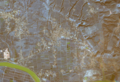 | 527 × 360 (742 KB) | Pieceofmetalwork | Uploaded a work by ESA from https://dataspace.copernicus.eu/browser/ with UploadWizard |
이 파일을 사용하는 문서
다음 문서 1개가 이 파일을 사용하고 있습니다:
이 파일을 사용하고 있는 모든 위키의 문서 목록
다음 위키에서 이 파일을 사용하고 있습니다:
- en.wikipedia.org에서 이 파일을 사용하고 있는 문서 목록
- id.wikipedia.org에서 이 파일을 사용하고 있는 문서 목록
- zh.wikipedia.org에서 이 파일을 사용하고 있는 문서 목록