
파일:Eastern Bloc countries Europe 1948.png
미리 보기 크기: 479 × 599 픽셀 다른 해상도: 192 × 240 픽셀 | 383 × 480 픽셀 | 823 × 1,030 픽셀
원본 파일 (823 × 1,030 픽셀, 파일 크기: 120 KB, MIME 종류: image/png)
파일 설명
| 설명 |
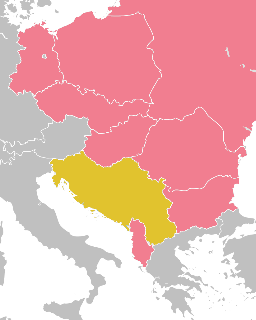
English: Eastern Bloc countries in Europe, 1948 (pink) and Yugoslavia (yellow) العربية: دول الكتلة الشرقية الأوروبية في 1948 (الوردي) ويوغوسلافيا (الأصفر)
Map extent: N 55,82; E 29,13; S 36,197; W 9,3 |
| 날짜 | |
| 출처 | Base map cropped from File:Blank map of Europe 1956-1990.svg authored by Alphathon; Map contents data: Norman J. G. Pounds, "Fissures in the Eastern European Bloc", The Annals of the American Academy of Political and Social Science, vol. 372, 1967, pp. 41–43, www.jstor.org/stable/1037711 |
| 저자 | Tomobe03 |
라이선스
나는 아래 작품의 저작권자로서, 이 저작물을 다음과 같은 라이선스로 배포합니다:
이 파일은 크리에이티브 커먼즈 저작자표시-동일조건변경허락 4.0 국제 라이선스로 배포됩니다.
- 이용자는 다음의 권리를 갖습니다:
- 공유 및 이용 – 저작물의 복제, 배포, 전시, 공연 및 공중송신
- 재창작 – 저작물의 개작, 수정, 2차적저작물 창작
- 다음과 같은 조건을 따라야 합니다:
- 저작자표시 – 적절한 저작자 표시를 제공하고, 라이센스에 대한 링크를 제공하고, 변경사항이 있는지를 표시해야 합니다. 당신은 합리적인 방식으로 표시할 수 있지만, 어떤 방식으로든 사용권 허가자가 당신 또는 당신의 사용을 지지하는 방식으로 표시할 수 없습니다.
- 동일조건변경허락 – 만약 당신이 이 저작물을 리믹스 또는 변형하거나 이 저작물을 기반으로 제작하는 경우, 당신은 당신의 기여물을 원저작물과 동일하거나 호환 가능한 라이선스에 따라 배포하여야 합니다.
파일 역사
날짜/시간 링크를 클릭하면 해당 시간의 파일을 볼 수 있습니다.
| 날짜/시간 | 섬네일 | 크기 | 사용자 | 설명 | |
|---|---|---|---|---|---|
| 현재 | 2021년 12월 13일 (월) 02:00 | | 823 × 1,030 (120 KB) | Tomobe03 | Switch shading for Yugoslavia for better contrast with wikilink text |
| 2021년 12월 13일 (월) 01:43 |  | 823 × 1,030 (120 KB) | Tomobe03 | Uploaded own work with UploadWizard |
이 파일을 사용하는 문서
다음 문서 4개가 이 파일을 사용하고 있습니다:
이 파일을 사용하고 있는 모든 위키의 문서 목록
다음 위키에서 이 파일을 사용하고 있습니다:
- en.wikipedia.org에서 이 파일을 사용하고 있는 문서 목록
- fr.wikipedia.org에서 이 파일을 사용하고 있는 문서 목록
- id.wikipedia.org에서 이 파일을 사용하고 있는 문서 목록
- si.wikipedia.org에서 이 파일을 사용하고 있는 문서 목록
- sl.wikipedia.org에서 이 파일을 사용하고 있는 문서 목록