파일:Tropical Cyclone Alenga Dec 8 2011 0705Z.jpg

문서 내용이 다른 언어로는 지원되지 않습니다.
위키백과, 우리 모두의 백과사전.

원본 파일(6,000 × 6,940 픽셀, 파일 크기: 5.14 MB, MIME 종류: image/jpeg)

파일 설명

설명
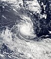
English: Tropical Storm Alenga formed over the Indian Ocean on December 5, 2011, and strengthened into a cyclone two days later. On December 8, 2011, the U.S. Navy’s Joint Typhoon Warning Center (JTWC) reported that Alenga was located roughly 400 nautical miles (740 kilometers) south-southeast of the Cocos Islands. Alenga had maximum sustained winds of 80 knots (150 kilometers per hour) with gusts up to 100 knots (185 kilometers per hour).

The Moderate Resolution Imaging Spectroradiometer (MODIS) on NASA’s Aqua satellite captured this natural-color image on December 8, 2011. Although a central eye is barely discernible, Alenga bears the spiral shape characteristic of strong storms.

The JTWC forecast that Alenga would continue moving in a southeastward direction, but increasing vertical wind shear (changing wind speed and direction with altitude) and decreasing sea surface temperatures would likely weaken the storm.
날짜
출처 http://earthobservatory.nasa.gov/NaturalHazards/view.php?id=76627
저자 NASA image courtesy LANCE/EOSDIS MODIS Rapid Response Team at NASA GSFC. Caption by Michon Scott.

라이선스

Public domain 이 파일은 NASA에서 제작하였으므로 퍼블릭 도메인입니다. NASA의 저작권 정책에 따르면 NASA의 자료는 명시하지 않는 이상 저작권의 보호를 받지 않습니다. (Template:PD-USGov, 또는 NASA 저작권 정책 문서, JPL 그림 사용 정책을 참고하세요.)
주의사항:

설명

이 파일이 나타내는 바에 대한 한 줄 설명을 추가합니다

이 파일에 묘사된 항목

다음을 묘사함

파일 역사

날짜/시간 링크를 클릭하면 해당 시간의 파일을 볼 수 있습니다.

날짜/시간섬네일크기사용자설명
현재2011년 12월 8일 (목) 20:592011년 12월 8일 (목) 20:59 판의 섬네일6,000 × 6,940 (5.14 MB)Supportstorm{{Information |Description ={{en|1=Tropical Cyclone Alenga on December 8, 2011}} |Source =http://lance-modis.eosdis.nasa.gov/wms/?zoom=5&lat=-16.48242&lon=92.36133&layers=000B0FFFFT&datum1=12/08/2011 |Author =NASA, MODIS Rapid Response

다음 문서 1개가 이 파일을 사용하고 있습니다:

이 파일을 사용하고 있는 모든 위키의 문서 목록

다음 위키에서 이 파일을 사용하고 있습니다:

메타데이터