
파일:Pulaski Skyway full view.jpg
미리 보기 크기: 750 × 600 픽셀 다른 해상도: 300 × 240 픽셀 | 600 × 480 픽셀 | 960 × 768 픽셀 | 1,280 × 1,024 픽셀 | 2,560 × 2,048 픽셀 | 3,000 × 2,400 픽셀
원본 파일 (3,000 × 2,400 픽셀, 파일 크기: 1.56 MB, MIME 종류: image/jpeg)
| 설명 |
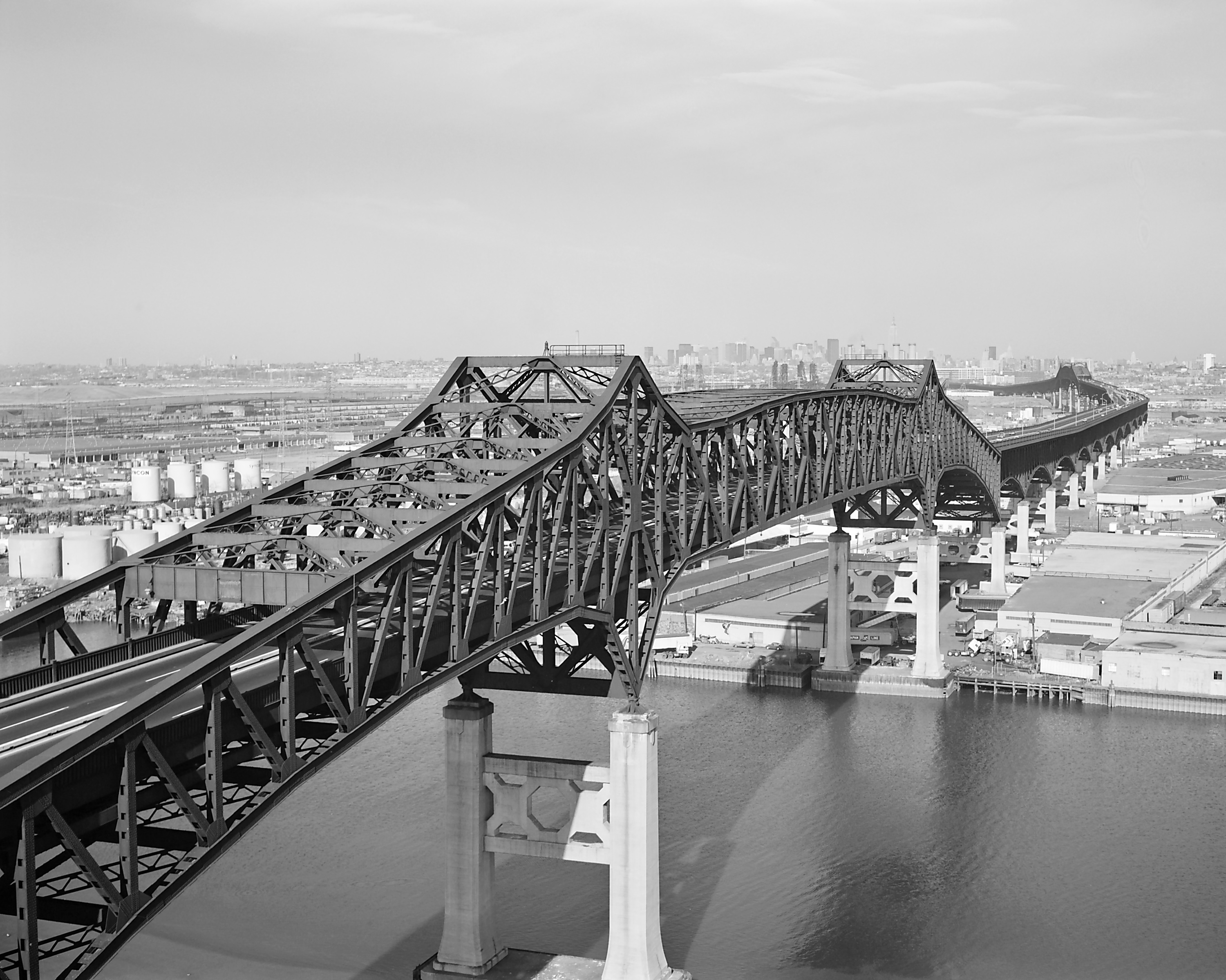
English: Pulaski Skyway — spanning the Passaic & Hackensack Rivers, Jersey City, Hudson County, New Jersey.
Français : Pont du général Pulaski, sur les fleuves Passaic et Hackensack, à Jersey City, dans le New Jersey, en 1978. Vue en gros plan et de biais depuis l'amont de la section franchissant la Passaic River. |
|||||||||||||||||||||||||
| 날짜 | ||||||||||||||||||||||||||
| 출처 |
|
|||||||||||||||||||||||||
| 저자 |
|
|||||||||||||||||||||||||
| 저작권 (이 파일을 인용하기) |
|
|||||||||||||||||||||||||

| 카메라 위치 | | 이 지역의 다른 사진을 보기: OpenStreetMap |
|---|
|
이 이미지는 2005년 3월 4일의 오늘의 이미지로 선정되었습니다. 이미지 설명은 다음과 같습니다. English: Pulaski Skyway, New Jersey, USA 다른 언어들:
English: Pulaski Skyway, New Jersey, USA Español: Pulaski Skyway, Nueva Jersey, EE.UU. Esperanto: Pulaski Skyway kie estas en Nov-Ĵerzejo en Usono. Italiano: Sopraelevata Pulaski, New Jersey USA. Nederlands: De Pulaski Skyway in New Jersey, VS Suomi: Pulaski Skyway, New Jersey, Yhdysvallat Svenska: Motorvägsbron "Pulaski skyway" i New Jersey, U.S.A. Български: "Пуласки Скайуей", Ню Джърски, САЩ 日本語: 米国・ニュージャージー州のプラスキー・スカイウェイ |
파일 역사
날짜/시간 링크를 클릭하면 해당 시간의 파일을 볼 수 있습니다.
| 날짜/시간 | 섬네일 | 크기 | 사용자 | 설명 | |
|---|---|---|---|---|---|
| 현재 | 2005년 1월 14일 (금) 05:44 | | 3,000 × 2,400 (1.56 MB) | MarkSweep | replaced existing file: cleaner (and therefore smaller) version, better tonality, sharper |
| 2005년 1월 13일 (목) 02:22 |  | 3,000 × 2,400 (1.7 MB) | MarkSweep | replaced exiting file: different crop, restored 4x5 aspect ratio | |
| 2005년 1월 11일 (화) 09:51 |  | 4,828 × 2,493 (1.26 MB) | SPUI~commonswiki | {{HABS}} A 1978 view of the Pulaski Skyway. Taken by Jack Boucher. |
이 파일을 사용하는 문서
다음 문서 1개가 이 파일을 사용하고 있습니다:
이 파일을 사용하고 있는 모든 위키의 문서 목록
다음 위키에서 이 파일을 사용하고 있습니다:
- bg.wikipedia.org에서 이 파일을 사용하고 있는 문서 목록
- bn.wikipedia.org에서 이 파일을 사용하고 있는 문서 목록
- ca.wikipedia.org에서 이 파일을 사용하고 있는 문서 목록
- de.wikipedia.org에서 이 파일을 사용하고 있는 문서 목록
- de.wikivoyage.org에서 이 파일을 사용하고 있는 문서 목록
- en.wikipedia.org에서 이 파일을 사용하고 있는 문서 목록
- U.S. Route 1
- Pulaski Skyway
- Cantilever bridge
- Wikipedia:Today's featured article/January 2005
- Wikipedia:Today's featured article/January 29, 2005
- Portal:U.S. roads/Selected article
- Portal:New Jersey/Selected article
- User:Nauticashades/FPC
- Wikipedia:Featured picture candidates/Pulaski Skyway
- Wikipedia:Featured picture candidates/October-2006
- National Register of Historic Places listings in Essex County, New Jersey
- Portal:U.S. roads/Selected article/April 2006
- List of bridges on the National Register of Historic Places in New Jersey
- Portal:New Jersey/Selected article/5
- Transportation in New Jersey
- Wikipedia:WikiProject U.S. Roads/New Jersey/Selected article
- Wikipedia:WikiProject U.S. Roads/New Jersey/Selected article/July 2010
- Wikipedia:Valued picture candidates/August-2010
- Wikipedia:Valued picture candidates/Pulaski Skyway
- List of crossings of the Lower Passaic River
- Sigvald Johannesson
- Talk:Fort Lee lane closure scandal/Archive 3
- User talk:Jack/Archive 2010
- en.wikivoyage.org에서 이 파일을 사용하고 있는 문서 목록
- es.wikipedia.org에서 이 파일을 사용하고 있는 문서 목록
- fi.wikipedia.org에서 이 파일을 사용하고 있는 문서 목록
- fr.wikipedia.org에서 이 파일을 사용하고 있는 문서 목록
- Liste de ponts aux États-Unis
- Wikipédia:Image du jour/4 mars 2005
- Wikipédia:Image du jour/mars 2005
- U.S. Route 1
- Liste des ponts les plus longs du monde
- Wikipédia:Le Bistro/31 mai 2009
- Utilisateur:Glabb/Brouillon/Liste des ponts les plus longs du monde
- Utilisateur:Roland45/Ponts les plus longs du monde
- Wikipédia:Le Bistro/Galerie/2009
- Wikipédia:Le Bistro/Galerie/Mai
- Pulaski Skyway
- ia.wikipedia.org에서 이 파일을 사용하고 있는 문서 목록
이 파일의 더 많은 사용 내역을 봅니다.