
파일:North West Leicestershire UK locator map.svg

SVG 파일의 PNG 형식의 미리보기 크기: 761 × 600 픽셀. 다른 해상도: 305 × 240 픽셀 | 609 × 480 픽셀 | 975 × 768 픽셀 | 1,280 × 1,009 픽셀 | 2,560 × 2,017 픽셀 | 1,425 × 1,123 픽셀
원본 파일 (SVG 파일, 실제 크기 1,425 × 1,123 픽셀, 파일 크기: 1,021 KB)
| 설명 |
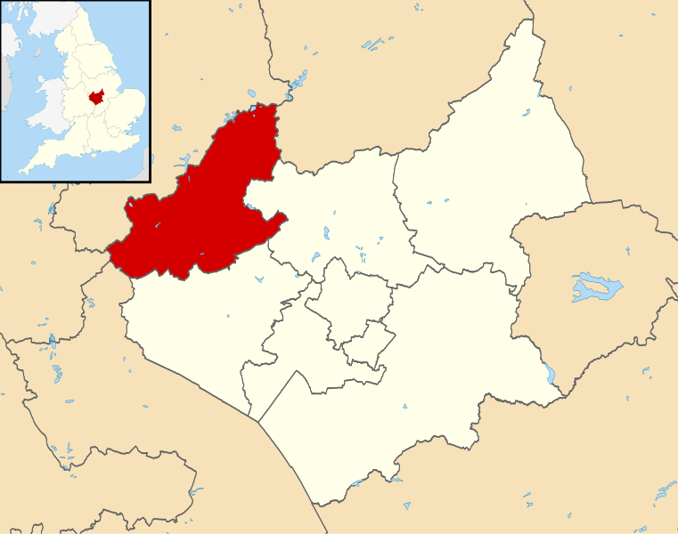
Map of Leicestershire, UK with North West Leicestershire highlighted. Equirectangular map projection on WGS 84 datum, with N/S stretched 160% |
| 날짜 | |
| 출처 |
|
| 저자 | Nilfanion, created using Ordnance Survey data |
| 저작권 (이 파일을 인용하기) |
이 파일은 크리에이티브 커먼즈 저작자표시-동일조건변경허락 3.0 Unported 라이선스로 배포됩니다. 저작자표시: Contains Ordnance Survey data © Crown copyright and database right
|
파일 역사
날짜/시간 링크를 클릭하면 해당 시간의 파일을 볼 수 있습니다.
| 날짜/시간 | 섬네일 | 크기 | 사용자 | 설명 | |
|---|---|---|---|---|---|
| 현재 | 2011년 8월 14일 (일) 06:53 | | 1,425 × 1,123 (1,021 KB) | Nilfanion | {{Information |Description=Map of Leicestershire, UK with North West Leicestershire highlighted. Equirectangular map projection on WGS 84 datum, with N/S stretched 160% |Source=[[w:Ordnance Survey|Ordn |
이 파일을 사용하는 문서
다음 문서 1개가 이 파일을 사용하고 있습니다:
이 파일을 사용하고 있는 모든 위키의 문서 목록
다음 위키에서 이 파일을 사용하고 있습니다:
- bg.wikipedia.org에서 이 파일을 사용하고 있는 문서 목록
- cy.wikipedia.org에서 이 파일을 사용하고 있는 문서 목록
- en.wikipedia.org에서 이 파일을 사용하고 있는 문서 목록
- Ashby-de-la-Zouch
- Breedon on the Hill
- Moira, Leicestershire
- Donisthorpe
- North West Leicestershire
- Coalville
- Kegworth
- Measham
- Willesley
- Whitwick
- Castle Donington
- Copt Oak
- Acresford
- Ibstock
- Heather, Leicestershire
- Belton, Leicestershire
- Ravenstone, Leicestershire
- Charley, Leicestershire
- Appleby Magna
- Snarestone
- Swepstone
- Stretton en le Field
- Bardon, Leicestershire
- Worthington, Leicestershire
- Packington
- Diseworth
- Appleby Parva
- Ellistown
- Osgathorpe
- Snibston
- Oakthorpe
- Thringstone
- Long Whatton
- Oaks in Charnwood
- Swannington, Leicestershire
- Albert Village
- Battram
- Wilson, Leicestershire
- Hemington, Leicestershire
- Blackfordby
- Coleorton
- Staunton Harold
- Normanton le Heath
- Chilcote
- Isley cum Langley
- Hugglescote
- Donington le Heath
- Griffydam
이 파일의 더 많은 사용 내역을 봅니다.