
파일:MartinsburgWV HistoricDistrict.jpg
미리 보기 크기: 800 × 531 픽셀 다른 해상도: 320 × 212 픽셀 | 640 × 424 픽셀 | 1,024 × 679 픽셀 | 1,280 × 849 픽셀 | 2,560 × 1,698 픽셀 | 3,468 × 2,300 픽셀
원본 파일 (3,468 × 2,300 픽셀, 파일 크기: 1.04 MB, MIME 종류: image/jpeg)
|
This is an image of a place or building that is listed on the National Register of Historic Places in the United States of America. Its reference number is 80004416. |
파일 설명
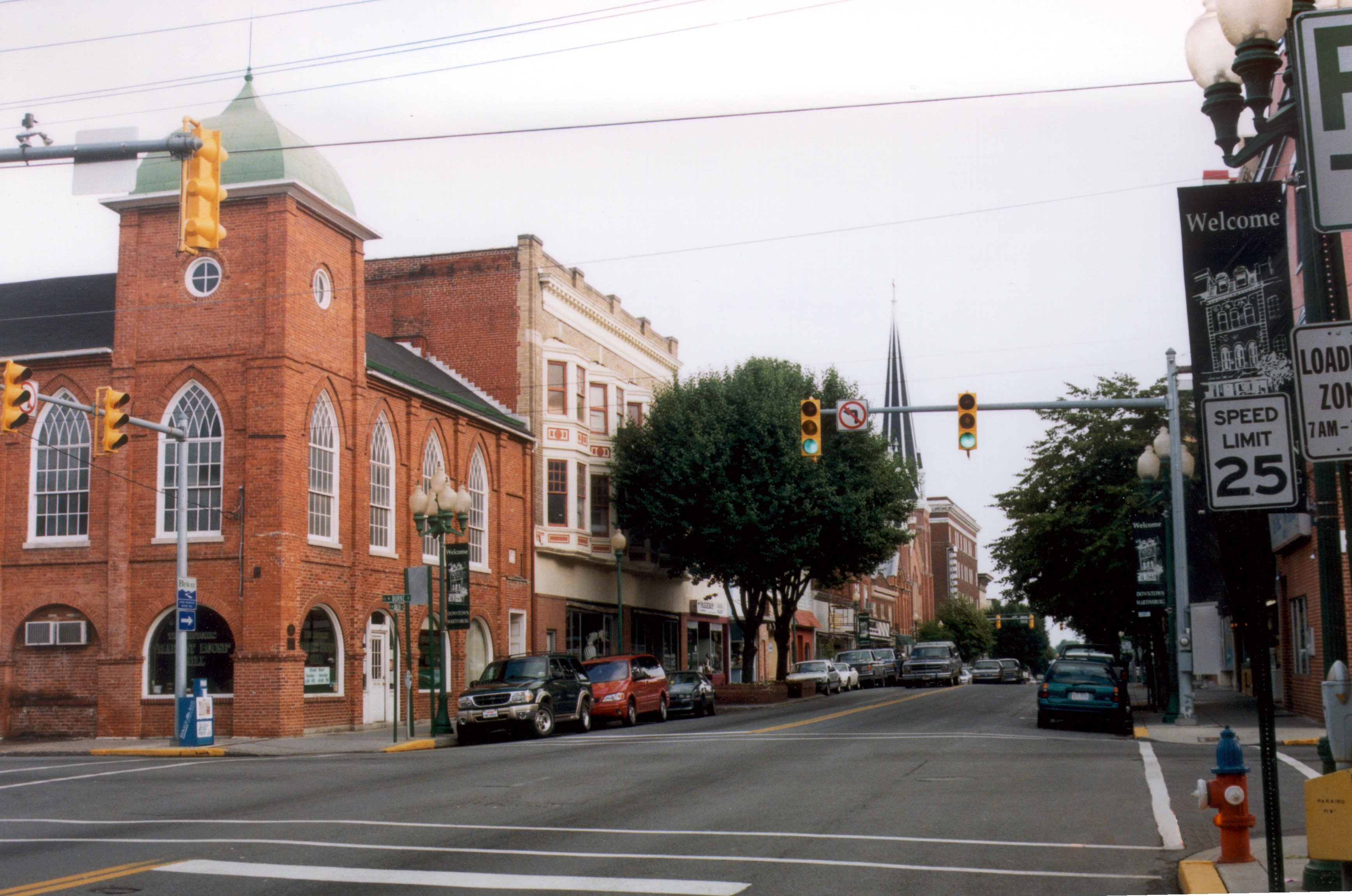
| 설명 | View north along U.S. Route 11, west along West Virginia Route 9 and east along West Virginia Route 45 (Queen Street) at Burke Street in downtown w:Martinsburg, West Virginia (USA) Historic District |
| 날짜 | |
| 출처 | http://www.fhwa.dot.gov/byways/photos/28506 |
| 저자 | A.E. Crane; rotated and color-corrected by Howcheng. |
| 저작권 (이 파일을 인용하기) |
Terms of use (shown when attempting to download image): Permission granted for public use in the following ways:
Provided that the public meets the following conditions:
|
| 다른 버전 | Original sample available at source URL. |
| 대상 위치 | | 이 지역의 다른 사진을 보기: OpenStreetMap |
|---|
라이선스

|
이 파일의 저작권자는 저작권자를 명시한다는 조건에 따라 누구에게나 어떤 목적으로든지 사용할 수 있도록 허용합니다.
이 저작물의 재배포나 이차적 저작물 작성 및 상업적 이용 등이 허용됩니다. |
저작자표시:
(1) Link or reference required to http://www.byways.org and (2) copyright and credits from above author's field
|
파일 역사
날짜/시간 링크를 클릭하면 해당 시간의 파일을 볼 수 있습니다.
| 날짜/시간 | 섬네일 | 크기 | 사용자 | 설명 | |
|---|---|---|---|---|---|
| 현재 | 2006년 4월 26일 (수) 02:28 | | 3,468 × 2,300 (1.04 MB) | Holly Cheng | ==Summary== {{Information | Description=w:Martinsburg, West Virginia (USA) Historic District | Source=http://library.byways.org/view_details.html?MEDIA_OBJECT_ID=28506 | Date=2000 | Author=A.E. Crane; rotated and color-corrected by User:Howcheng. |
이 파일을 사용하는 문서
다음 문서 1개가 이 파일을 사용하고 있습니다:
이 파일을 사용하고 있는 모든 위키의 문서 목록
다음 위키에서 이 파일을 사용하고 있습니다:
- ar.wikipedia.org에서 이 파일을 사용하고 있는 문서 목록
- arz.wikipedia.org에서 이 파일을 사용하고 있는 문서 목록
- ca.wikipedia.org에서 이 파일을 사용하고 있는 문서 목록
- ceb.wikipedia.org에서 이 파일을 사용하고 있는 문서 목록
- ce.wikipedia.org에서 이 파일을 사용하고 있는 문서 목록
- cy.wikipedia.org에서 이 파일을 사용하고 있는 문서 목록
- dag.wikipedia.org에서 이 파일을 사용하고 있는 문서 목록
- da.wikipedia.org에서 이 파일을 사용하고 있는 문서 목록
- en.wikipedia.org에서 이 파일을 사용하고 있는 문서 목록
- en.wikivoyage.org에서 이 파일을 사용하고 있는 문서 목록
- es.wikipedia.org에서 이 파일을 사용하고 있는 문서 목록
- eu.wikipedia.org에서 이 파일을 사용하고 있는 문서 목록
- fa.wikipedia.org에서 이 파일을 사용하고 있는 문서 목록
- fr.wikipedia.org에서 이 파일을 사용하고 있는 문서 목록
- hu.wikipedia.org에서 이 파일을 사용하고 있는 문서 목록
- it.wikipedia.org에서 이 파일을 사용하고 있는 문서 목록
- ja.wikipedia.org에서 이 파일을 사용하고 있는 문서 목록
- kw.wikipedia.org에서 이 파일을 사용하고 있는 문서 목록
- lld.wikipedia.org에서 이 파일을 사용하고 있는 문서 목록
- nl.wikipedia.org에서 이 파일을 사용하고 있는 문서 목록
- no.wikipedia.org에서 이 파일을 사용하고 있는 문서 목록
- pl.wikipedia.org에서 이 파일을 사용하고 있는 문서 목록
- ru.wikipedia.org에서 이 파일을 사용하고 있는 문서 목록
- sr.wikipedia.org에서 이 파일을 사용하고 있는 문서 목록
- tl.wikipedia.org에서 이 파일을 사용하고 있는 문서 목록
- tr.wikipedia.org에서 이 파일을 사용하고 있는 문서 목록
- tt.wikipedia.org에서 이 파일을 사용하고 있는 문서 목록
- uk.wikipedia.org에서 이 파일을 사용하고 있는 문서 목록
- ur.wikipedia.org에서 이 파일을 사용하고 있는 문서 목록
- vi.wikipedia.org에서 이 파일을 사용하고 있는 문서 목록
- vo.wikipedia.org에서 이 파일을 사용하고 있는 문서 목록
- www.wikidata.org에서 이 파일을 사용하고 있는 문서 목록
- zh-min-nan.wikipedia.org에서 이 파일을 사용하고 있는 문서 목록