
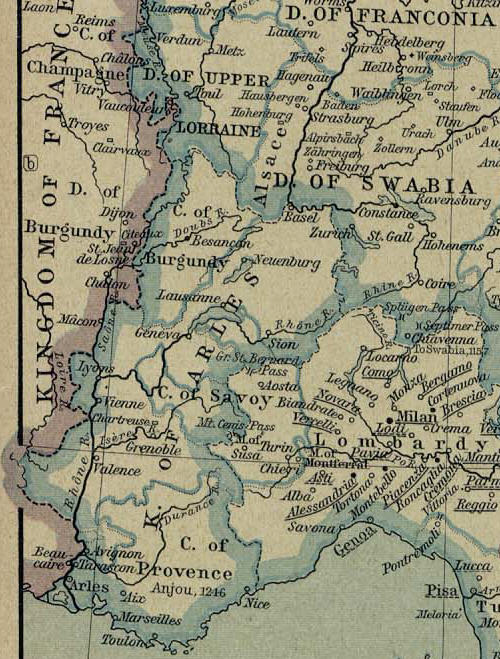
파일:Map of kingdom of Arles.jpg
원본 파일 (500 × 659 픽셀, 파일 크기: 112 KB, MIME 종류: image/jpeg)
파일 설명
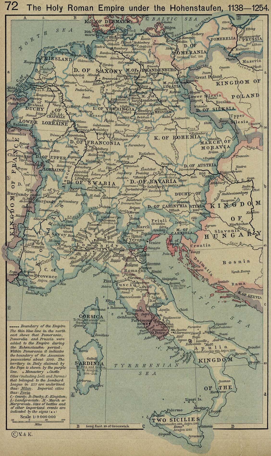
Map of Kingdom of Arles extracted from a map from the Holy Roman Empire (1138-1254)
From: Home > Finding Information > PCL Map Collection > Historical Maps of Europe - [Germany] The Holy Roman Empire under the Hohenstaufen, 1138-1254 (458K)
From The Historical Atlas by William R. Shepherd, 1926.
Initial Map modified by Poppy
라이선스
|
이 작품은 미국, 그리고 저작권 보호 기간이 저작자 사후 70년, 또는 그 이하인 모든 국가에서 퍼블릭 도메인입니다.
| |
| 이 저작물은 모든 저작인접권을 포함한 저작권법하의 규제로부터 자유로운 것으로 확인되었습니다. | |
파일 역사
날짜/시간 링크를 클릭하면 해당 시간의 파일을 볼 수 있습니다.
| 날짜/시간 | 섬네일 | 크기 | 사용자 | 설명 | |
|---|---|---|---|---|---|
| 현재 | 2006년 1월 4일 (수) 04:42 | | 500 × 659 (112 KB) | Poppy | == Description == {{PD-PCL|shepherd/roman_empire_1138_1254.jpg|historical/}} Map of Kingdom of Arles extracted from a map from the Holy Roman Empire (1138-1254) From: Home > Finding Information > PCL Map Collection > Historical Maps of Europe - [German |
이 파일을 사용하는 문서
다음 문서 1개가 이 파일을 사용하고 있습니다:
이 파일을 사용하고 있는 모든 위키의 문서 목록
다음 위키에서 이 파일을 사용하고 있습니다:
- br.wikipedia.org에서 이 파일을 사용하고 있는 문서 목록
- ca.wikipedia.org에서 이 파일을 사용하고 있는 문서 목록
- da.wikipedia.org에서 이 파일을 사용하고 있는 문서 목록
- de.wikipedia.org에서 이 파일을 사용하고 있는 문서 목록
- en.wikipedia.org에서 이 파일을 사용하고 있는 문서 목록
- eo.wikipedia.org에서 이 파일을 사용하고 있는 문서 목록
- et.wikipedia.org에서 이 파일을 사용하고 있는 문서 목록
- fr.wikipedia.org에서 이 파일을 사용하고 있는 문서 목록
- it.wikipedia.org에서 이 파일을 사용하고 있는 문서 목록
- pl.wikipedia.org에서 이 파일을 사용하고 있는 문서 목록
- vls.wikipedia.org에서 이 파일을 사용하고 있는 문서 목록