
파일:LongBranchLoop.jpg

원본 파일 (1,050 × 644 픽셀, 파일 크기: 184 KB, MIME 종류: image/jpeg)
| 설명 |
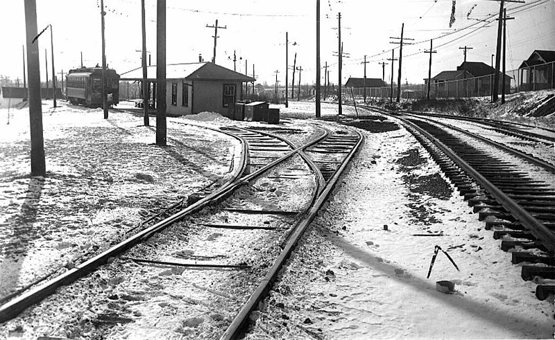
English: Looking west to Long Branch Loop on Lake Shore Rd (now Boulevard) north side at Brown's Line, western limits of New Toronto TEXT: "Long Branch Loop, looking west (Port Credit car on the left making last trip 1.30 a.m. Feb. 10 1935.)" |
|||
| 날짜 | ||||
| 출처 |
https://gencat4.eloquent-systems.com/webcat/systems/toronto.arch/resource/ser71/s0071_it10748.jpg
|
|||
| 저자 | Toronto Transit Commission | |||
| 저작권 (이 파일을 인용하기) |
|

| 카메라 위치 | | 이 지역의 다른 사진을 보기: OpenStreetMap |
|---|
파일 역사
날짜/시간 링크를 클릭하면 해당 시간의 파일을 볼 수 있습니다.
| 날짜/시간 | 섬네일 | 크기 | 사용자 | 설명 | |
|---|---|---|---|---|---|
| 현재 | 2012년 4월 3일 (화) 06:24 | | 1,050 × 644 (184 KB) | Secondarywaltz | removed text |
| 2012년 4월 3일 (화) 06:23 |  | 1,050 × 768 (196 KB) | Secondarywaltz | full size | |
| 2009년 6월 4일 (목) 05:32 |  | 885 × 388 (89 KB) | JosephIWMolto | {{Information |Description={{en|1=Looking west to Long Branch Loop}} |Source=Toronto Archives |Author=Toronto Transit Commission |Date=1935 |Permission={{PD-Canada}} |other_versions= }} Lake Shore Boulevard West, north side, west of Brown's Line Etobicoke |
이 파일을 사용하는 문서
다음 문서 1개가 이 파일을 사용하고 있습니다:
이 파일을 사용하고 있는 모든 위키의 문서 목록
다음 위키에서 이 파일을 사용하고 있습니다:
- en.wikipedia.org에서 이 파일을 사용하고 있는 문서 목록