
파일:Grenada relief location map.jpg

미리 보기 크기: 634 × 599 픽셀 다른 해상도: 254 × 240 픽셀 | 508 × 480 픽셀 | 813 × 768 픽셀 | 1,084 × 1,024 픽셀 | 1,435 × 1,356 픽셀
원본 파일 (1,435 × 1,356 픽셀, 파일 크기: 424 KB, MIME 종류: image/jpeg)
파일 설명
| 설명 |
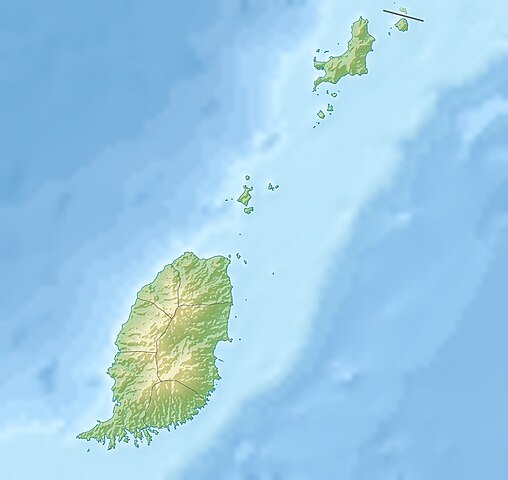
English: Relief location map of Grenada.
|
||
| 날짜 | |||
| 출처 | 자작 | ||
| 저자 | Uwe Dedering | ||
| 저작권 (이 파일을 인용하기) |
나는 아래 작품의 저작권자로서, 이 저작물을 다음과 같은 라이선스로 배포합니다: 이 파일은 크리에이티브 커먼즈 저작자표시-동일조건변경허락 3.0 Unported 라이선스로 배포됩니다.
이 라이선스 중에서 목적에 맞는 것을 선택하여 사용할 수 있습니다. |
||
| 다른 버전 |
|


파일 역사
날짜/시간 링크를 클릭하면 해당 시간의 파일을 볼 수 있습니다.
| 날짜/시간 | 섬네일 | 크기 | 사용자 | 설명 | |
|---|---|---|---|---|---|
| 현재 | 2010년 12월 24일 (금) 20:14 | | 1,435 × 1,356 (424 KB) | Uwe Dedering | initial upload |
이 파일을 사용하는 문서
다음 문서 1개가 이 파일을 사용하고 있습니다:
이 파일을 사용하고 있는 모든 위키의 문서 목록
다음 위키에서 이 파일을 사용하고 있습니다:
- ar.wikipedia.org에서 이 파일을 사용하고 있는 문서 목록
- ast.wikipedia.org에서 이 파일을 사용하고 있는 문서 목록
- ba.wikipedia.org에서 이 파일을 사용하고 있는 문서 목록
- bg.wikipedia.org에서 이 파일을 사용하고 있는 문서 목록
- bn.wikipedia.org에서 이 파일을 사용하고 있는 문서 목록
- bs.wikipedia.org에서 이 파일을 사용하고 있는 문서 목록
- ceb.wikipedia.org에서 이 파일을 사용하고 있는 문서 목록
- ce.wikipedia.org에서 이 파일을 사용하고 있는 문서 목록
- ckb.wikipedia.org에서 이 파일을 사용하고 있는 문서 목록
- cs.wikipedia.org에서 이 파일을 사용하고 있는 문서 목록
- da.wikipedia.org에서 이 파일을 사용하고 있는 문서 목록
- de.wikipedia.org에서 이 파일을 사용하고 있는 문서 목록
- Grenada
- Carriacou
- Mount Saint Catherine
- Petite Martinique
- Vorlage:Positionskarte Grenada
- Wikipedia:Kartenwerkstatt/Positionskarten/Nordamerika
- Benutzer:Uwe Dedering
- Ronde Island
- Lake Antoine
- Grand Etang Lake
- Caille Island
- Diamond Island (Grenada)
- Large Island (Grenada)
- Frigate Island (Carriacou)
- White Island (Grenada)
- Saline Island
- Cassada Rocks
- Mushroom Island (Grenada)
- Sandy Island (Carriacou)
- Mabouya Island
- Sister Rocks (Grenada)
- Bird Island (Grenada)
- Sugarloaf (Grenada)
- Green Island (Grenada)
- Sandy Island (Grenada)
- London Bridge (Grenadinen)
- Bonaparte Rocks
- Rose Rock (Grenada)
- Les Tantes
- Palmiste Lake
- Concord Falls
- Annendale Falls
- Seven Sisters Waterfalls
이 파일의 더 많은 사용 내역을 봅니다.