
파일:GRAIL's Final Resting Spot.jpg
미리 보기 크기: 800 × 469 픽셀 다른 해상도: 320 × 188 픽셀 | 640 × 375 픽셀 | 1,024 × 600 픽셀 | 1,702 × 998 픽셀
원본 파일 (1,702 × 998 픽셀, 파일 크기: 1.39 MB, MIME 종류: image/jpeg)
파일 설명
| 설명 |
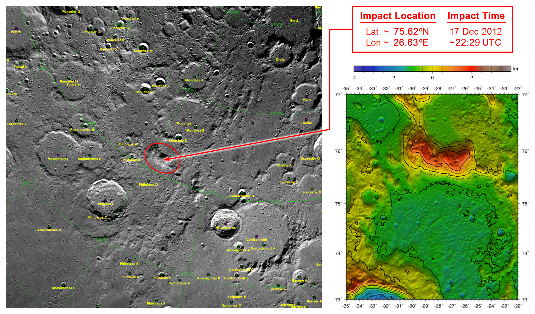
English: These maps of Earth's moon highlight the region where the twin spacecraft of NASA's Gravity Recovery and Interior Laboratory (GRAIL) mission will impact on Dec. 17, marking the end of its successful endeavor to map the moon's gravity. The two washing-machine-sized spacecraft, named Ebb and Flow, will impact at an unnamed mountain near the moon's North Pole.
These maps are from NASA's Lunar Reconnaissance Orbiter. |
| 출처 | http://www.nasa.gov/mission_pages/grail/multimedia/pia16603.html |
| 저자 | NASA |
라이선스
| 이 파일은 NASA에서 제작하였으므로 퍼블릭 도메인입니다. NASA의 저작권 정책에 따르면 NASA의 자료는 명시하지 않는 이상 저작권의 보호를 받지 않습니다. (Template:PD-USGov, 또는 NASA 저작권 정책 문서, JPL 그림 사용 정책을 참고하세요.) | ||
 |
주의사항:
|
기존 올리기 기록
The original description page was here. All following user names refer to en.wikipedia.
| 날짜/시간 | 크기 | 사용자 | 설명 |
|---|---|---|---|
| 2012-12-14 19:34 | 1702×998× (1460257 bytes) | RadioFan | Uploading a public-domain item using [[Wikipedia:File_Upload_Wizard|File Upload Wizard]] |
파일 역사
날짜/시간 링크를 클릭하면 해당 시간의 파일을 볼 수 있습니다.
| 날짜/시간 | 섬네일 | 크기 | 사용자 | 설명 | |
|---|---|---|---|---|---|
| 현재 | 2014년 9월 18일 (목) 16:18 | | 1,702 × 998 (1.39 MB) | Rcbutcher | Transferred from en.wikipedia |
이 파일을 사용하는 문서
다음 문서 1개가 이 파일을 사용하고 있습니다:
이 파일을 사용하고 있는 모든 위키의 문서 목록
다음 위키에서 이 파일을 사용하고 있습니다:
- ca.wikipedia.org에서 이 파일을 사용하고 있는 문서 목록
- en.wikipedia.org에서 이 파일을 사용하고 있는 문서 목록
- es.wikipedia.org에서 이 파일을 사용하고 있는 문서 목록
- ru.wikipedia.org에서 이 파일을 사용하고 있는 문서 목록
- zh.wikipedia.org에서 이 파일을 사용하고 있는 문서 목록