
파일:Franklin County Courthouse in Brookville.jpg
미리 보기 크기: 800 × 600 픽셀 다른 해상도: 320 × 240 픽셀 | 640 × 480 픽셀 | 1,024 × 768 픽셀 | 1,280 × 960 픽셀 | 2,560 × 1,920 픽셀 | 2,816 × 2,112 픽셀
원본 파일 (2,816 × 2,112 픽셀, 파일 크기: 2.36 MB, MIME 종류: image/jpeg)
|
This is an image of a place or building that is listed on the National Register of Historic Places in the United States of America. Its reference number is 75000018. |
| 카메라 위치 | | 이 지역의 다른 사진을 보기: OpenStreetMap |
|---|
| 설명 |
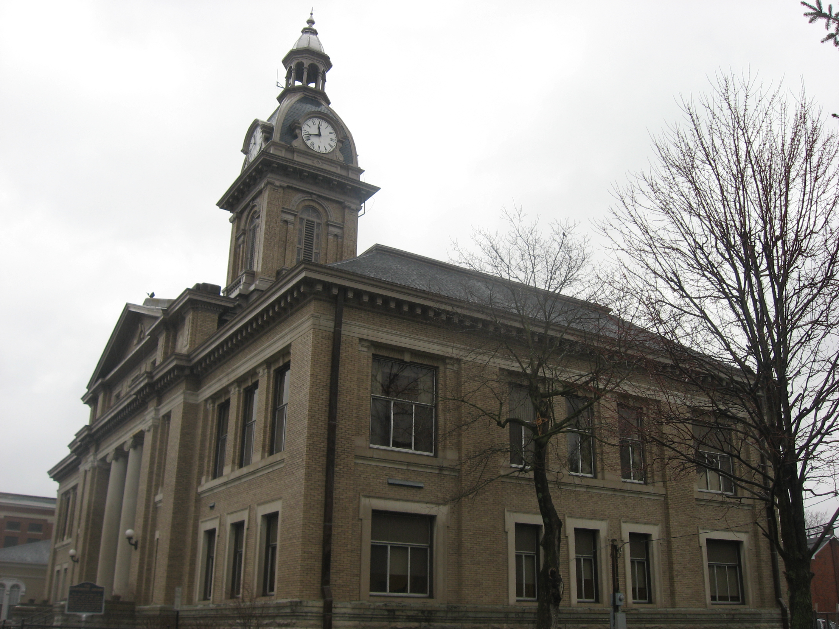
English: Front and southern side of the Franklin County Courthouse, located on Main Street (U.S. Route 52/State Road 1) between Fourth and Fifth Streets in Brookville, Indiana, United States. Built in 1859, it is part of a historic district, the Brookville Historic District, which is listed on the National Register of Historic Places. |
||
| 날짜 | 촬영 날짜: 2012년 3월 8일 | ||
| 출처 | 자작 | ||
| 저자 | Nyttend | ||
| 저작권 (이 파일을 인용하기) |
|
파일 역사
날짜/시간 링크를 클릭하면 해당 시간의 파일을 볼 수 있습니다.
| 날짜/시간 | 섬네일 | 크기 | 사용자 | 설명 | |
|---|---|---|---|---|---|
| 현재 | 2012년 3월 15일 (목) 01:21 | | 2,816 × 2,112 (2.36 MB) | Nyttend | {{NRHP|75000018}} {{Location|39|25|9|N|85|0|45|W}} {{Information |Description={{en|Front and southern side of the {{w|Franklin County Courthouse (Indiana)|Franklin County Courthouse}}, located on Main Street ({{w|U.S. Route 52}}/{{w|Indiana State Road ... |
이 파일을 사용하는 문서
다음 문서 1개가 이 파일을 사용하고 있습니다:
이 파일을 사용하고 있는 모든 위키의 문서 목록
다음 위키에서 이 파일을 사용하고 있습니다:
- de.wikipedia.org에서 이 파일을 사용하고 있는 문서 목록
- en.wikipedia.org에서 이 파일을 사용하고 있는 문서 목록
- et.wikipedia.org에서 이 파일을 사용하고 있는 문서 목록
- fr.wikipedia.org에서 이 파일을 사용하고 있는 문서 목록
- nl.wikipedia.org에서 이 파일을 사용하고 있는 문서 목록
- pt.wikipedia.org에서 이 파일을 사용하고 있는 문서 목록
- simple.wikipedia.org에서 이 파일을 사용하고 있는 문서 목록
- sv.wikipedia.org에서 이 파일을 사용하고 있는 문서 목록
- www.wikidata.org에서 이 파일을 사용하고 있는 문서 목록