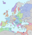
파일:Europe in 1328.png
보이기

미리 보기 크기: 552 × 600 픽셀 다른 해상도: 221 × 240 픽셀 | 442 × 480 픽셀 | 707 × 768 픽셀 | 942 × 1,024 픽셀 | 2,150 × 2,336 픽셀
원본 파일 (2,150 × 2,336 픽셀, 파일 크기: 761 KB, MIME 종류: image/png)
파일 역사
날짜/시간 링크를 클릭하면 해당 시간의 파일을 볼 수 있습니다.
| 날짜/시간 | 섬네일 | 크기 | 사용자 | 설명 | |
|---|---|---|---|---|---|
| 현재 | 2023년 8월 13일 (일) 00:29 |  | 2,150 × 2,336 (761 KB) | Gyalu22 | |
| 2023년 8월 7일 (월) 23:28 |  | 1,075 × 1,168 (114 KB) | Yuri V. | Novgorod Republic | |
| 2023년 8월 7일 (월) 10:22 |  | 1,075 × 1,168 (96 KB) | Yuri V. | Kingdom of Galicia–Volhynia 1199–1349, reverted to version as of 20:03, 7 November 2022 (UTC) | |
| 2022년 11월 17일 (목) 00:48 |  | 2,150 × 2,337 (116 KB) | Gyalu22 | Reverted to version as of 07:03, 14 July 2022 (UTC) | |
| 2022년 11월 8일 (화) 05:03 |  | 1,075 × 1,168 (96 KB) | Maxglig | Reverted to version as of 18:52, 26 December 2018 (UTC) | |
| 2022년 7월 14일 (목) 16:03 |  | 2,150 × 2,337 (116 KB) | Gligan1 | Original version restored | |
| 2018년 12월 27일 (목) 03:52 |  | 1,075 × 1,168 (96 KB) | Julieta39 | Details according with H.-E. Stier (dir.), ''Grosser Atlas zur Weltgeschichte'', Westermann 1985, (ISBN 3-14-100919-8), p. 71; ''Putzger historischer Weltatlas'', Cornelsen 1990, (ISBN 3-464-00176-8); Georges Duby, ''Atlas historique'', Larousse 1987, (ISBN 2-03-503009-9), André & Jean Sellier '''Atlas des Peuples'' La Découverte : ''Orient'' 1993, (ISBN 2-7071-2222-X), Claude Mutafian & Éric Van Lauwe, ''Atlas historique de l'Arménie'', Autrement, coll. « Atlas / Mémoires », 2005 (ISBN 978-2... | |
| 2017년 12월 24일 (일) 21:09 |  | 1,075 × 1,168 (101 KB) | Trey Kincaid | I've corrected Sicily, who was at that times an independent kingdom with Federico III as a king. | |
| 2017년 4월 28일 (금) 07:53 |  | 1,075 × 1,168 (87 KB) | Santasa99 | Rivers redrawn in blue, some info added and some corrections per Euroatlas - Historical Maps, [http://www.euratlas.net/history/europe/1300/index.html Euratlas Periodis Web - Map of Europe in Year 1300] | |
| 2015년 5월 11일 (월) 04:35 |  | 1,075 × 1,168 (120 KB) | Artemis Dread | Baia?! |
이 파일을 사용하는 문서
이 파일을 사용하는 문서가 없습니다.
이 파일을 사용하고 있는 모든 위키의 문서 목록
다음 위키에서 이 파일을 사용하고 있습니다:
- an.wikipedia.org에서 이 파일을 사용하고 있는 문서 목록
- ar.wikipedia.org에서 이 파일을 사용하고 있는 문서 목록
- ast.wikipedia.org에서 이 파일을 사용하고 있는 문서 목록
- az.wikipedia.org에서 이 파일을 사용하고 있는 문서 목록
- ban.wikipedia.org에서 이 파일을 사용하고 있는 문서 목록
- ba.wikipedia.org에서 이 파일을 사용하고 있는 문서 목록
- beta.wikiversity.org에서 이 파일을 사용하고 있는 문서 목록
- be.wikipedia.org에서 이 파일을 사용하고 있는 문서 목록
- bg.wikipedia.org에서 이 파일을 사용하고 있는 문서 목록
- bn.wikipedia.org에서 이 파일을 사용하고 있는 문서 목록
- bn.wikibooks.org에서 이 파일을 사용하고 있는 문서 목록
- bs.wikipedia.org에서 이 파일을 사용하고 있는 문서 목록
- bxr.wikipedia.org에서 이 파일을 사용하고 있는 문서 목록
- ca.wikipedia.org에서 이 파일을 사용하고 있는 문서 목록
- cs.wikipedia.org에서 이 파일을 사용하고 있는 문서 목록
- cv.wikipedia.org에서 이 파일을 사용하고 있는 문서 목록
- da.wikipedia.org에서 이 파일을 사용하고 있는 문서 목록
- de.wikipedia.org에서 이 파일을 사용하고 있는 문서 목록
- el.wikipedia.org에서 이 파일을 사용하고 있는 문서 목록
- en.wikipedia.org에서 이 파일을 사용하고 있는 문서 목록
- en.wikibooks.org에서 이 파일을 사용하고 있는 문서 목록
- es.wikipedia.org에서 이 파일을 사용하고 있는 문서 목록
이 파일의 더 많은 사용 내역을 봅니다.

