
파일:Cornwall UK location map.svg

SVG 파일의 PNG 형식의 미리보기 크기: 800 × 588 픽셀. 다른 해상도: 320 × 235 픽셀 | 640 × 471 픽셀 | 1,024 × 753 픽셀 | 1,280 × 941 픽셀 | 2,560 × 1,883 픽셀 | 1,425 × 1,048 픽셀
원본 파일 (SVG 파일, 실제 크기 1,425 × 1,048 픽셀, 파일 크기: 1.66 MB)
| 설명 |
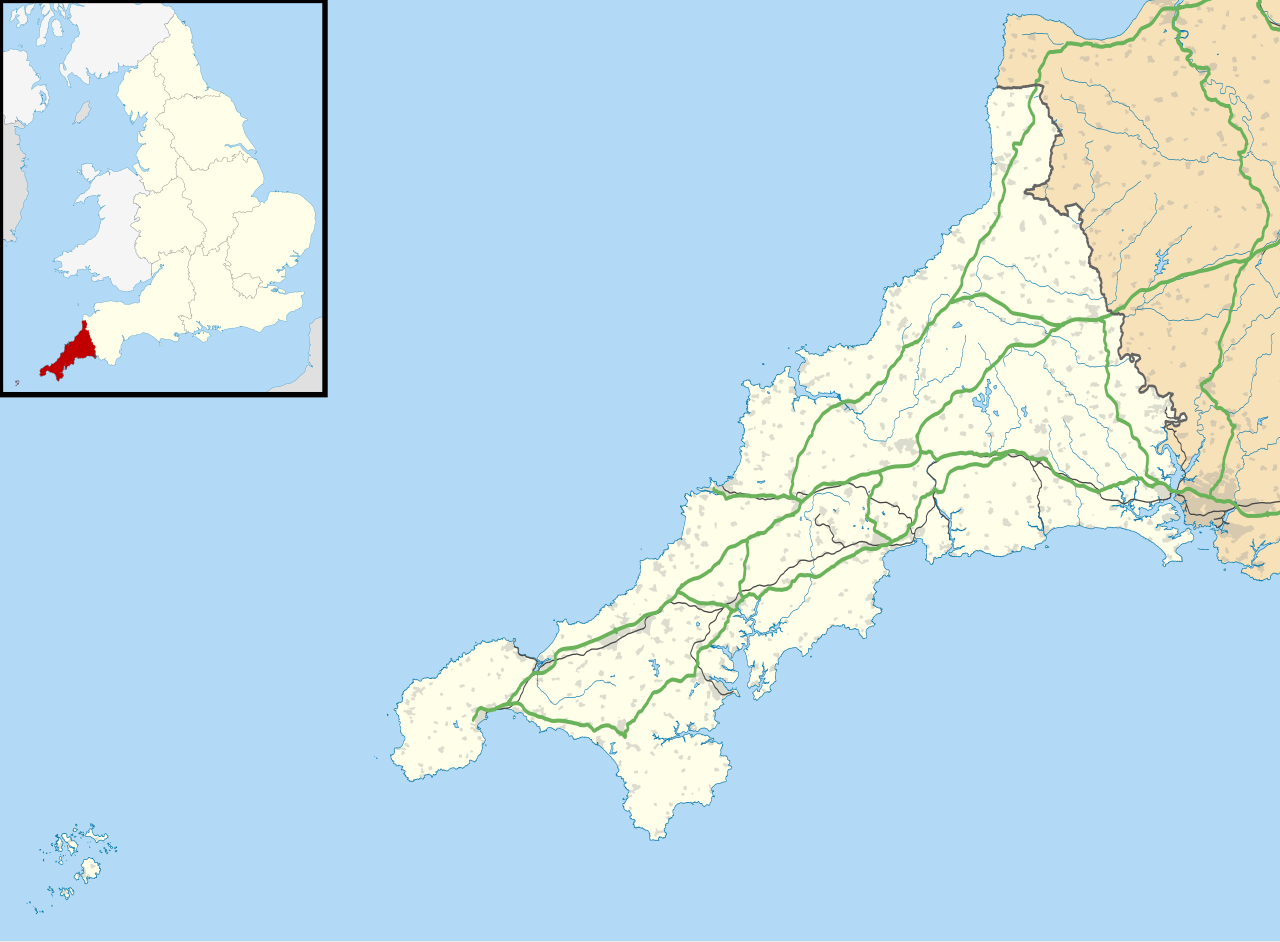
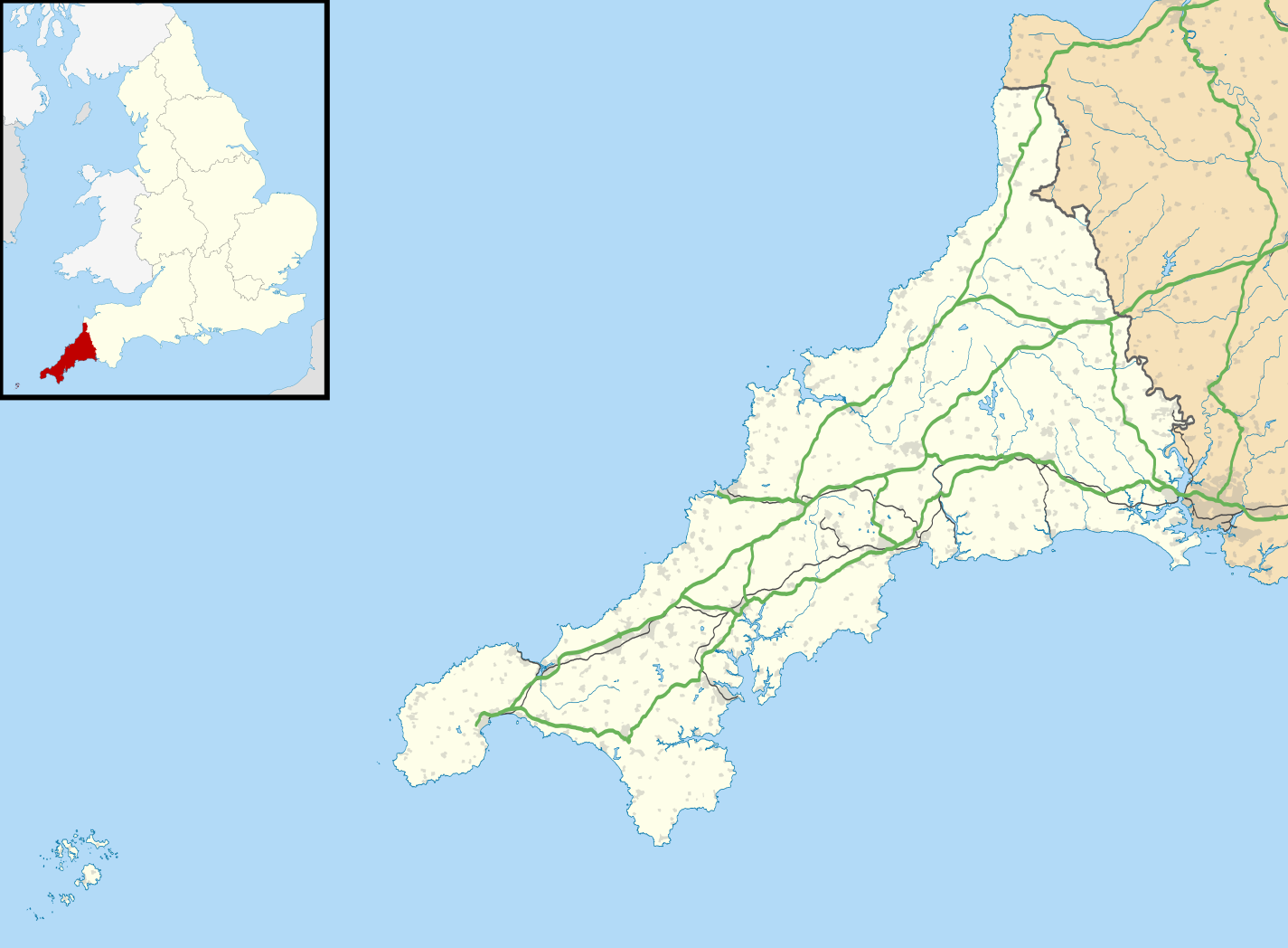
Map of Cornwall, UK with the following information shown:
Equirectangular map projection on WGS 84 datum, with N/S stretched 150% Geographic limits:
|
| 날짜 | |
| 출처 |
|
| 저자 | Nilfanion, created using Ordnance Survey data |
| 저작권 (이 파일을 인용하기) |
이 파일은 크리에이티브 커먼즈 저작자표시-동일조건변경허락 3.0 Unported 라이선스로 배포됩니다. 저작자표시: Contains Ordnance Survey data © Crown copyright and database right
|
| 다른 버전 |
File:Cornwall UK district map (blank).svg - Blank map File:Cornwall UK mainland location map.svg - Without Isles of Scilly |
.svg)
파일 역사
날짜/시간 링크를 클릭하면 해당 시간의 파일을 볼 수 있습니다.
| 날짜/시간 | 섬네일 | 크기 | 사용자 | 설명 | |
|---|---|---|---|---|---|
| 현재 | 2010년 9월 27일 (월) 03:43 | | 1,425 × 1,048 (1.66 MB) | Nilfanion | {{Information |Description=Map of Cornwall, UK with the following information shown: *Administrative borders *Coastline, lakes and rivers *Roads and railways *Urban areas Equirectangular map projection on WGS 84 datum, with N/S stretched 1 |
이 파일을 사용하는 문서
다음 문서 1개가 이 파일을 사용하고 있습니다:
이 파일을 사용하고 있는 모든 위키의 문서 목록
다음 위키에서 이 파일을 사용하고 있습니다:
- ar.wikipedia.org에서 이 파일을 사용하고 있는 문서 목록
- bg.wikipedia.org에서 이 파일을 사용하고 있는 문서 목록
- ceb.wikipedia.org에서 이 파일을 사용하고 있는 문서 목록
- en.wikipedia.org에서 이 파일을 사용하고 있는 문서 목록
- List of lighthouses in England
- Tintagel Castle
- Chûn Castle
- Truro Cathedral
- Port Eliot
- Lanhydrock House
- Carn Brea, Redruth
- Runnel Stone
- RAF St Mawgan
- Jamaica Inn
- List of places in Cornwall
- Penryn Campus
- St German's Priory
- Rillaton Barrow
- Roseland Peninsula
- Pendennis Castle
- Tregenna Castle
- Tregothnan
- Picklecombe Fort
- Restormel Castle
- Redruth transmitting station
- St Bartholomew's Church, Lostwithiel
- Caradon Hill transmitting station
- Goldsithney
- Mount Wellington Tin Mine
- Brisons
- Penlee Battery
- Newquay Airport
- RNAS Culdrose (HMS Seahawk)
- Geevor Tin Mine
- Botallack Mine
- Camborne School of Mines
- Prideaux Place
- Cotehele
- Trerice
- The Hurlers (stone circles)
- Poldice mine
- Godolphin Estate
- RAF Davidstow Moor
- Levant Mine and Beam Engine
- Trelissick
- Antony House
- Mount Edgcumbe House
- Trengwainton Garden
- Trevenson
- St Ervan
- HMS Raleigh (shore establishment)
이 파일의 더 많은 사용 내역을 봅니다.