
파일:America location map with borders.svg

SVG 파일의 PNG 형식의 미리보기 크기: 400 × 350 픽셀. 다른 해상도: 274 × 240 픽셀 | 549 × 480 픽셀 | 878 × 768 픽셀 | 1,170 × 1,024 픽셀 | 2,341 × 2,048 픽셀
원본 파일 (SVG 파일, 실제 크기 400 × 350 픽셀, 파일 크기: 173 KB)
파일 설명
| 설명 |
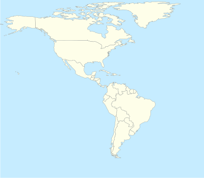
English: Location map for the Americas with national borders |
| 날짜 |
(UTC) |
| 출처 |
Transferred from en.wikipedia |
| 저자 |
Phósphoros (talk) 17:36, 16 September 2010 (UTC). Original uploader was Phósphoros at en.wikipedia |
| 저작권 (이 파일을 인용하기) |
Released under the GNU Free Documentation License. |
라이선스

|
GNU 자유 문서 사용 허가서 1.2판 또는 자유 소프트웨어 재단에서 발행한 이후 판의 규정에 따라 본 문서를 복제하거나 개작 및 배포할 수 있습니다. 본 문서에는 변경 불가 부분이 없으며, 앞 표지 구절과 뒷 표지 구절도 없습니다. 본 사용 허가서의 전체 내용은 GNU 자유 문서 사용 허가서 부분에 포함되어 있습니다. |
기존 올리기 기록
The original description page was here. All following user names refer to en.wikipedia.
- 2010-09-16 17:36 Phósphoros 400×350× (177397 bytes) {{Information |Description = Location map for America |Source = Modified for [[World Location map.svg]] |Date = ~~~~~ |Author = ~~~~ |Permission = |other_versions = }}
파일 역사
날짜/시간 링크를 클릭하면 해당 시간의 파일을 볼 수 있습니다.
| 날짜/시간 | 섬네일 | 크기 | 사용자 | 설명 | |
|---|---|---|---|---|---|
| 현재 | 2010년 9월 18일 (토) 19:18 | | 400 × 350 (173 KB) | Obersachse | {{Information |Description={{en|Location map for America}} |Source=Transferred from [http://en.wikipedia.org en.wikipedia]<br/> (Original text : ''Modified for en:World Location map.svg'') |Date=17:36, 16 September 2010 (UTC)<br/> ({{Date|2010|09|16 |
이 파일을 사용하는 문서
다음 문서 1개가 이 파일을 사용하고 있습니다:
이 파일을 사용하고 있는 모든 위키의 문서 목록
다음 위키에서 이 파일을 사용하고 있습니다:
- az.wikipedia.org에서 이 파일을 사용하고 있는 문서 목록
- ba.wikipedia.org에서 이 파일을 사용하고 있는 문서 목록
- da.wikipedia.org에서 이 파일을 사용하고 있는 문서 목록
- de.wikipedia.org에서 이 파일을 사용하고 있는 문서 목록
- fa.wikipedia.org에서 이 파일을 사용하고 있는 문서 목록
- it.wikipedia.org에서 이 파일을 사용하고 있는 문서 목록
- Cucina messicana
- Cucina argentina
- Cucina brasiliana
- Cucina cubana
- Cucina haitiana
- Cucina peruviana
- Cucina canadese
- Cucina statunitense
- Cucina groenlandese
- Cucina venezuelana
- Cucina colombiana
- Cucina di Barbados
- Cucina ecuadoriana
- Cucina costaricana
- Cucina uruguaiana
- Cucina giamaicana
- Cucina di Trinidad e Tobago
- Cucina cilena
- Template:Cucina americana
- Cucina boliviana
- Cucina bahamense
- Cucina beliziana
- Cucina paraguaiana
- Cucina guatemalteca
- Cucina nicaraguense
- Cucina di Antigua e Barbuda
- ru.wikipedia.org에서 이 파일을 사용하고 있는 문서 목록
- sq.wikipedia.org에서 이 파일을 사용하고 있는 문서 목록