
파일:Africa-countries-EAC.png
최대 해상도입니다.
Africa-countries-EAC.png (350 × 350 픽셀, 파일 크기: 10 KB, MIME 종류: image/png)

|
이 그림은 벡터 그래픽 버전(SVG)이 있습니다. 래스터 그림 대신 벡터 그래픽 그림을 사용해야 합니다.
File:Africa-countries-EAC.png → File:Africa-countries-EAC.svg
|
 |
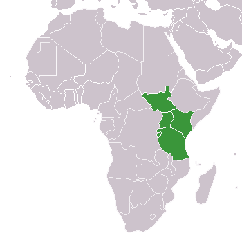
- Description: Map of African Countries of EAC
- Beschreibung: Karte von afrikanischen Ländern der EAC
- old image originally from Wikimedia Commons Image:BlankMap-Africa.png
- new image is self-created
- created by de:Benutzer:Sven-steffen arndt
| 나는 이 작품의 저작권자로서, 이 작품을 퍼블릭 도메인으로 모두에게 공개합니다. 이 공개 선언은 전 세계적으로 유효합니다. 만약 저작권의 포기가 법률적으로 가능하지 않은 경우, 나는 이 작품을 법적으로 허용되는 한도 내에서 누구나 자유롭게 어떤 목적으로도 제한없이 사용할 수 있도록 허용합니다. |
파일 역사
날짜/시간 링크를 클릭하면 해당 시간의 파일을 볼 수 있습니다.
| 날짜/시간 | 섬네일 | 크기 | 사용자 | 설명 | |
|---|---|---|---|---|---|
| 현재 | 2016년 3월 10일 (목) 05:30 | | 350 × 350 (10 KB) | Einsamer Schütze | South Sudan joined as new member on march 2nd 2016 |
| 2011년 7월 15일 (금) 21:26 |  | 350 × 350 (11 KB) | Nicolay Sidorov | Hala'ib triangle is a dispute territory | |
| 2011년 7월 10일 (일) 00:56 |  | 350 × 350 (11 KB) | Maphobbyist | South Sudan has become independent on July 9, 2011. Sudan and South Sudan are shown with the new international border between them. | |
| 2007년 7월 1일 (일) 17:09 |  | 350 × 350 (11 KB) | Béka~commonswiki | Reverted to earlier revision | |
| 2007년 1월 12일 (금) 03:00 |  | 350 × 350 (11 KB) | Nightstallion | Reverted to earlier revision | |
| 2006년 12월 1일 (금) 04:38 |  | 350 × 350 (11 KB) | Nightstallion | burundi and rwanda | |
| 2006년 4월 16일 (일) 07:50 |  | 350 × 350 (11 KB) | Aris Katsaris | corrected and cropped a bit | |
| 2005년 8월 22일 (월) 02:33 |  | 360 × 392 (7 KB) | Sven-steffen arndt | :'''Description''': Map of African Countries of EAC :'''Beschreibung''': Karte von afrikanischen Ländern der EAC :old image originally from Wikimedia Commons Image:BlankMap-Africa.png :new image is self-created :'''created by''' [[:de:Benutzer:Sven- |
이 파일을 사용하는 문서
이 파일을 사용하는 문서가 없습니다.
이 파일을 사용하고 있는 모든 위키의 문서 목록
다음 위키에서 이 파일을 사용하고 있습니다:
- en.wikipedia.org에서 이 파일을 사용하고 있는 문서 목록