
파일:1918-1949 Bradford South.png
최대 해상도입니다.
1918-1949_Bradford_South.png (370 × 330 픽셀, 파일 크기: 6 KB, MIME 종류: image/png)
파일 설명
| 설명 |
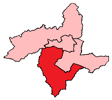
English: 1918-1949 Bradford South
|
| 날짜 | 날짜를 알 수 없음 |
| 출처 | http://uselectionatlas.org/FORUM/index.php?action=profile;u=9106;sa=showPosts;start=50 |
| 저자 | 미상 |
라이선스
| 이 저작물은 완전히 공공의 재산으로서의 정보로만 구성되어 있으며, 창작성이 있는 요소가 포함되어 있지 않아 저작권 보호에 부적격하므로 퍼블릭 도메인입니다. |
기존 올리기 기록
The original description page was here. All following user names refer to en.wikipedia.
| 날짜/시간 | 크기 | 사용자 | 설명 |
|---|---|---|---|
| 2017-02-08 07:33 | 370×330× (6098 bytes) | Graemp | Uploading a public-domain item using [[Wikipedia:File_Upload_Wizard|File Upload Wizard]] |
파일 역사
날짜/시간 링크를 클릭하면 해당 시간의 파일을 볼 수 있습니다.
| 날짜/시간 | 섬네일 | 크기 | 사용자 | 설명 | |
|---|---|---|---|---|---|
| 현재 | 2018년 10월 3일 (수) 22:11 | | 370 × 330 (6 KB) | Junior Jumper | == {{int:filedesc}} == {{Information |Description={{en|1918-1949 Bradford South<br/> ;Other information: this is a simplified version of a map originally created by the UK Boundary Commission.}} |Source={{transferred from|en.wikipedia}}<br/> (Original text : ''http://uselectionatlas.org/FORUM/index.php?action=profile;u=9106;sa=showPosts;start=50'') |Date=unknown<br/> ({{Original upload date|2017-02-08}}) |Author=unknown. {{Original uploader|Graemp|wikipedia|en}} |Permission=This image is in t... |
이 파일을 사용하는 문서
다음 문서 1개가 이 파일을 사용하고 있습니다:
이 파일을 사용하고 있는 모든 위키의 문서 목록
다음 위키에서 이 파일을 사용하고 있습니다:
- en.wikipedia.org에서 이 파일을 사용하고 있는 문서 목록