파일:Philippines location map (square).svg
문서 내용이 다른 언어로는 지원되지 않습니다.
위키백과, 우리 모두의 백과사전.

원본 파일(SVG 파일, 실제 크기 1,332 × 1,332 픽셀, 파일 크기: 1.49 MB)

파일 설명

https://commons.m.wikimedia.org/wiki/File:VisualEditor_tables_type_inside_a_cell.png

설명
English: Located in Burgos, Ilocos Norte
This is a photo of a cultural heritage property in the Philippines with ID
PH-01-0006
날짜
출처 자작
저자

[[User:Lumaktaw sa pangunahing content Account Kahapon, 12:53 AMBago

Bagong pag-sign in sa Galaxy A03 larendovaldez0@gmail.com Nasa panganib ang iyong account kung hindi ikaw ito

Galaxy A03 Pilipinas Ang teleponong ito Pamilyar ba sa iyo ang aktibidad na ito? Hindi, i-secure ang account Oo, ako iyon |

Map data ©2024 5 km Devices La Dez 11th Apr 8:16 PM 4HMH+8X San Nicolas, Ilocos Norte, Philippines

]]

Wikimedia Commons

Search File:Cape Bojeador Light House.JPG Language Watch Edit File File history File usage on Commons File usage on other wikis Metadata File:Cape Bojeador Light House.JPG Size of this preview: 800 × 536 pixels. Other resolutions: 320 × 214 pixels | 640 × 429 pixels | 1,024 × 686 pixels | 1,280 × 857 pixels | 2,890 × 1,935 pixels. Original file ‎(2,890 × 1,935 pixels, file size: 5.43 MB, MIME type: image/jpeg); ZoomViewer

File information Structured data Structured data labels link to their respective Wikidata pages and will open in a new window. Items portrayed in this file depicts Search to add items

Custom value Cape Bojeador Lighthouse Mark as prominent creator Search to add items

Custom value some value Mark as prominent Qualifiers object has role photographer

Custom value URL https://commons.wikimedia.org/wiki/User:File:VisualEditor_tables_type_inside_a_cell.png author name string File:VisualEditor_tables_type_inside_a_cell.png Wikimedia username https://commons.m.wikimedia.org/wiki/File:Cape_Bojeador_Light_House.JPG#/editor/1 References

copyright status copyrighted Mark as prominent copyright license Creative Commons Attribution-ShareAlike 3.0 Unported Mark as prominent source of file original creation by uploader Mark as prominent inception 2 April 2010 Mark as prominent captured with Nikon D60 Mark as prominent participant in Wiki Loves Monuments 2012 Mark as prominent MIME type image/jpeg Mark as prominent checksum

설명 Wikipedia logo 2.0
날짜 n/a
출처 Wikimedia Foundation
저자 https://commons.m.wikimedia.org/wiki/File:VisualEditor_tables_type_inside_a_cell.png
저작권
(이 파일을 인용하기)
Trademarked
™ Wikimedia Foundation, Inc.
이 파일은 위키미디어 재단이나 위키미디어의 프로젝트 중 어느 하나에서 사용되는 공식 로고나 디자인을 포함하고 있습니다. 위키미디어 로고와 상표의 이용은 상표권 정책시각적 아이덴티티 가이드라인이 적용되며, 별도의 허락이 필요할 수 있습니다.

이 태그는 첨부된 저작물의 저작권 상태를 나타내지 않습니다. 일반 저작권 태그는 여전히 필요합니다. Commons:라이선스를 참고하십시오. 

w:ko:크리에이티브 커먼즈
저작자표시 동일조건변경허락
저작자표시: Wikimedia Foundation
이용자는 다음의 권리를 갖습니다:
  • 공유 및 이용 – 저작물의 복제, 배포, 전시, 공연 및 공중송신
  • 재창작 – 저작물의 개작, 수정, 2차적저작물 창작
다음과 같은 조건을 따라야 합니다:
  • 저작자표시 – 적절한 저작자 표시를 제공하고, 라이센스에 대한 링크를 제공하고, 변경사항이 있는지를 표시해야 합니다. 당신은 합리적인 방식으로 표시할 수 있지만, 어떤 방식으로든 사용권 허가자가 당신 또는 당신의 사용을 지지하는 방식으로 표시할 수 없습니다.
  • 동일조건변경허락 – 만약 당신이 이 저작물을 리믹스 또는 변형하거나 이 저작물을 기반으로 제작하는 경우, 당신은 당신의 기여물을 원저작물과 동일하거나 호환 가능한 라이선스에 따라 배포하여야 합니다.

Mark as prominent determination method

SHA-1 data size 5,694,181 byte Mark as prominent height 1,935 pixel Mark as prominent width 2,890 pixel Mark as prominent Wikimedia Commons Files are available under licenses specified on their description page. All structured data from the file namespace is available under the Creative Commons CC0 License; all unstructured text is available under the Creative Commons Attribution-ShareAlike License; additional terms may apply. By using this site, you agree to the Terms of Use and the Privacy Policy. Privacy policy Terms of UseDesktop You are not logged in and your IP address will be publicly visible if you make any edits. Logging in or creating an account will conceal your IP address and provide you with many other benefits. Please do not save test edits. If you want to experiment, please use the Sandbox.

==파일 설명==
설명
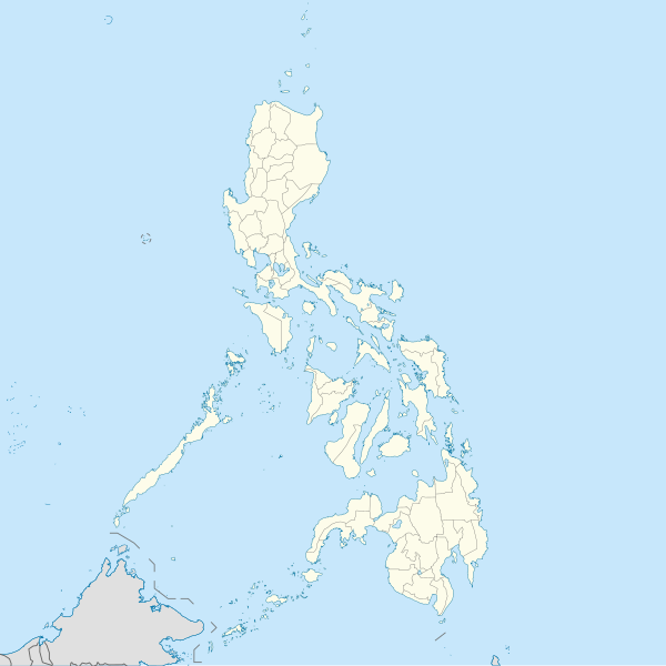
English: Location map of the Philippines

Equirectangular projection based on the parallel of 10°43' N

  • N: 21.2° N
  • S: 4.3° N
  • W: 114.0° E
  • E: 131.2° E
날짜
출처

자작

Author=WikiRoulete
저자 Hellerick Edit this at Structured Data on Commons

|other fields=SVG 발전

InfoField
 
SVG 파일의 소스 코드 문법이 올바릅니다.
 
벡터 그림Inkscape(으)로 제작되었습니다.

}}This template has no documented parameters and may be intended for use without them.

라이선스

나는 아래 작품의 저작권자로서, 이 저작물을 다음과 같은 라이선스로 배포합니다:
w:ko:크리에이티브 커먼즈
저작자표시 동일조건변경허락
이용자는 다음의 권리를 갖습니다:
  • 공유 및 이용 – 저작물의 복제, 배포, 전시, 공연 및 공중송신
  • 재창작 – 저작물의 개작, 수정, 2차적저작물 창작
다음과 같은 조건을 따라야 합니다:
  • 저작자표시 – 적절한 저작자 표시를 제공하고, 라이센스에 대한 링크를 제공하고, 변경사항이 있는지를 표시해야 합니다. 당신은 합리적인 방식으로 표시할 수 있지만, 어떤 방식으로든 사용권 허가자가 당신 또는 당신의 사용을 지지하는 방식으로 표시할 수 없습니다.
  • 동일조건변경허락 – 만약 당신이 이 저작물을 리믹스 또는 변형하거나 이 저작물을 기반으로 제작하는 경우, 당신은 당신의 기여물을 원저작물과 동일하거나 호환 가능한 라이선스에 따라 배포하여야 합니다.

설명

이 파일이 나타내는 바에 대한 한 줄 설명을 추가합니다
Map of the Philippines Islands (P.I.)

이 파일에 묘사된 항목

다음을 묘사함

image/svg+xml

파일 역사

날짜/시간 링크를 클릭하면 해당 시간의 파일을 볼 수 있습니다.

(최신 | 오래됨) (다음 10개 | ) (10 | 20 | 50 | 100 | 250 | 500) 보기
날짜/시간섬네일크기사용자설명
현재2021년 8월 19일 (목) 19:172021년 8월 19일 (목) 19:17 판의 섬네일1,332 × 1,332 (1.49 MB)AichiWikiFixerUpdated boundaries
2021년 6월 18일 (금) 16:532021년 6월 18일 (금) 16:53 판의 섬네일1,332 × 1,332 (2.24 MB)AichiWikiFixerMap update.
2021년 6월 18일 (금) 12:552021년 6월 18일 (금) 12:55 판의 섬네일1,332 × 1,332 (2.23 MB)AichiWikiFixerSmall changes.
2021년 6월 18일 (금) 12:492021년 6월 18일 (금) 12:49 판의 섬네일1,332 × 1,332 (2.23 MB)AichiWikiFixerExternal changes for boundaries and coastlines.
2021년 6월 17일 (목) 22:112021년 6월 17일 (목) 22:11 판의 섬네일1,332 × 1,332 (2.23 MB)AichiWikiFixerAdditional islands, lakes, and updated coastlines.
2021년 6월 17일 (목) 19:342021년 6월 17일 (목) 19:34 판의 섬네일1,332 × 1,332 (2.23 MB)AichiWikiFixerUpdate boundaries.
2021년 5월 25일 (화) 11:042021년 5월 25일 (화) 11:04 판의 섬네일1,332 × 1,332 (2.22 MB)HueMan1Reverted to version as of 07:24, 7 September 2020 (UTC)
2021년 5월 17일 (월) 16:112021년 5월 17일 (월) 16:11 판의 섬네일1,332 × 1,332 (3.72 MB)PetrioloReverted to version as of 05:36, 3 May 2021 (UTC) The new administrative borders are based from the Philippine government websites (https://www.geoportal.gov.ph/; http://noah.up.edu.ph/), and is deemed accurate. These new files have reliable sources and there's no "beauty" in it if it is inaccurate in the first place.
2021년 5월 16일 (일) 23:002021년 5월 16일 (일) 23:00 판의 섬네일1,332 × 1,332 (2.22 MB)AichiWikiFixerReverted to version as of 07:24, 7 September 2020 (UTC) (Borders seen as ugly)
2021년 5월 3일 (월) 14:362021년 5월 3일 (월) 14:36 판의 섬네일1,332 × 1,332 (3.72 MB)Petrioloupdated with NAMRIA borders
(최신 | 오래됨) (다음 10개 | ) (10 | 20 | 50 | 100 | 250 | 500) 보기

이 파일을 사용하고 있는 모든 위키의 문서 목록

다음 위키에서 이 파일을 사용하고 있습니다:

이 파일의 더 많은 사용 내역을 봅니다.

메타데이터