
파일:ASTER Views the Himalaya.jpg

미리 보기 크기: 600 × 600 픽셀 다른 해상도: 240 × 240 픽셀 | 480 × 480 픽셀 | 768 × 768 픽셀 | 1,024 × 1,024 픽셀 | 2,048 × 2,048 픽셀 | 3,648 × 3,648 픽셀
원본 파일 (3,648 × 3,648 픽셀, 파일 크기: 3.73 MB, MIME 종류: image/jpeg)
파일 설명
| 설명 | |
| 날짜 | |
| 출처 | NASA Earth Observatory |
| 저자 | USGS EROS Data Center Satellite Systems Branch |
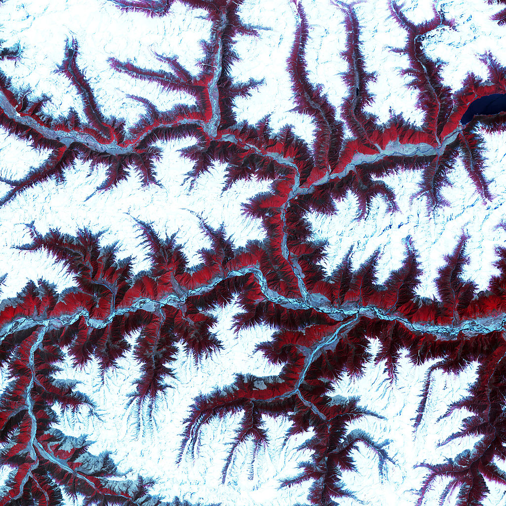
This scene was acquired by the Advanced Spaceborne Thermal Emission and Reflection Radiometer (ASTER), flying aboard NASA’s Terra satellite. This false-colour composite image was created by combining near-infra-red, red, and green wavelengths (ASTER bands 3, 2, and 1, respectively).
라이선스
|
|
파일 역사
날짜/시간 링크를 클릭하면 해당 시간의 파일을 볼 수 있습니다.
| 날짜/시간 | 섬네일 | 크기 | 사용자 | 설명 | |
|---|---|---|---|---|---|
| 현재 | 2010년 4월 27일 (화) 01:00 | | 3,648 × 3,648 (3.73 MB) | Originalwana | {{Information |Description={{en|1=Soaring, snow-capped peaks and ridges of the eastern Himalaya Mountains create an irregular white-on-red patchwork between major rivers in south-western [[ |
이 파일을 사용하는 문서
다음 문서 1개가 이 파일을 사용하고 있습니다:
이 파일을 사용하고 있는 모든 위키의 문서 목록
다음 위키에서 이 파일을 사용하고 있습니다:
- pnb.wikipedia.org에서 이 파일을 사용하고 있는 문서 목록
- ur.wikipedia.org에서 이 파일을 사용하고 있는 문서 목록