
파일:Weil, Stephan.jpg

원본 파일 (2,347 × 3,527 픽셀, 파일 크기: 1.68 MB, MIME 종류: image/jpeg)
파일 설명
| 설명 |
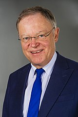
Deutsch: Stephan Weil |
||||||||||||
| 날짜 | |||||||||||||
| 출처 | 자작 | ||||||||||||
| 저자 | Foto-AG Melle | ||||||||||||
| 저작권 (이 파일을 인용하기) |
|
||||||||||||


| 대상 위치 | | 이 지역의 다른 사진을 보기: OpenStreetMap |
|---|
| 카메라 위치 | | 이 지역의 다른 사진을 보기: OpenStreetMap |
|---|
라이선스
- 이용자는 다음의 권리를 갖습니다:
- 공유 및 이용 – 저작물의 복제, 배포, 전시, 공연 및 공중송신
- 재창작 – 저작물의 개작, 수정, 2차적저작물 창작
- 다음과 같은 조건을 따라야 합니다:
- 저작자표시 – 적절한 저작자 표시를 제공하고, 라이센스에 대한 링크를 제공하고, 변경사항이 있는지를 표시해야 합니다. 당신은 합리적인 방식으로 표시할 수 있지만, 어떤 방식으로든 사용권 허가자가 당신 또는 당신의 사용을 지지하는 방식으로 표시할 수 없습니다.
|
|
파일 역사
날짜/시간 링크를 클릭하면 해당 시간의 파일을 볼 수 있습니다.
| 날짜/시간 | 섬네일 | 크기 | 사용자 | 설명 | |
|---|---|---|---|---|---|
| 현재 | 2018년 2월 28일 (수) 19:17 | | 2,347 × 3,527 (1.68 MB) | Foto-AG Melle | User created page with UploadWizard |
이 파일을 사용하는 문서
다음 문서 1개가 이 파일을 사용하고 있습니다:
이 파일을 사용하고 있는 모든 위키의 문서 목록
다음 위키에서 이 파일을 사용하고 있습니다:
- ar.wikipedia.org에서 이 파일을 사용하고 있는 문서 목록
- arz.wikipedia.org에서 이 파일을 사용하고 있는 문서 목록
- az.wikipedia.org에서 이 파일을 사용하고 있는 문서 목록
- da.wikipedia.org에서 이 파일을 사용하고 있는 문서 목록
- de.wikipedia.org에서 이 파일을 사용하고 있는 문서 목록
- Liste der Ministerpräsidenten der deutschen Länder
- Liste der Mitglieder des Bundesrates (Deutschland)
- Sozialdemokratische Partei Deutschlands
- Portal:Politiker/Regierungsmitglieder
- SPD Niedersachsen
- Landtagswahlkreis Hannover-Buchholz
- Wikipedia:Landtagsprojekt/Galerie
- Liste der Staatsoberhäupter Deutschlands
- Liste der Mitglieder des Niedersächsischen Landtages (18. Wahlperiode)
- Kabinett Weil II
- Landtagswahl in Niedersachsen 2022
- Benutzer:Connoisseur of politics/Parteivorsitzende
- Kabinett Weil III
- Wikipedia:Hauptseite/Archiv/9. November 2022
- Wikipedia:Hauptseite/Archiv/10. November 2022
- Wikipedia:Hauptseite/Archiv/11. November 2022
- en.wikipedia.org에서 이 파일을 사용하고 있는 문서 목록
- President of the German Bundesrat
- Minister-President of Lower Saxony
- Stephan Weil
- Cabinet Weil I
- User:Gag0409/sandbox
- User:Alektor89/sandbox
- Minister president (Germany)
- 2022 Lower Saxony state election
- List of current heads of government of the German federal states
- Cabinet Weil II
- Cabinet Weil III
- eo.wikipedia.org에서 이 파일을 사용하고 있는 문서 목록
- es.wikipedia.org에서 이 파일을 사용하고 있는 문서 목록
- fr.wikipedia.org에서 이 파일을 사용하고 있는 문서 목록
- he.wikipedia.org에서 이 파일을 사용하고 있는 문서 목록
- hu.wikipedia.org에서 이 파일을 사용하고 있는 문서 목록
- ie.wikipedia.org에서 이 파일을 사용하고 있는 문서 목록
- it.wikipedia.org에서 이 파일을 사용하고 있는 문서 목록
- ja.wikipedia.org에서 이 파일을 사용하고 있는 문서 목록
- la.wikipedia.org에서 이 파일을 사용하고 있는 문서 목록
- nl.wikipedia.org에서 이 파일을 사용하고 있는 문서 목록
이 파일의 더 많은 사용 내역을 봅니다.