
파일:Morocco (orthographic projection).svg

SVG 파일의 PNG 형식의 미리보기 크기: 550 × 550 픽셀. 다른 해상도: 240 × 240 픽셀 | 480 × 480 픽셀 | 768 × 768 픽셀 | 1,024 × 1,024 픽셀 | 2,048 × 2,048 픽셀
원본 파일 (SVG 파일, 실제 크기 550 × 550 픽셀, 파일 크기: 307 KB)
Sahara marocain
파일 설명

| 설명 |
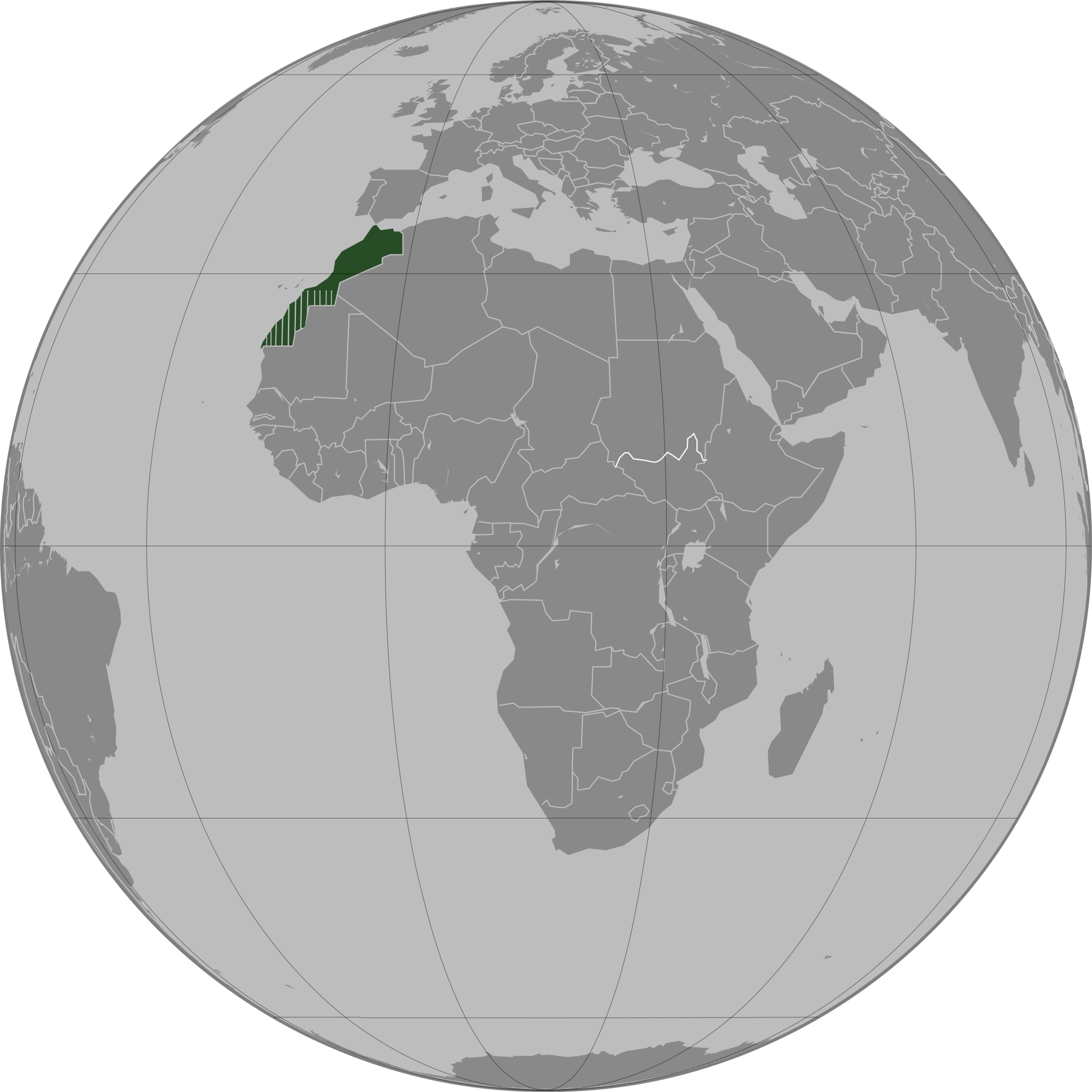
العربية: تحديد المغرب مع إقليمه المتنازع عليه الصحراء المغربية بشكل مخطط، الأمم المتحدة تعترف بصحراء المغرب.
Español: Localización de Marruecos y del territorio ocupado del Sahara Occidental. Ni las Naciones Unidas ni nungún país del mundo reconoce a Marruecos la soberanía sobre dicho territorio, que a ojos de la Comunidad Internacional sigue siendo considerado un Territorio No Autónomo pendiente de descolonización como así lo corrobora el informe S/2002/161.
Français : Localisation du Maroc et de son territoire contesté Sahara occidental, en pointillés. Les Nations Unies reconnaissent au Maroc la souveraineté administrative sur ce territoire.
Deutsch: Lokalisierung Marokkos und seines strittigen Territoriums Westsahara, gestrichelt dargestellt. Die Vereinten Nationen gestehen Marokko Verwaltungshoheit über das Territorium zu.
English: Locator of Morocco and the disputed territory Western Sahara shown as striped. United Nations recognize Morocco as an administrative power of the territory.
Português: Localização de Marrocos e do seu território contestado Saara Ocidental, tracejado. As Nações Unidas concedem a Marrocos a soberania administrativa sobre esse território. |
||||
| 날짜 | |||||
| 출처 |
자작
|
||||
| 저자 | Flad | ||||
| 다른 버전 |
|
.svg)
.svg)
.svg)
.svg)
_highlighted.svg)
.svg?uselang=ko)
.svg)
والمغرب في صحرائه وصحراء في مغربها
라이선스

|
GNU 자유 문서 사용 허가서 1.2판 또는 자유 소프트웨어 재단에서 발행한 이후 판의 규정에 따라 본 문서를 복제하거나 개작 및 배포할 수 있습니다. 본 문서에는 변경 불가 부분이 없으며, 앞 표지 구절과 뒷 표지 구절도 없습니다. 본 사용 허가서의 전체 내용은 GNU 자유 문서 사용 허가서 부분에 포함되어 있습니다. |
| 이 파일은 크리에이티브 커먼즈 저작자표시-동일조건변경허락 3.0 Unported 라이선스로 배포됩니다. | ||
| ||
| 이 라이선스 틀은 GFDL 라이선스 변경의 일부로 이 파일에 추가되었습니다. |
파일 역사
날짜/시간 링크를 클릭하면 해당 시간의 파일을 볼 수 있습니다.
.svg&dir=prev)
.svg&offset=20110503163341)
.svg&offset=&limit=20)
.svg&offset=&limit=50)
.svg&offset=&limit=100)
.svg&offset=&limit=250)
.svg&offset=&limit=500)
| 날짜/시간 | 섬네일 | 크기 | 사용자 | 설명 | |
|---|---|---|---|---|---|
| 현재 | 2011년 8월 13일 (토) 13:40 | | 550 × 550 (307 KB) | Banhtrung1 | Added the South Sudan. |
| 2011년 5월 10일 (화) 04:30 |  | 550 × 550 (292 KB) | Omar-Toons | please read the description + consensus that this is the right version to be shared under this name | |
| 2011년 5월 10일 (화) 04:28 |  | 550 × 550 (293 KB) | Eddo | User talk:Omar-Toons | |
| 2011년 5월 10일 (화) 01:22 |  | 550 × 550 (292 KB) | Omar-Toons | Reverted to version as of 13:04, 8 May 2011 please read the description | |
| 2011년 5월 9일 (월) 15:25 |  | 550 × 550 (293 KB) | Eddo | Reverted to version as of 07:11, 8 May 2011 | |
| 2011년 5월 8일 (일) 22:04 |  | 550 × 550 (292 KB) | Rekaf | Reverted to version as of 00:02, 6 July 2010 -- the original file is already striped, you can upload a new version with light-green | |
| 2011년 5월 8일 (일) 16:11 |  | 550 × 550 (293 KB) | Eddo | West Sahara is not part of Morocco | |
| 2011년 5월 6일 (금) 17:15 |  | 550 × 550 (292 KB) | Omar-Toons | Reverted to version as of 16:33, 3 May 2011 Another version (WS excluded) exists. Reverting non-consensual change | |
| 2011년 5월 4일 (수) 03:01 |  | 550 × 550 (293 KB) | Eddo | Redrawing the border between Morocco and West Sahara, please don't erase it | |
| 2011년 5월 4일 (수) 01:33 |  | 550 × 550 (292 KB) | Flad | Reverted to version as of 00:02, 6 July 2010 |
이 파일을 사용하는 문서
이 파일을 사용하는 문서가 없습니다.
이 파일을 사용하고 있는 모든 위키의 문서 목록
다음 위키에서 이 파일을 사용하고 있습니다:
- ar.wikipedia.org에서 이 파일을 사용하고 있는 문서 목록
- ca.wikipedia.org에서 이 파일을 사용하고 있는 문서 목록
- da.wikipedia.org에서 이 파일을 사용하고 있는 문서 목록
- en.wikipedia.org에서 이 파일을 사용하고 있는 문서 목록
- en.wikinews.org에서 이 파일을 사용하고 있는 문서 목록
- es.wikipedia.org에서 이 파일을 사용하고 있는 문서 목록
- fr.wikipedia.org에서 이 파일을 사용하고 있는 문서 목록
- fr.wikinews.org에서 이 파일을 사용하고 있는 문서 목록
- incubator.wikimedia.org에서 이 파일을 사용하고 있는 문서 목록
- nap.wikipedia.org에서 이 파일을 사용하고 있는 문서 목록
- tr.wikipedia.org에서 이 파일을 사용하고 있는 문서 목록
.svg)