
파일:Map of Kentucky highlighting Breathitt County.svg

SVG 파일의 PNG 형식의 미리보기 크기: 800 × 345 픽셀. 다른 해상도: 320 × 138 픽셀 | 640 × 276 픽셀 | 1,024 × 441 픽셀 | 1,280 × 551 픽셀 | 2,560 × 1,103 픽셀 | 6,770 × 2,916 픽셀
원본 파일 (SVG 파일, 실제 크기 6,770 × 2,916 픽셀, 파일 크기: 127 KB)
파일 설명
| 설명 |
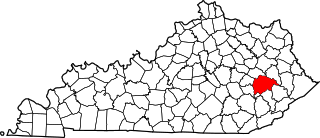
English: This is a locator map showing Breathitt County in Kentucky. For more information, see Commons:United States county locator maps. |
| 날짜 | |
| 출처 |
자작: English: The maps use data from nationalatlas.gov, specifically countyp020.tar.gz on the Raw Data Download page. The maps also use state outline data from statesp020.tar.gz. The Florida maps use hydrogm020.tar.gz to display Lake Okeechobee. |
| 저자 | David Benbennick |
라이선스
| 나는 이 작품의 저작권자로서, 이 작품을 퍼블릭 도메인으로 모두에게 공개합니다. 이 공개 선언은 전 세계적으로 유효합니다. 만약 저작권의 포기가 법률적으로 가능하지 않은 경우, 나는 이 작품을 법적으로 허용되는 한도 내에서 누구나 자유롭게 어떤 목적으로도 제한없이 사용할 수 있도록 허용합니다. |
파일 역사
날짜/시간 링크를 클릭하면 해당 시간의 파일을 볼 수 있습니다.
| 날짜/시간 | 섬네일 | 크기 | 사용자 | 설명 | |
|---|---|---|---|---|---|
| 현재 | 2006년 2월월 12일 (일) 21:20 | | 6,770 × 2,916 (127 KB) | David Benbennick | {{subst:User:Dbenbenn/clm|county=Breathitt County|state=Kentucky}} |
이 파일을 사용하는 문서
다음 문서 2개가 이 파일을 사용하고 있습니다:
이 파일을 사용하고 있는 모든 위키의 문서 목록
다음 위키에서 이 파일을 사용하고 있습니다:
- ar.wikipedia.org에서 이 파일을 사용하고 있는 문서 목록
- bg.wikipedia.org에서 이 파일을 사용하고 있는 문서 목록
- bpy.wikipedia.org에서 이 파일을 사용하고 있는 문서 목록
- cdo.wikipedia.org에서 이 파일을 사용하고 있는 문서 목록
- ceb.wikipedia.org에서 이 파일을 사용하고 있는 문서 목록
- ce.wikipedia.org에서 이 파일을 사용하고 있는 문서 목록
- cs.wikipedia.org에서 이 파일을 사용하고 있는 문서 목록
- cy.wikipedia.org에서 이 파일을 사용하고 있는 문서 목록
- de.wikipedia.org에서 이 파일을 사용하고 있는 문서 목록
- en.wikipedia.org에서 이 파일을 사용하고 있는 문서 목록
- Breathitt County, Kentucky
- Jackson, Kentucky
- North Fork Kentucky River
- Quicksand, Kentucky
- List of counties in Kentucky
- Eastern Kentucky Coalfield
- Template:Breathitt County, Kentucky
- User:Nyttend/County templates/KY/1
- National Register of Historic Places listings in Breathitt County, Kentucky
- Category:Populated places in Breathitt County, Kentucky
- Turkey, Kentucky
- Canoe, Kentucky
- Shoulderblade, Kentucky
- Wolf Coal, Kentucky
- Altro, Kentucky
- Barwick, Kentucky
- Elkatawa, Kentucky
- Roosevelt, Kentucky
- Whick, Kentucky
- Wilhurst, Kentucky
- Wolverine, Kentucky
- Frozen Creek, Kentucky
- Moct, Kentucky
- Little, Kentucky
- Kragon, Kentucky
- Keck, Kentucky
- Morris Fork, Kentucky
- Bays, Kentucky
- Rousseau, Kentucky
- Vancleve, Kentucky
- Template:BreathittCountyKY-geo-stub
- Troublesome Creek (North Fork Kentucky River tributary)
- Beech, Kentucky
- Lunah, Kentucky
- Lost Creek (Kentucky)
이 파일의 더 많은 사용 내역을 봅니다.