
파일:Location of North America.svg

SVG 파일의 PNG 형식의 미리보기 크기: 585 × 299 픽셀. 다른 해상도: 320 × 164 픽셀 | 640 × 327 픽셀 | 1,024 × 523 픽셀 | 1,280 × 654 픽셀 | 2,560 × 1,308 픽셀
원본 파일 (SVG 파일, 실제 크기 585 × 299 픽셀, 파일 크기: 104 KB)
파일 설명
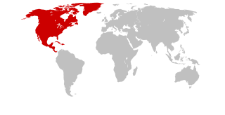
| 설명 | Continents with North America marked |
| 날짜 | (UTC) |
| 출처 | Self drawn, based on Image:Continents.svg |
| 저자 | maix¿? |
| 저작권 (이 파일을 인용하기) |
CreativeCommons ShareAlike or GPL |
| 다른 버전 | see Category:Locator maps for continents |
라이선스
나는 아래 작품의 저작권자로서, 이 저작물을 다음과 같은 라이선스로 배포합니다:
이 파일은 크리에이티브 커먼즈 동일조건변경허락 1.0 라이선스로 배포됩니다..
|

|
이 저작물은 자유 소프트웨어입니다. 당신은 자유 소프트웨어 재단이 발표한 GNU 일반 공중 사용 허가서 버전 2나 그 이후 버전에 따라 이 파일을 재배포하거나 수정할 수 있습니다. 이 저작물이 유용하게 사용될 수 있기를 바라지만 상용으로 사용되거나 특정 목적에 맞을 것이라는 것을 보증하지 않습니다. 자세한 내용은 GNU 일반 공중 사용 허가서 버전 2와 버전 3 전문을 참조하십시오. |
이 라이선스 중에서 목적에 맞는 것을 선택하여 사용할 수 있습니다.
파일 역사
날짜/시간 링크를 클릭하면 해당 시간의 파일을 볼 수 있습니다.
| 날짜/시간 | 섬네일 | 크기 | 사용자 | 설명 | |
|---|---|---|---|---|---|
| 현재 | 2007년 1월 26일 (금) 06:20 | | 585 × 299 (104 KB) | Maix | without CSS |
| 2007년 1월 26일 (금) 06:05 |  | 585 × 299 (105 KB) | Maix | {{Information |Description=Continents with North America marked |Source=Self drawn, based on Image:Continents.svg |Date=~~~~~ |Author=~~~ |Permission=CreativeCommons ShareAlike or GPL |other_versions=see Category:Locator maps for continents }} |
이 파일을 사용하는 문서
이 파일을 사용하는 문서가 없습니다.
이 파일을 사용하고 있는 모든 위키의 문서 목록
다음 위키에서 이 파일을 사용하고 있습니다:
- als.wikipedia.org에서 이 파일을 사용하고 있는 문서 목록
- Kanada
- USA
- Haiti
- Mexiko
- Nordamerika
- Costa Rica
- Jamaika
- Honduras
- Belize
- Vorlage:Navigationsleiste Staaten in Nordamerika
- Barbados
- Antigua und Barbuda
- Bahamas
- St. Kitts und Nevis
- Bermuda
- Dominica
- Guatemala
- El Salvador
- Nicaragua
- Panama
- Dominikanische Republik
- Grenada
- Kuba
- St. Lucia
- St. Vincent und die Grenadinen
- Amerikanische Jungferninseln
- Anguilla
- Britische Jungferninseln
- Kaimaninseln
- Aruba
- Curaçao
- Grönland
- Guadeloupe
- Martinique
- Montserrat
- Navassa
- Puerto Rico
- Turks- und Caicosinseln
- San Andrés und Providencia
- Saint-Barthélemy (Insel)
- Saint-Martin (Insel)
- Saint-Pierre und Miquelon
- Bonaire
- Saba (Insel)
- Sint Eustatius
- bg.wikipedia.org에서 이 파일을 사용하고 있는 문서 목록
- de.wikipedia.org에서 이 파일을 사용하고 있는 문서 목록
이 파일의 더 많은 사용 내역을 봅니다.