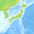
파일:Japan relief location map with side map of the Ryukyu Islands.jpg
보이기

미리 보기 크기: 664 × 600 픽셀 다른 해상도: 266 × 240 픽셀 | 531 × 480 픽셀 | 850 × 768 픽셀 | 1,133 × 1,024 픽셀 | 2,497 × 2,256 픽셀
원본 파일 (2,497 × 2,256 픽셀, 파일 크기: 2.25 MB, MIME 종류: image/jpeg)
파일 역사
날짜/시간 링크를 클릭하면 해당 시간의 파일을 볼 수 있습니다.
| 날짜/시간 | 섬네일 | 크기 | 사용자 | 설명 | |
|---|---|---|---|---|---|
| 현재 | 2022년 3월월 10일 (목) 06:18 |  | 2,497 × 2,256 (2.25 MB) | Sting | == {{int:filedesc}} == {{Location|37|56|24|N|138|45|18|E|scale:10000000}} {{Information |description={{en|Blank relief location map of {{W|Japan}}, with the main islands on the main map and the {{W|Ryukyu Islands}}, aka Nansei Islands, on a secondary map.}} {{fr|Carte physique vierge du {{Wf|Japon}} destinée à la géolocalisation avec les îles principales sur la carte principale et l’{{Wf|archipel Nansei}} sur une carte secondaire.}} *Equirectangular projection; WGS84 datum *Scale: 1:3,060,000... |
이 파일을 사용하는 문서
이 파일을 사용하는 문서가 없습니다.
이 파일을 사용하고 있는 모든 위키의 문서 목록
다음 위키에서 이 파일을 사용하고 있습니다:
- fr.wikipedia.org에서 이 파일을 사용하고 있는 문서 목록
- Chiba
- Hiroshima
- Kagoshima
- Kyoto
- Mont Fuji
- Nagasaki
- Osaka
- Sapporo
- Seto
- Shinjuku
- Shibuya
- Yokohama
- Nara
- Sendai
- Fukui
- Minamata
- Yokosuka
- Saga (Saga)
- Nikkō
- Nagoya
- Matsuyama (Ehime)
- Imabari
- Tanabe (Wakayama)
- Kumamoto
- Fukuoka
- Fukushima (Fukushima)
- Jeux olympiques d'hiver de 1972
- Jeux olympiques d'hiver de 1998
- Centrale nucléaire de Mihama
- Bataille de Tsushima
- Mito
- Nagano
- Naha
- Izu
- Kamakura
- Hitachiōmiya
- Shizuoka
- Kobe
- Baie de Tokyo
- Zushi
- Détroit de La Pérouse
- Himeji
- Ōita
- Ise (Mie)
- Kokura
- Aomori
- Tottori
- Takatsuki
- Kitakyūshū
- Kōchi
이 파일의 더 많은 사용 내역을 봅니다.


