
파일:BlankMap-USA-states-Canada-provinces, HI closer.svg

SVG 파일의 PNG 형식의 미리보기 크기: 512 × 512 픽셀. 다른 해상도: 240 × 240 픽셀 | 480 × 480 픽셀 | 768 × 768 픽셀 | 1,024 × 1,024 픽셀 | 2,048 × 2,048 픽셀
원본 파일 (SVG 파일, 실제 크기 512 × 512 픽셀, 파일 크기: 104 KB)
| 설명 |
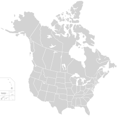
English: Blank SVG map of USA and Canada with state and province borders. Hawaii has been moved closer to the mainland USA to reduce width of image.
Non-contiguous parts of a states/provinces are "grouped" together with the main area of the state/provinces, so any state/provinces can be coloured in completion with one click anywhere on the state/provinces's area. Also, all states/provinces have a "id" attached to them, making them easy to find. Select "find" and then enter in the state/provinces's ISO 3166-2 code in the "id" field to find it. The codes can be found here (Canada) and here (USA). |
| 날짜 | |
| 출처 |
|
| 저자 | Lokal_Profil |
| 저작권 (이 파일을 인용하기) |
이 파일은 크리에이티브 커먼즈 저작자표시-동일조건변경허락 2.5 일반 라이선스로 배포됩니다. 저작자표시: Lokal_Profil
|
| 다른 버전 |
This vector image includes elements that have been taken or adapted from this file:
The same as this map with the two-letter state or province name label for each one |
파일 역사
날짜/시간 링크를 클릭하면 해당 시간의 파일을 볼 수 있습니다.
| 날짜/시간 | 섬네일 | 크기 | 사용자 | 설명 | |
|---|---|---|---|---|---|
| 현재 | 2020년 11월 23일 (월) 10:48 | | 512 × 512 (104 KB) | Ponderosapine210 | Accidentally uploaded wrong version. Here is the correct one. |
| 2020년 11월 23일 (월) 10:38 |  | 512 × 596 (132 KB) | Ponderosapine210 | Added the prominent islands of Manitoulin (Ontario) and Isle Royale (Michigan) to the Great Lakes. | |
| 2019년 6월 2일 (일) 07:59 |  | 512 × 512 (99 KB) | Fluffy89502 | added territories | |
| 2007년 12월 9일 (일) 06:18 |  | 1,730 × 1,730 (212 KB) | Lokal Profil | Code trimming | |
| 2007년 7월 3일 (화) 13:21 |  | 1,730 × 1,730 (213 KB) | Lokal Profil | {{Information |Description={{en|Blank SVG map of USA and Canada with state and province borders. Hawaii has been moved closer to the mainland USA to reduce width of image.}} Non-contiguous parts of a states/provinces are "grouped" together with the main a |
이 파일을 사용하는 문서
이 파일을 사용하는 문서가 없습니다.
이 파일을 사용하고 있는 모든 위키의 문서 목록
다음 위키에서 이 파일을 사용하고 있습니다:
- en.wikipedia.org에서 이 파일을 사용하고 있는 문서 목록
- fr.wikipedia.org에서 이 파일을 사용하고 있는 문서 목록