
파일:Arrondissement Brussels-Periphery Belgium Map.PNG
최대 해상도입니다.
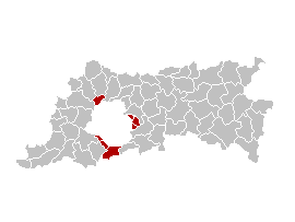
Arrondissement_Brussels-Periphery_Belgium_Map.PNG (270 × 203 픽셀, 파일 크기: 5 KB, MIME 종류: image/png)
English: Map of the former Arrondissement of Brussels-Periphery in the Province of Flemish Brabant, Belgium.
Nederlands: Kaart van het voormalige arrondissement Brussel-Randgemeenten in de provincie Vlaams-Brabant.
Français : Carte indiquant la localisation de l'ancien arronddissement de Bruxelles-Périphérie dans la Province de Brabant-Flamand.
| 이 작품은 저작자인 Ganchelkas에 의해 퍼블릭 도메인으로 공개된 작품입니다. 이 공개 선언은 전 세계적으로 유효합니다. 만약 저작권의 포기가 법률적으로 가능하지 않은 경우, |
I changed the colors of this map, based on the work of w:nl:Gebruiker:LennartBolks/kaartenhoekje, which is also in the public domain.
파일 역사
날짜/시간 링크를 클릭하면 해당 시간의 파일을 볼 수 있습니다.
| 날짜/시간 | 섬네일 | 크기 | 사용자 | 설명 | |
|---|---|---|---|---|---|
| 현재 | 2007년 3월 31일 (토) 22:45 | | 270 × 203 (5 KB) | Ganchelkas~commonswiki | {{en|Map of the former Arrondissement of Brussels-Periphery in the Province of Flemish Brabant, Belgium.}} {{nl|Kaart van het voormalige arrondissement Brussel-Randgemeenten in de provincie Vlaams-Brabant.}} {{fr|Carte indiquant la localisation de l'ancie |
이 파일을 사용하는 문서
다음 문서 1개가 이 파일을 사용하고 있습니다:
이 파일을 사용하고 있는 모든 위키의 문서 목록
다음 위키에서 이 파일을 사용하고 있습니다:
- ar.wikipedia.org에서 이 파일을 사용하고 있는 문서 목록
- ast.wikipedia.org에서 이 파일을 사용하고 있는 문서 목록
- ca.wikipedia.org에서 이 파일을 사용하고 있는 문서 목록
- de.wikipedia.org에서 이 파일을 사용하고 있는 문서 목록
- en.wikipedia.org에서 이 파일을 사용하고 있는 문서 목록
- es.wikipedia.org에서 이 파일을 사용하고 있는 문서 목록
- fr.wikipedia.org에서 이 파일을 사용하고 있는 문서 목록
- fr.wiktionary.org에서 이 파일을 사용하고 있는 문서 목록
- nl.wikipedia.org에서 이 파일을 사용하고 있는 문서 목록
- ro.wikipedia.org에서 이 파일을 사용하고 있는 문서 목록
- sco.wikipedia.org에서 이 파일을 사용하고 있는 문서 목록
- sl.wikipedia.org에서 이 파일을 사용하고 있는 문서 목록
- vi.wikipedia.org에서 이 파일을 사용하고 있는 문서 목록
- www.wikidata.org에서 이 파일을 사용하고 있는 문서 목록
- zh-yue.wikipedia.org에서 이 파일을 사용하고 있는 문서 목록
- zh.wikipedia.org에서 이 파일을 사용하고 있는 문서 목록