
파일:20190725 Oeschinensee-Panorama, Kandersteg (06540-42 stitch).jpg

원본 파일 (9,603 × 5,138 픽셀, 파일 크기: 28.09 MB, MIME 종류: image/jpeg)
.jpg?uselang=ko)
파일 설명
| 설명 | |
| 날짜 | |
| 출처 | Photo taken by Watzmann |
| 저자 | Günter Seggebäing, Coesfeld |
| 카메라 위치 | | 이 지역의 다른 사진을 보기: OpenStreetMap |
|---|
.jpg¶ms=046.504444_N_0007.720833_E_globe:Earth_type:camera_heading:135.00&language=ko)
- 이용자는 다음의 권리를 갖습니다:
- 공유 및 이용 – 저작물의 복제, 배포, 전시, 공연 및 공중송신
- 재창작 – 저작물의 개작, 수정, 2차적저작물 창작
- 다음과 같은 조건을 따라야 합니다:
- 저작자표시 – 적절한 저작자 표시를 제공하고, 라이센스에 대한 링크를 제공하고, 변경사항이 있는지를 표시해야 합니다. 당신은 합리적인 방식으로 표시할 수 있지만, 어떤 방식으로든 사용권 허가자가 당신 또는 당신의 사용을 지지하는 방식으로 표시할 수 없습니다.
- 동일조건변경허락 – 만약 당신이 이 저작물을 리믹스 또는 변형하거나 이 저작물을 기반으로 제작하는 경우, 당신은 당신의 기여물을 원저작물과 동일하거나 호환 가능한 라이선스에 따라 배포하여야 합니다.
I have published this image (this file) as author under the Creative-Commons-License CC BY-SA 3.0 (“Attribution-ShareAlike 3.0”). Legally binding is only the full legalcode.
This means that free usage outside of Wikimedia projects is possible under the following terms of license:
- The image is credited with “© Günter Seggebäing, CC BY-SA 3.0” as part of the caption, of the image credits or of the edition notice. Provide a copy of, or the URI for, the applicable license (https://creativecommons.org/licenses/by-sa/3.0/legalcode).
- If this is not possible (due to shortage of space), contact me first.
- In online presences the author is mentioned, and weblinks to the original image and to the licence model are set: “© Günter Seggebäing, Wikimedia Commons, CC BY-SA 3.0”
.jpg)
Any of the above conditions can be waived if you get permission from the copyright holder.
This license and the rights granted hereunder will terminate automatically upon any breach by you of the terms of this license. In this case the author reserves to demand declaration to cease and desist, and compensation (according to the MFM fee references currently in force).
I would be happy to receive a specimen copy or the URL of the website where the image is used.
Please contact me (eMail via Wikipedia), if you
- need my postal address for sending a specimen copy or
- have further questions to the terms of license or
- like to have the picture in higher resolution or
- need another license model for usage.
⇒ More informations about reusing content from Wikimedia Commons.
|
The license of this work is not consistent with the licensing terms of Facebook. Therfore it is not permitted to use this work on Facebook |
| 주석 | 이 이미지에는 주석이 있습니다: 공용에서 주석을 보기 |
.jpg)
파일 역사
날짜/시간 링크를 클릭하면 해당 시간의 파일을 볼 수 있습니다.
| 날짜/시간 | 섬네일 | 크기 | 사용자 | 설명 | |
|---|---|---|---|---|---|
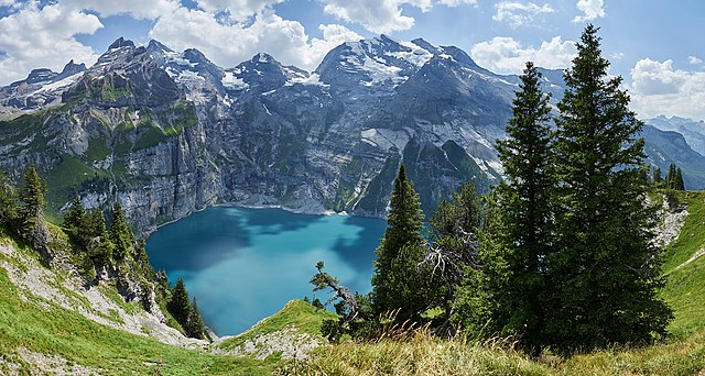
| 현재 | 2020년 11월 29일 (일) 08:43 | | 9,603 × 5,138 (28.09 MB) | Watzmann | == {{int:filedesc}} == {{Information |Description={{de|Oeschinensee-Panorama gegen Blüemlisalp, Fründenhorn und Doldenhorn.}} {{en|Panoramic view of Oeschinensee wirh Blüemlisalp, Fründenhorn and Doldenhorn.}} |Source=Photo taken by Watzmann |Date=2019-07-25 13:38:51 |Author=Günter Seggebäing, Coesfeld |Permission= |other_v... |
이 파일을 사용하는 문서
이 파일을 사용하고 있는 모든 위키의 문서 목록
다음 위키에서 이 파일을 사용하고 있습니다:
- arz.wikipedia.org에서 이 파일을 사용하고 있는 문서 목록
- ceb.wikipedia.org에서 이 파일을 사용하고 있는 문서 목록
- cs.wikipedia.org에서 이 파일을 사용하고 있는 문서 목록
- de.wikipedia.org에서 이 파일을 사용하고 있는 문서 목록
- de.wikivoyage.org에서 이 파일을 사용하고 있는 문서 목록
- en.wikipedia.org에서 이 파일을 사용하고 있는 문서 목록
- en.wikivoyage.org에서 이 파일을 사용하고 있는 문서 목록
- fi.wikipedia.org에서 이 파일을 사용하고 있는 문서 목록
- he.wikivoyage.org에서 이 파일을 사용하고 있는 문서 목록
- www.wikidata.org에서 이 파일을 사용하고 있는 문서 목록
.jpg)