
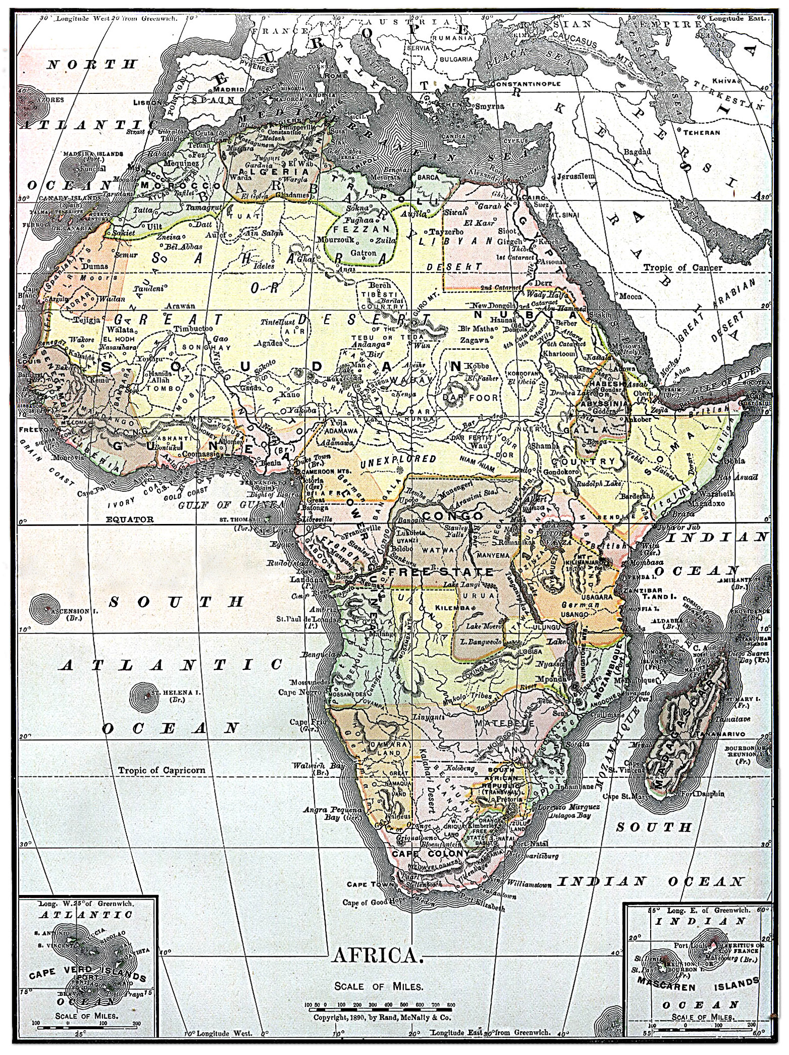
파일:Map of Africa from Encyclopaedia Britannica 1890.jpg
미리 보기 크기: 448 × 599 픽셀 다른 해상도: 179 × 240 픽셀 | 359 × 480 픽셀 | 574 × 768 픽셀 | 766 × 1,024 픽셀 | 1,563 × 2,090 픽셀
원본 파일 (1,563 × 2,090 픽셀, 파일 크기: 2.07 MB, MIME 종류: image/jpeg)
파일 설명
라이선스
|
이 작품은 미국, 그리고 저작권 보호 기간이 저작자 사후 70년, 또는 그 이하인 모든 국가에서 퍼블릭 도메인입니다.
| |
| 이 저작물은 모든 저작인접권을 포함한 저작권법하의 규제로부터 자유로운 것으로 확인되었습니다. | |
| This image comes from the 13th edition of the Encyclopædia Britannica or earlier. The copyrights for that book have expired in the United States because the book was first published in the US with the publication occurring before January 1, 1929. As such, this image is in the public domain in the United States. |  |
이 이미지는 2005년 6월 24일의 오늘의 이미지로 선정되었습니다. 이미지 설명은 다음과 같습니다. English: Map of Africa 1890 다른 언어들:
Bân-lâm-gú: 1890 nî Hui-chiu ê tē-tô·. Brezhoneg : Kartenn eus Afrika er bloaz 1890 Čeština: Mapa Afriky z roku 1890 Cymraeg: Map o Affrica yn y flwyddyn 1890 Dansk: Kort over Africa fra 1890 Deutsch: Karte von Afrika aus dem Jahr 1890 English: Map of Africa 1890 Español: Mapa de África del año 1890 Français : Carte du continent africain des années 1890. Galego: Mapa de África do ano 1890 Latina: Tabula geographica Africae, 1890 Nederlands: Kaart van Afrika uit 1890 Norsk nynorsk: Kart over Afrika frå 1890 Português: Mapa de África 1890 Slovenščina: Zemljevid Afrike, 1890. Suomi: Vuoden 1890 Encyclopaedia Britannican Afrikan kartta Svenska: En karta över Afrika från 1890. Русский: Карта Африки 1890-ого года ગુજરાતી : આફ્રિકાનો નક્શો, ૧૮૯૦ ไทย: แผนที่ทวีปแอฟริกา ค.ศ. ๑๘๙๐ 日本語: アフリカの地図 (1890年) 中文: 非洲1890年地图 中文(繁體): 非洲1890年地圖 粵語: 1890 年嘅非洲地圖 עברית : מפה של אפריקה מ1890 |
파일 역사
날짜/시간 링크를 클릭하면 해당 시간의 파일을 볼 수 있습니다.
| 날짜/시간 | 섬네일 | 크기 | 사용자 | 설명 | |
|---|---|---|---|---|---|
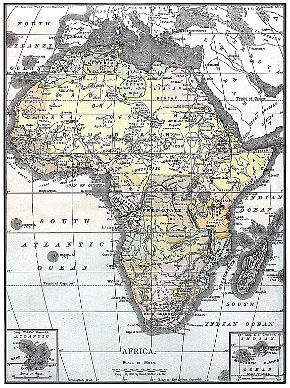
| 현재 | 2010년 8월 5일 (목) 03:30 | | 1,563 × 2,090 (2.07 MB) | Orionist | fixed warp on the top and removed the seam in the middle |
| 2010년 8월 5일 (목) 03:15 |  | 1,563 × 2,090 (1.57 MB) | Orionist | higher resolution version | |
| 2010년 8월 4일 (수) 15:48 |  | 787 × 1,054 (425 KB) | PawełMM | warp on top fixed | |
| 2004년 12월 5일 (일) 21:03 |  | 787 × 1,054 (410 KB) | TOR | Map of Africa from Encyclopaedia Britannica, 1890 {{PD}} |
이 파일을 사용하는 문서
다음 문서 2개가 이 파일을 사용하고 있습니다:
이 파일을 사용하고 있는 모든 위키의 문서 목록
다음 위키에서 이 파일을 사용하고 있습니다:
- arz.wikipedia.org에서 이 파일을 사용하고 있는 문서 목록
- azb.wikipedia.org에서 이 파일을 사용하고 있는 문서 목록
- bg.wiktionary.org에서 이 파일을 사용하고 있는 문서 목록
- da.wikipedia.org에서 이 파일을 사용하고 있는 문서 목록
- en.wikipedia.org에서 이 파일을 사용하고 있는 문서 목록
- User:Kentfowl
- User:Enlil Ninlil
- User:Hibernian
- User:Pwjb
- User:Cold Water
- User:ForestAngel
- User:Mr A
- User:Orionist
- User:Reno vercetti
- User talk:Gidonb/Archive 2008
- User:PinkPanthress
- User:El monty
- Wikipedia talk:WikiProject History/Task force images
- User:Patricius Augustus
- User:1c33y37
- User:Bubbles02
- User:HalleluYHWH
- User:HalleluYHWH/Userboxes/Africa
- User:Secret Saturdays
- User:Alumnum
- User:Yertul
- User:Sparrowhawk64
- User:Saukkomies/My userboxes
- User:Sewati
- User:HypertimeTraveller
- User:SocialPhysics
- Wikipedia:Graphics Lab/Photography workshop/Archive/Aug 2010
- User:Orionist/Gallery
- User:Metallurgist/userboxes
- User:Pacificus Viridis
- User:Mikisrb
- User:BrunGunth
- User:FeleciaQ
- User:Smart30
- User:Lyaika
- User:Flinders Petrie
- User:Bouncingnewsgreen
- User:Polskivinnik
- User:Ilmurov
- User:Autioitua
- User:IjonTichyIjonTichy
- User:Yo222
- User:Terminator484/sandbox
- User:Oxyaena
- User:Bodney/sandbox
- User:GangGangQuokka2
이 파일의 더 많은 사용 내역을 봅니다.