
파일:Ancient Khorasan highlighted.jpg
Ancient_Khorasan_highlighted.jpg (373 × 320 픽셀, 파일 크기: 58 KB, MIME 종류: image/jpeg)
| 설명 |
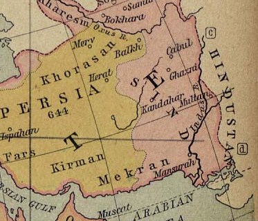
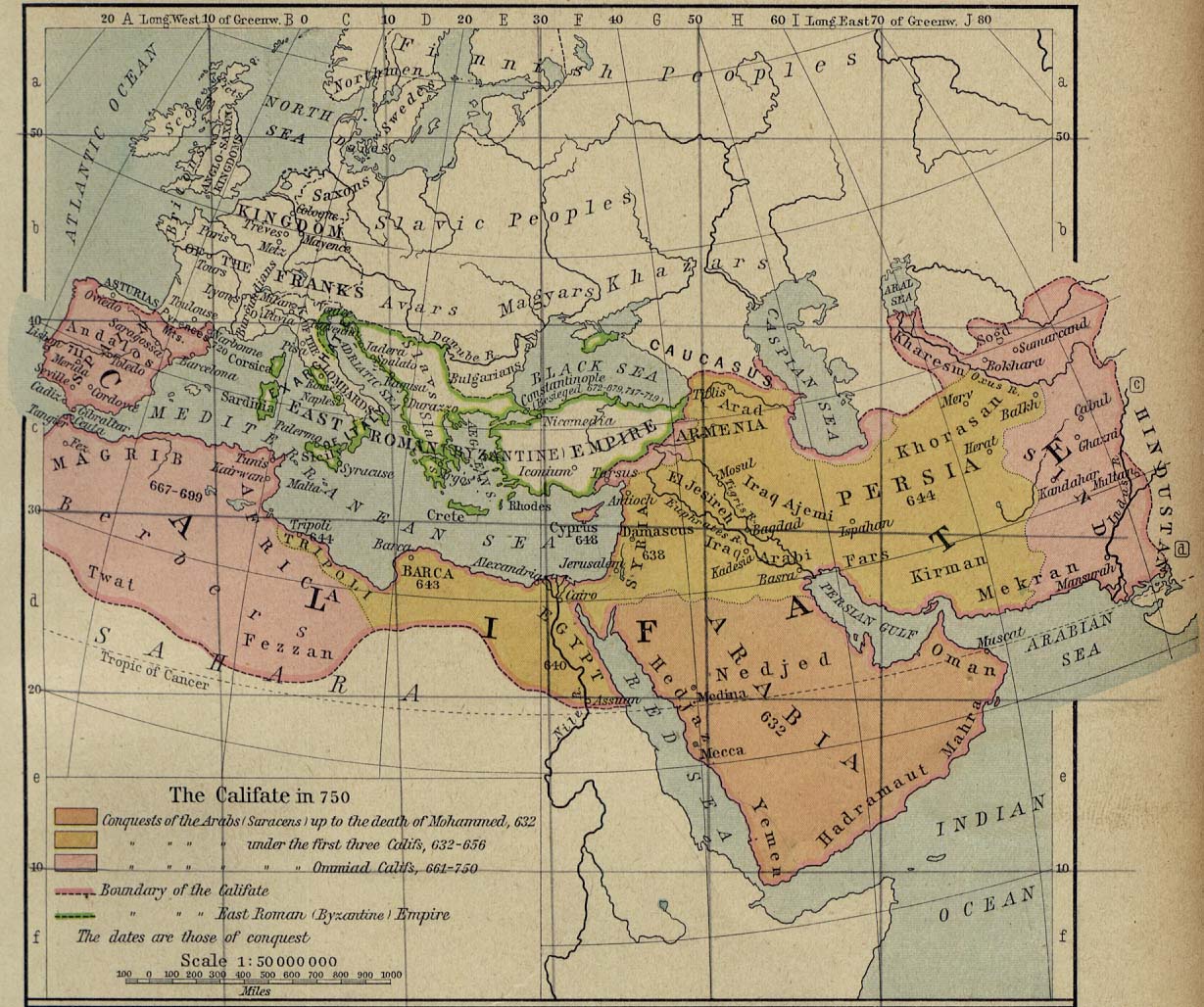
Map showing Ancient Persia in light yellowish and the the land called Sind (most of today's Afghanistan and part of Pakistan) in pinkish. A number of ancient references are made to the names shown in this map. Ibn Batutta writes in 1333 AD: [1]
|
||||
| 날짜 | |||||
| 출처 | University of Texas at Austin, Middle East and Europe - The Caliphate in 750 (293K) | ||||
| 저자 | William R. Shepherd | ||||
| 저작권 (이 파일을 인용하기) |
|
||||
| 다른 버전 | full version: File:Califate 750.jpg | ||||
파일 역사
날짜/시간 링크를 클릭하면 해당 시간의 파일을 볼 수 있습니다.
| 날짜/시간 | 섬네일 | 크기 | 사용자 | 설명 | |
|---|---|---|---|---|---|
| 현재 | 2010년 10월 23일 (토) 04:07 | | 373 × 320 (58 KB) | Officer | {{Information |Description= |Source= |Date= |Author= |Permission= |other_versions= }} |
이 파일을 사용하는 문서
다음 문서 1개가 이 파일을 사용하고 있습니다:
이 파일을 사용하고 있는 모든 위키의 문서 목록
다음 위키에서 이 파일을 사용하고 있습니다:
- an.wikipedia.org에서 이 파일을 사용하고 있는 문서 목록
- ar.wikipedia.org에서 이 파일을 사용하고 있는 문서 목록
- arz.wikipedia.org에서 이 파일을 사용하고 있는 문서 목록
- azb.wikipedia.org에서 이 파일을 사용하고 있는 문서 목록
- ba.wikipedia.org에서 이 파일을 사용하고 있는 문서 목록
- bn.wikipedia.org에서 이 파일을 사용하고 있는 문서 목록
- ca.wikipedia.org에서 이 파일을 사용하고 있는 문서 목록
- ckb.wikipedia.org에서 이 파일을 사용하고 있는 문서 목록
- de.wikipedia.org에서 이 파일을 사용하고 있는 문서 목록
- el.wikipedia.org에서 이 파일을 사용하고 있는 문서 목록
- en.wikipedia.org에서 이 파일을 사용하고 있는 문서 목록
- Muslim conquests of Afghanistan
- History of Afghanistan
- Kabul
- Al-Mansur
- Muslim conquest of Persia
- Greater Khorasan
- Jewish mythology
- History of Arabs in Afghanistan
- Portal:Afghanistan
- Delhi–Multan road
- Talk:Afghanistan/Archive 8
- Siege of Kabul (1504)
- User:Tisquesusa/sandbox9
- User:Falcaorib
- User:Northamerica1000/Portals of the world
- User:HistoryofIran/Greater Khorasan
- List of sieges of Kabul
- en.wiktionary.org에서 이 파일을 사용하고 있는 문서 목록
- eo.wikipedia.org에서 이 파일을 사용하고 있는 문서 목록
- es.wikipedia.org에서 이 파일을 사용하고 있는 문서 목록
- fa.wikipedia.org에서 이 파일을 사용하고 있는 문서 목록
이 파일의 더 많은 사용 내역을 봅니다.