
파일:Tuscany landscape west of Siena.jpg

원본 파일 (2,592 × 1,944 픽셀, 파일 크기: 3.08 MB, MIME 종류: image/jpeg)
파일 설명
| 설명 |
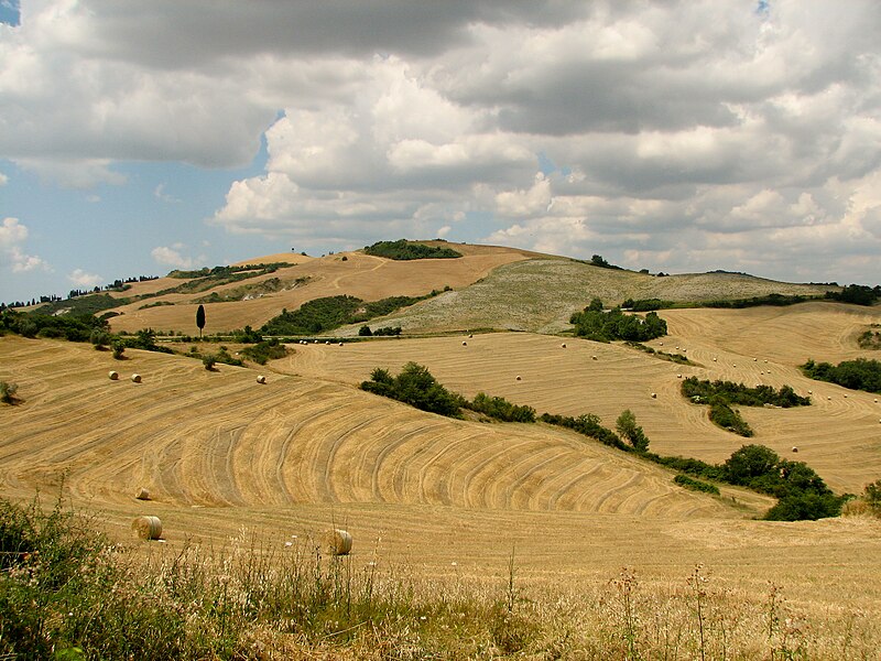
English: Tuscany landscape west of Siena with agricultural area
Deutsch: Toskana-Landschaft westlich von Siena |
| 날짜 | |
| 출처 | 자작 |
| 저자 | Norbert Nagel, Mörfelden-Walldorf, Germany |
| 저작권 (이 파일을 인용하기) |
이 파일은 크리에이티브 커먼즈 저작자표시-동일조건변경허락 3.0 Unported 라이선스로 배포됩니다.
|
| 대상 위치 | | 이 지역의 다른 사진을 보기: OpenStreetMap |
|---|
라이선스
- 이용자는 다음의 권리를 갖습니다:
- 공유 및 이용 – 저작물의 복제, 배포, 전시, 공연 및 공중송신
- 재창작 – 저작물의 개작, 수정, 2차적저작물 창작
- 다음과 같은 조건을 따라야 합니다:
- 저작자표시 – 적절한 저작자 표시를 제공하고, 라이센스에 대한 링크를 제공하고, 변경사항이 있는지를 표시해야 합니다. 당신은 합리적인 방식으로 표시할 수 있지만, 어떤 방식으로든 사용권 허가자가 당신 또는 당신의 사용을 지지하는 방식으로 표시할 수 없습니다.
- 동일조건변경허락 – 만약 당신이 이 저작물을 리믹스 또는 변형하거나 이 저작물을 기반으로 제작하는 경우, 당신은 당신의 기여물을 원저작물과 동일하거나 호환 가능한 라이선스에 따라 배포하여야 합니다.
|
The author of this file, Norbert Nagel, published this file under the licence CC-BY-SA-3.0 on Wikimedia Commons. This means that free, commercial usage is permitted under the following terms and conditions:
These conditions also apply for any further use of the respective print and online publication. Please send me a specimen copy or the URL of the website where the file is used. Feel free to contact me via e-mail for any questions or in case you need...
Violations of the above terms and conditions will be prosecuted. |
|
Der Urheber Norbert Nagel hat diese Datei unter der Lizenz CC-BY-SA-3.0 auf Wikimedia Commons veröffentlicht. Dies bedeutet, dass eine kostenlose, auch kommerzielle Nutzung möglich ist, wenn die folgenden Bedingungen eingehalten werden:
Diese Bedingungen gelten auch für jegliche Weiterverwendung des jeweiligen Druck- und Onlinepublikation. Bitte senden Sie mir ein Belegexemplar bzw. die URL Ihrer Publikation zu, in der Sie meine Arbeit verwenden. Bei allen Fragen zu diesem Bild und seine Lizenzbedingungen und für die Zusendung der Belegexemplare stehe ich Ihnen gerne per E-Mail zur Verfügung. Bitte melden sie sich auch, falls Sie das Bild...
Verstöße gegen diese Lizenzbedingungen werden verfolgt. |
파일 역사
날짜/시간 링크를 클릭하면 해당 시간의 파일을 볼 수 있습니다.
| 날짜/시간 | 섬네일 | 크기 | 사용자 | 설명 | |
|---|---|---|---|---|---|
| 현재 | 2011년 1월 4일 (화) 04:55 | | 2,592 × 1,944 (3.08 MB) | NorbertNagel | {{Information |Description={{en|1=Tuscany landscape west of Siena with agricultural area }} {{de|1=Toskana-Landschaft westlich von Siena }} |Source={{own}} |Author=Norbert Nagel, Mörfelden-Walldorf, Germany |Date=2008-06-18 |Permiss |
이 파일을 사용하는 문서
다음 문서 1개가 이 파일을 사용하고 있습니다:
이 파일을 사용하고 있는 모든 위키의 문서 목록
다음 위키에서 이 파일을 사용하고 있습니다:
- azb.wikipedia.org에서 이 파일을 사용하고 있는 문서 목록
- az.wikipedia.org에서 이 파일을 사용하고 있는 문서 목록
- bn.wikipedia.org에서 이 파일을 사용하고 있는 문서 목록
- cs.wikipedia.org에서 이 파일을 사용하고 있는 문서 목록
- eu.wikipedia.org에서 이 파일을 사용하고 있는 문서 목록
- fr.wikipedia.org에서 이 파일을 사용하고 있는 문서 목록
- io.wikipedia.org에서 이 파일을 사용하고 있는 문서 목록
- it.wikiquote.org에서 이 파일을 사용하고 있는 문서 목록
- ka.wikipedia.org에서 이 파일을 사용하고 있는 문서 목록
- li.wikipedia.org에서 이 파일을 사용하고 있는 문서 목록
- ms.wikipedia.org에서 이 파일을 사용하고 있는 문서 목록
- nl.wikivoyage.org에서 이 파일을 사용하고 있는 문서 목록
- sw.wikipedia.org에서 이 파일을 사용하고 있는 문서 목록
- tr.wikipedia.org에서 이 파일을 사용하고 있는 문서 목록
- vi.wikipedia.org에서 이 파일을 사용하고 있는 문서 목록
- xmf.wikipedia.org에서 이 파일을 사용하고 있는 문서 목록