파일:Roma Plan.jpg

미리 보기 크기: 754 × 600 픽셀 다른 해상도: 302 × 240 픽셀 | 604 × 480 픽셀 | 966 × 768 픽셀 | 1,280 × 1,018 픽셀 | 1,840 × 1,463 픽셀
원본 파일 (1,840 × 1,463 픽셀, 파일 크기: 2.5 MB, MIME 종류: image/jpeg)
파일 역사
날짜/시간 링크를 클릭하면 해당 시간의 파일을 볼 수 있습니다.
| 날짜/시간 | 섬네일 | 크기 | 사용자 | 설명 | |
|---|---|---|---|---|---|
| 현재 | 2015년 3월 31일 (화) 01:14 |  | 1,840 × 1,463 (2.5 MB) | Jonstevn | Reverted to version as of 19:01, 28 August 2006 |
| 2015년 3월 31일 (화) 01:10 |  | 1,840 × 1,463 (2.5 MB) | Jonstevn | Reverted to version as of 19:01, 28 August 2006 | |
| 2015년 3월 31일 (화) 01:10 |  | 1,840 × 1,463 (2.5 MB) | Jonstevn | Reverted to version as of 19:01, 28 August 2006 | |
| 2008년 7월 27일 (일) 15:40 |  | 1,840 × 1,463 (3.38 MB) | Amadscientist | {{Information |Description= |Source= |Date= |Author= |Permission= |other_versions= }} | |
| 2008년 7월 27일 (일) 13:57 |  | 4,000 × 3,180 (12.21 MB) | Amadscientist | {{Information |Description= |Source= |Date= |Author= |Permission= |other_versions= }} | |
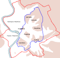
| 2006년 8월 29일 (화) 04:01 |  | 1,840 × 1,463 (2.5 MB) | Nikephoros | {{Information |Description=Plan Roms im Altertum / Map of Rome during Antiquity |Source=G. Droysens Allgemeiner Historischer Handatlas |Date=1886 |Author=? |Permission= not needed |other_versions= no }} |
이 파일을 사용하는 문서
다음 문서 9개가 이 파일을 사용하고 있습니다:
이 파일을 사용하고 있는 모든 위키의 문서 목록
다음 위키에서 이 파일을 사용하고 있습니다:
- ar.wikipedia.org에서 이 파일을 사용하고 있는 문서 목록
- as.wikipedia.org에서 이 파일을 사용하고 있는 문서 목록
- azb.wikipedia.org에서 이 파일을 사용하고 있는 문서 목록
- beta.wikiversity.org에서 이 파일을 사용하고 있는 문서 목록
- bg.wikipedia.org에서 이 파일을 사용하고 있는 문서 목록
- bn.wikipedia.org에서 이 파일을 사용하고 있는 문서 목록
- bs.wikipedia.org에서 이 파일을 사용하고 있는 문서 목록
- bxr.wikipedia.org에서 이 파일을 사용하고 있는 문서 목록
- ca.wikipedia.org에서 이 파일을 사용하고 있는 문서 목록
- ceb.wikipedia.org에서 이 파일을 사용하고 있는 문서 목록
- cs.wikipedia.org에서 이 파일을 사용하고 있는 문서 목록
이 파일의 더 많은 사용 내역을 봅니다.


