
파일:Poitou-Charentes region location map.svg

SVG 파일의 PNG 형식의 미리보기 크기: 538 × 599 픽셀. 다른 해상도: 215 × 240 픽셀 | 431 × 480 픽셀 | 690 × 768 픽셀 | 920 × 1,024 픽셀 | 1,839 × 2,048 픽셀 | 1,136 × 1,265 픽셀
원본 파일 (SVG 파일, 실제 크기 1,136 × 1,265 픽셀, 파일 크기: 538 KB)
파일 설명
| 카메라 위치 | | 이 지역의 다른 사진을 보기: OpenStreetMap |
|---|
| 설명 |
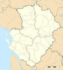
English: Blank administrative map of the region of Poitou-Charentes, France, for geo-location purpose, with distinct boundaries for regions, departments and arrondissements as set in 2008.
Français : Carte administrative vierge de la région Poitou-Charentes, France, destinée à la géolocalisation, avec limite distincte des régions, départements et arrondissements tels que définis en 2008. Approximate scale: 1:800,000 (precision: 200 m)
Geographic limits of the map:
|
||
| 날짜 | |||
| 출처 |
자작
|
||
| 저자 | Eric Gaba (Sting - fr:Sting) | ||
| 저작권 (이 파일을 인용하기) |
|
||
| 다른 버전 |
|

라이선스
나는 아래 작품의 저작권자로서, 이 저작물을 다음과 같은 라이선스로 배포합니다:
이 파일은 크리에이티브 커먼즈 저작자표시-동일조건변경허락 3.0 Unported 라이선스로 배포됩니다.
- 이용자는 다음의 권리를 갖습니다:
- 공유 및 이용 – 저작물의 복제, 배포, 전시, 공연 및 공중송신
- 재창작 – 저작물의 개작, 수정, 2차적저작물 창작
- 다음과 같은 조건을 따라야 합니다:
- 저작자표시 – 적절한 저작자 표시를 제공하고, 라이센스에 대한 링크를 제공하고, 변경사항이 있는지를 표시해야 합니다. 당신은 합리적인 방식으로 표시할 수 있지만, 어떤 방식으로든 사용권 허가자가 당신 또는 당신의 사용을 지지하는 방식으로 표시할 수 없습니다.
- 동일조건변경허락 – 만약 당신이 이 저작물을 리믹스 또는 변형하거나 이 저작물을 기반으로 제작하는 경우, 당신은 당신의 기여물을 원저작물과 동일하거나 호환 가능한 라이선스에 따라 배포하여야 합니다.

|
GNU 자유 문서 사용 허가서 1.2판 또는 자유 소프트웨어 재단에서 발행한 이후 판의 규정에 따라 본 문서를 복제하거나 개작 및 배포할 수 있습니다. 본 문서에는 변경 불가 부분이 없으며, 앞 표지 구절과 뒷 표지 구절도 없습니다. 본 사용 허가서의 전체 내용은 GNU 자유 문서 사용 허가서 부분에 포함되어 있습니다. |
이 라이선스 중에서 목적에 맞는 것을 선택하여 사용할 수 있습니다.
파일 역사
날짜/시간 링크를 클릭하면 해당 시간의 파일을 볼 수 있습니다.
| 날짜/시간 | 섬네일 | 크기 | 사용자 | 설명 | |
|---|---|---|---|---|---|
| 현재 | 2008년 10월 15일 (수) 05:32 | | 1,136 × 1,265 (538 KB) | Sting | == Summary == {{Location|46|08|15|N|00|10|30|W|scale:2000000}} <br/> {{Information |Description={{en|Blank administrative map of the region of Poitou-Charentes, France, for geo-location purpose, with distinct boundaries for region |
이 파일을 사용하는 문서
다음 문서 1개가 이 파일을 사용하고 있습니다:
이 파일을 사용하고 있는 모든 위키의 문서 목록
다음 위키에서 이 파일을 사용하고 있습니다:
- ar.wikipedia.org에서 이 파일을 사용하고 있는 문서 목록
- bg.wikipedia.org에서 이 파일을 사용하고 있는 문서 목록
- ca.wikipedia.org에서 이 파일을 사용하고 있는 문서 목록
- ceb.wikipedia.org에서 이 파일을 사용하고 있는 문서 목록
- cs.wikipedia.org에서 이 파일을 사용하고 있는 문서 목록
- cv.wikipedia.org에서 이 파일을 사용하고 있는 문서 목록
- de.wikipedia.org에서 이 파일을 사용하고 있는 문서 목록
- el.wikipedia.org에서 이 파일을 사용하고 있는 문서 목록
- en.wikipedia.org에서 이 파일을 사용하고 있는 문서 목록
- eo.wikipedia.org에서 이 파일을 사용하고 있는 문서 목록
- es.wikipedia.org에서 이 파일을 사용하고 있는 문서 목록
- fa.wikipedia.org에서 이 파일을 사용하고 있는 문서 목록
- fr.wikipedia.org에서 이 파일을 사용하고 있는 문서 목록
- Pictons
- Baptistère Saint-Jean de Poitiers
- Cathédrale Saint-Pierre de Poitiers
- Raids vikings en Poitou et dans la vallée de la Charente
- Modèle:Infobox Port
- Grand Pavois de La Rochelle
- Commanderie d'Ozon
- Abbaye de Saint-Savin-sur-Gartempe
- Église Notre-Dame-de-la-Couldre
- Tumulus de Bougon
- Abbaye Saint-Sauveur de Charroux
- Commanderie Saint-Antoine-de-la-Lande
- Musée Sainte-Croix
- Abbaye de Mauléon
- Pont Neuf (Poitiers)
- Modèle:Géolocalisation/Poitou-Charentes
- Modèle:Carte/Poitou-Charentes
- Wikipédia:Atelier graphique/Cartes/Archives/novembre 2008
- Gare de Lussac-les-Châteaux
- Gare de Mignaloux - Nouaillé
- Projet:Cartographie/Cartes standards/France
- Temple protestant de Saintes
이 파일의 더 많은 사용 내역을 봅니다.