
파일:Paris department land cover location map.svg

SVG 파일의 PNG 형식의 미리보기 크기: 800 × 521 픽셀. 다른 해상도: 320 × 208 픽셀 | 640 × 417 픽셀 | 1,024 × 667 픽셀 | 1,280 × 834 픽셀 | 2,560 × 1,667 픽셀 | 1,371 × 893 픽셀
원본 파일 (SVG 파일, 실제 크기 1,371 × 893 픽셀, 파일 크기: 6.75 MB)
파일 설명
| 제목 |
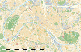
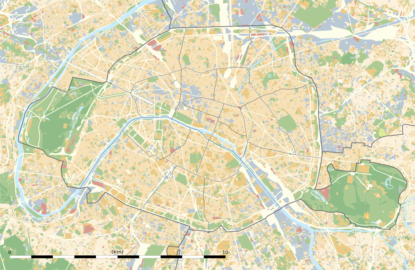
Blank land cover map of the city and department of Paris, France |
||||||||||||||||||||||||||||||||||||
| 묘사 |
English: Blank land cover map of the city and department of Paris, France, as in January 2012, for geo-location purpose, with distinct boundaries for departments and arrondissements.
Français : Carte vierge de l'occupation du sol de la ville et département de Paris, France, tel qu'en janvier 2012, destinée à la géolocalisation, avec limite distincte des départements et arrondissements. |
||||||||||||||||||||||||||||||||||||
| 지도 범례 |
|
||||||||||||||||||||||||||||||||||||
| 날짜 | |||||||||||||||||||||||||||||||||||||
| 출처 |
자작
|
||||||||||||||||||||||||||||||||||||
| 창작자 | |||||||||||||||||||||||||||||||||||||
| 저작권 (이 파일을 인용하기) |
|
||||||||||||||||||||||||||||||||||||
| 지리 정보 | |||||||||||||||||||||||||||||||||||||
| 기재된 날 | |||||||||||||||||||||||||||||||||||||
| 지도 위치 | 파리 48°51′24″N 2°21′03″E / 48.8567°N 2.3508°E | ||||||||||||||||||||||||||||||||||||
| 사용된 공간기준계 | WGS84 datum | ||||||||||||||||||||||||||||||||||||
| 축척 | 1:124,000 (precision: 31 m) | ||||||||||||||||||||||||||||||||||||
| 표제 |
 |
||||||||||||||||||||||||||||||||||||
| 영역 상자 |
|
||||||||||||||||||||||||||||||||||||
| 지리 참고 | 부적절한 경우에 숨기려면 warp_status = skip로 설정하세요. | ||||||||||||||||||||||||||||||||||||
| 다른 버전 |
|
||||||||||||||||||||||||||||||||||||


라이선스
Eric Gaba, Wikimedia Commons user Sting은(는) 아래 작품의 저작권자로서, 해당 저작물을 다음과 같은 라이선스로 배포합니다:
이 파일은 크리에이티브 커먼즈 저작자표시-동일조건변경허락 3.0 Unported 라이선스로 배포됩니다.
저작자표시: Eric Gaba, Wikimedia Commons user Sting
- 이용자는 다음의 권리를 갖습니다:
- 공유 및 이용 – 저작물의 복제, 배포, 전시, 공연 및 공중송신
- 재창작 – 저작물의 개작, 수정, 2차적저작물 창작
- 다음과 같은 조건을 따라야 합니다:
- 저작자표시 – 적절한 저작자 표시를 제공하고, 라이센스에 대한 링크를 제공하고, 변경사항이 있는지를 표시해야 합니다. 당신은 합리적인 방식으로 표시할 수 있지만, 어떤 방식으로든 사용권 허가자가 당신 또는 당신의 사용을 지지하는 방식으로 표시할 수 없습니다.
- 동일조건변경허락 – 만약 당신이 이 저작물을 리믹스 또는 변형하거나 이 저작물을 기반으로 제작하는 경우, 당신은 당신의 기여물을 원저작물과 동일하거나 호환 가능한 라이선스에 따라 배포하여야 합니다.
파일 역사
날짜/시간 링크를 클릭하면 해당 시간의 파일을 볼 수 있습니다.
| 날짜/시간 | 섬네일 | 크기 | 사용자 | 설명 | |
|---|---|---|---|---|---|
| 현재 | 2015년 2월 12일 (목) 11:18 | | 1,371 × 893 (6.75 MB) | Sting | == {{int:filedesc}} == {{Location|48|51|22.5|N|02|20|37.5|E|scale:50000}} {{Information |Description={{en|Blank land cover map of the city and department of Paris, France, as in January 2012, for geo-location purpose, with distinct bounda... |
이 파일을 사용하는 문서
다음 문서 13개가 이 파일을 사용하고 있습니다:
이 파일을 사용하고 있는 모든 위키의 문서 목록
다음 위키에서 이 파일을 사용하고 있습니다:
- als.wikipedia.org에서 이 파일을 사용하고 있는 문서 목록
- ar.wikipedia.org에서 이 파일을 사용하고 있는 문서 목록
- ast.wikipedia.org에서 이 파일을 사용하고 있는 문서 목록
- azb.wikipedia.org에서 이 파일을 사용하고 있는 문서 목록
- az.wikipedia.org에서 이 파일을 사용하고 있는 문서 목록
- be.wikipedia.org에서 이 파일을 사용하고 있는 문서 목록
- bg.wikipedia.org에서 이 파일을 사용하고 있는 문서 목록
- Бастилия
- Отьой
- Дефанс
- Пер Лашез
- Халите (Париж)
- Музей Орсе
- Монмартър
- Университет „Париж-VI: Пиер и Мария Кюри“
- Университет Париж-I Пантеон-Сорбона
- Университет Париж-VII: Дени Дидро
- Университет Пари-Дофин
- Национална библиотека на Франция
- Александър III (мост)
- Ил дьо ла Сите
- Монпарнас
- Маре (Париж)
- Жусийо (кампус)
- Музей на изкуството и историята на юдаизма
- Шаблон:ПК Франция Париж
이 파일의 더 많은 사용 내역을 봅니다.