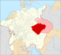
파일:Locator Bohemia within the Holy Roman Empire (1618).svg

SVG 파일의 PNG 형식의 미리보기 크기: 658 × 600 픽셀. 다른 해상도: 263 × 240 픽셀 | 527 × 480 픽셀 | 843 × 768 픽셀 | 1,123 × 1,024 픽셀 | 2,247 × 2,048 픽셀 | 2,769 × 2,524 픽셀
원본 파일 (SVG 파일, 실제 크기 2,769 × 2,524 픽셀, 파일 크기: 1,021 KB)
파일 역사
날짜/시간 링크를 클릭하면 해당 시간의 파일을 볼 수 있습니다.
| 날짜/시간 | 섬네일 | 크기 | 사용자 | 설명 | |
|---|---|---|---|---|---|
| 현재 | 2019년 5월 14일 (화) 06:32 |  | 2,769 × 2,524 (1,021 KB) | Ernio48 | Not a separate Land of the Bohemian Crown. There were 5 Lands. Eger was part of the Kingdom of Bohemia. Virtually every historical map includes it as its part. |
| 2019년 5월 13일 (월) 09:23 |  | 2,769 × 2,524 (1,023 KB) | David Beneš | Restored. The fact is stated in every WP article about Egerland/Chebsko, cf. the sources there. | |
| 2019년 5월 12일 (일) 00:53 |  | 2,769 × 2,524 (1,021 KB) | Ernio48 | Reverted to version as of 09:56, 30 April 2016 (UTC) Needs proof. | |
| 2016년 6월 23일 (목) 22:59 |  | 2,769 × 2,524 (1,023 KB) | David Beneš | Not the Land of Eger (a separate unit by then). | |
| 2016년 4월 30일 (토) 18:56 |  | 2,769 × 2,524 (1,021 KB) | David Beneš | + the County of Glaz. | |
| 2016년 4월 25일 (월) 16:13 |  | 2,769 × 2,524 (1,024 KB) | Der Golem | +Lands of the Bohemian Crown | |
| 2015년 1월 28일 (수) 09:48 |  | 2,769 × 2,524 (1,024 KB) | Sir Iain | Corrected Bohemian border | |
| 2015년 1월 27일 (화) 22:58 |  | 2,769 × 2,524 (1,014 KB) | Sir Iain | Redone Schleswig-Holstein | |
| 2015년 1월 5일 (월) 09:55 |  | 2,769 × 2,524 (994 KB) | Sir Iain | Savoy shown as core territory of the HRR | |
| 2014년 12월 24일 (수) 05:28 |  | 2,769 × 2,524 (994 KB) | Sir Iain | Removed the Imperial border between Germany and the Netherlands |
이 파일을 사용하는 문서
다음 문서 1개가 이 파일을 사용하고 있습니다:
이 파일을 사용하고 있는 모든 위키의 문서 목록
다음 위키에서 이 파일을 사용하고 있습니다:
- ar.wikipedia.org에서 이 파일을 사용하고 있는 문서 목록
- arz.wikipedia.org에서 이 파일을 사용하고 있는 문서 목록
- ast.wikipedia.org에서 이 파일을 사용하고 있는 문서 목록
- ba.wikipedia.org에서 이 파일을 사용하고 있는 문서 목록
- ca.wikipedia.org에서 이 파일을 사용하고 있는 문서 목록
- cs.wikipedia.org에서 이 파일을 사용하고 있는 문서 목록
- de.wikipedia.org에서 이 파일을 사용하고 있는 문서 목록
- de.wikibooks.org에서 이 파일을 사용하고 있는 문서 목록
- el.wikipedia.org에서 이 파일을 사용하고 있는 문서 목록
- en.wikipedia.org에서 이 파일을 사용하고 있는 문서 목록
- eo.wikipedia.org에서 이 파일을 사용하고 있는 문서 목록
- es.wikipedia.org에서 이 파일을 사용하고 있는 문서 목록
- et.wikipedia.org에서 이 파일을 사용하고 있는 문서 목록
- fa.wikipedia.org에서 이 파일을 사용하고 있는 문서 목록
- fi.wikipedia.org에서 이 파일을 사용하고 있는 문서 목록
- frr.wikipedia.org에서 이 파일을 사용하고 있는 문서 목록
- fr.wikipedia.org에서 이 파일을 사용하고 있는 문서 목록
- ga.wikipedia.org에서 이 파일을 사용하고 있는 문서 목록
- gl.wikipedia.org에서 이 파일을 사용하고 있는 문서 목록
- hr.wikipedia.org에서 이 파일을 사용하고 있는 문서 목록
- id.wikipedia.org에서 이 파일을 사용하고 있는 문서 목록
- it.wikipedia.org에서 이 파일을 사용하고 있는 문서 목록
- ja.wikipedia.org에서 이 파일을 사용하고 있는 문서 목록
- la.wikipedia.org에서 이 파일을 사용하고 있는 문서 목록
- lt.wikipedia.org에서 이 파일을 사용하고 있는 문서 목록
- lv.wikipedia.org에서 이 파일을 사용하고 있는 문서 목록
- mk.wikipedia.org에서 이 파일을 사용하고 있는 문서 목록
- nl.wikipedia.org에서 이 파일을 사용하고 있는 문서 목록
- no.wikipedia.org에서 이 파일을 사용하고 있는 문서 목록
- pl.wikipedia.org에서 이 파일을 사용하고 있는 문서 목록
- pt.wikipedia.org에서 이 파일을 사용하고 있는 문서 목록
- ro.wikipedia.org에서 이 파일을 사용하고 있는 문서 목록
- ru.wikipedia.org에서 이 파일을 사용하고 있는 문서 목록
이 파일의 더 많은 사용 내역을 봅니다.
