
파일:Karachay Cherkess03.png

미리 보기 크기: 626 × 599 픽셀 다른 해상도: 251 × 240 픽셀 | 502 × 480 픽셀 | 908 × 869 픽셀
원본 파일 (908 × 869 픽셀, 파일 크기: 67 KB, MIME 종류: image/png)
파일 설명
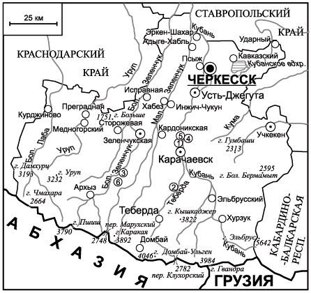
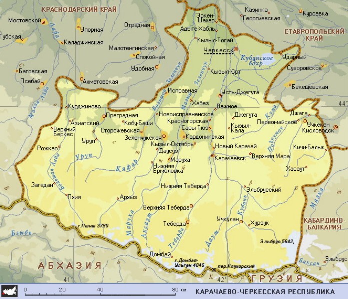
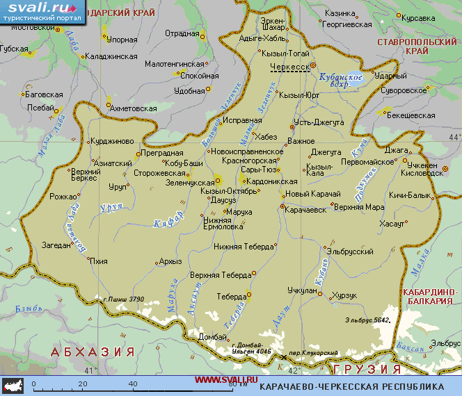
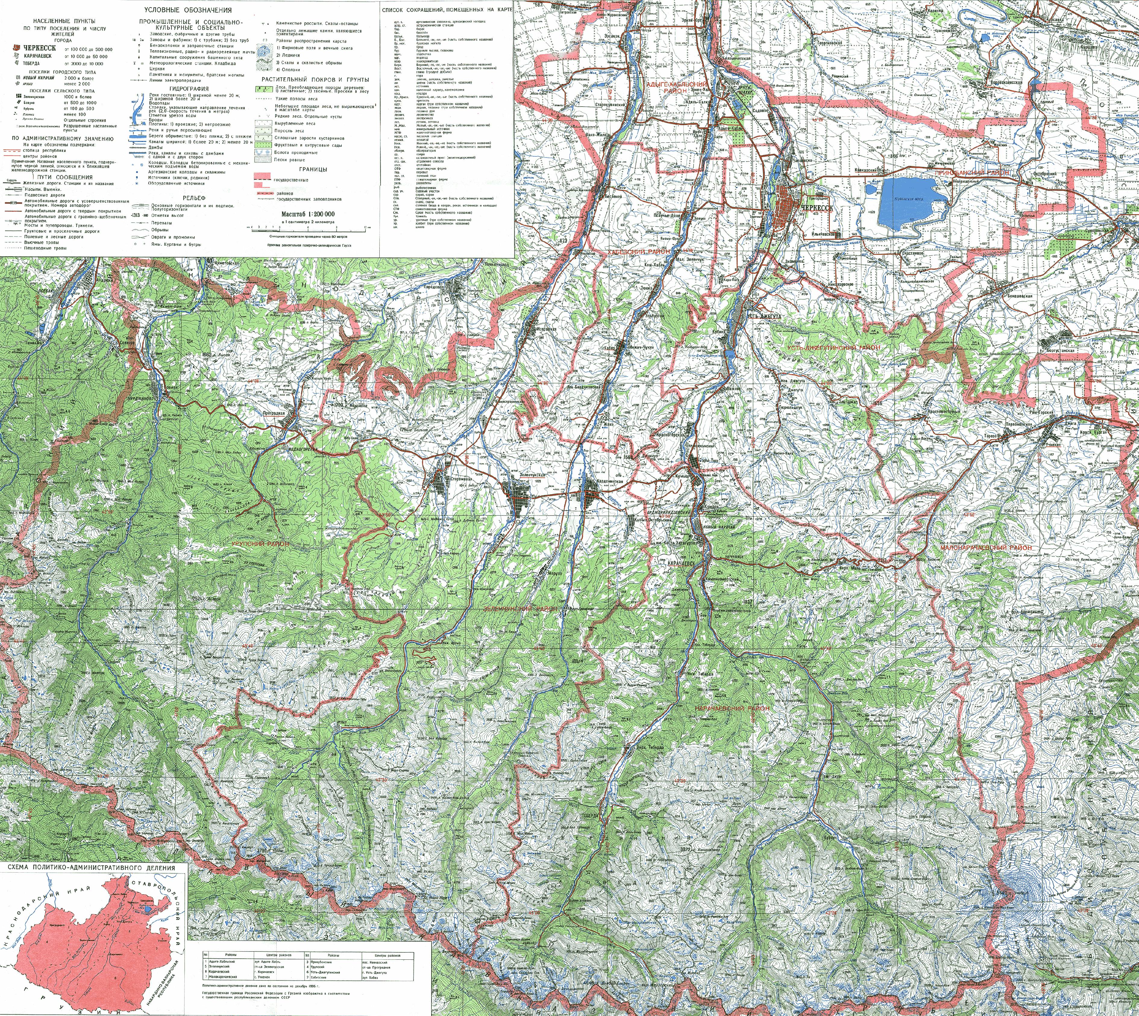
- English: Map of Karachay-Cherkessia (Federal subject - republic), in southwestern Russia, with locations of principal cities and towns, and district seats.
Source and license

|
This map has been uploaded by Electionworld from en.wikipedia.org to enable the |
Map made by PANONIAN
| 이 작품은 저작자인 PANONIAN에 의해 퍼블릭 도메인으로 공개된 작품입니다. 이 공개 선언은 전 세계적으로 유효합니다. 만약 저작권의 포기가 법률적으로 가능하지 않은 경우, |
References
Maps from external links:
- http://geo.1september.ru/2008/20/20-1.jpg
- http://www.circassianworld.com/Karachaycherkessia2a.jpg
- http://maps.at.ua/karta/Karachaevo-Cherkesskaya_Resp.jpg
- http://www.svali.ru/pic/pictures/73/r_m_31a01baaeeb343ef31cb70298f500238.png
- http://www.4kurorta.info/map/kchr.jpg
- http://www.circassianworld.com/karachaycherkessia1a.jpg
- http://map-site.narod.ru/karachcherkes-1.jpg
- http://files.vector-images.com/clipart/kchr_map.gif
- http://caucasus.org.ge/_Caucasusorg/Image/Cau_IMGS/kch_map.jpg
- http://myireg.ru/wp-content/uploads/2011/12/Karachaevo-CHerkesiya-1.png
- http://img.beta.rian.ru/images/42648/46/426484699.jpg
List of largest cities and towns:
파일 역사
날짜/시간 링크를 클릭하면 해당 시간의 파일을 볼 수 있습니다.
| 날짜/시간 | 섬네일 | 크기 | 사용자 | 설명 | |
|---|---|---|---|---|---|
| 현재 | 2023년 2월 21일 (화) 23:15 | | 908 × 869 (67 KB) | Shibbolet3579 | Even if international law and the UN count less nowadays, we differentiated the international border from the limits of the autonomous republics |
| 2012년 6월 11일 (월) 06:42 |  | 908 × 869 (66 KB) | PANONIAN | improved my own work. new map version also include changes from file version uploaded by user:Iltever (more cities and more accurate borders) | |
| 2010년 7월 13일 (화) 21:39 |  | 848 × 758 (32 KB) | Ernác | new | |
| 2006년 12월 30일 (토) 01:09 |  | 707 × 607 (24 KB) | Electionworld | {{ew|en|PANONIAN}} Map made by PANONIAN {{PD-user|PANONIAN}} Category:Maps of the Russian republics |
이 파일을 사용하는 문서
다음 문서 1개가 이 파일을 사용하고 있습니다:
이 파일을 사용하고 있는 모든 위키의 문서 목록
다음 위키에서 이 파일을 사용하고 있습니다:
- ace.wikipedia.org에서 이 파일을 사용하고 있는 문서 목록
- be-tarask.wikipedia.org에서 이 파일을 사용하고 있는 문서 목록
- bs.wikipedia.org에서 이 파일을 사용하고 있는 문서 목록
- da.wikipedia.org에서 이 파일을 사용하고 있는 문서 목록
- en.wikipedia.org에서 이 파일을 사용하고 있는 문서 목록
- eo.wikipedia.org에서 이 파일을 사용하고 있는 문서 목록
- eu.wikipedia.org에서 이 파일을 사용하고 있는 문서 목록
- fa.wikipedia.org에서 이 파일을 사용하고 있는 문서 목록
- fi.wikipedia.org에서 이 파일을 사용하고 있는 문서 목록
- fr.wikipedia.org에서 이 파일을 사용하고 있는 문서 목록
- gag.wikipedia.org에서 이 파일을 사용하고 있는 문서 목록
- ga.wikipedia.org에서 이 파일을 사용하고 있는 문서 목록
- hi.wikipedia.org에서 이 파일을 사용하고 있는 문서 목록
- hr.wikipedia.org에서 이 파일을 사용하고 있는 문서 목록
- id.wikipedia.org에서 이 파일을 사용하고 있는 문서 목록
- it.wikipedia.org에서 이 파일을 사용하고 있는 문서 목록
- ja.wikipedia.org에서 이 파일을 사용하고 있는 문서 목록
- ka.wikipedia.org에서 이 파일을 사용하고 있는 문서 목록
- kbd.wikipedia.org에서 이 파일을 사용하고 있는 문서 목록
- koi.wikipedia.org에서 이 파일을 사용하고 있는 문서 목록
- kv.wikipedia.org에서 이 파일을 사용하고 있는 문서 목록
- mk.wikipedia.org에서 이 파일을 사용하고 있는 문서 목록
- mr.wikipedia.org에서 이 파일을 사용하고 있는 문서 목록
- ms.wikipedia.org에서 이 파일을 사용하고 있는 문서 목록
- nl.wikipedia.org에서 이 파일을 사용하고 있는 문서 목록
- nn.wikipedia.org에서 이 파일을 사용하고 있는 문서 목록
- no.wikipedia.org에서 이 파일을 사용하고 있는 문서 목록
- pl.wikipedia.org에서 이 파일을 사용하고 있는 문서 목록
- pnb.wikipedia.org에서 이 파일을 사용하고 있는 문서 목록
- pt.wikipedia.org에서 이 파일을 사용하고 있는 문서 목록
- ro.wikipedia.org에서 이 파일을 사용하고 있는 문서 목록
- sah.wikipedia.org에서 이 파일을 사용하고 있는 문서 목록
- sco.wikipedia.org에서 이 파일을 사용하고 있는 문서 목록
- se.wikipedia.org에서 이 파일을 사용하고 있는 문서 목록
- sh.wikipedia.org에서 이 파일을 사용하고 있는 문서 목록
- sk.wikipedia.org에서 이 파일을 사용하고 있는 문서 목록
- sl.wikipedia.org에서 이 파일을 사용하고 있는 문서 목록
- sq.wikipedia.org에서 이 파일을 사용하고 있는 문서 목록
- sr.wikipedia.org에서 이 파일을 사용하고 있는 문서 목록
- su.wikipedia.org에서 이 파일을 사용하고 있는 문서 목록
- sv.wikipedia.org에서 이 파일을 사용하고 있는 문서 목록
- ta.wikipedia.org에서 이 파일을 사용하고 있는 문서 목록
- tr.wikipedia.org에서 이 파일을 사용하고 있는 문서 목록
- udm.wikipedia.org에서 이 파일을 사용하고 있는 문서 목록
- ug.wikipedia.org에서 이 파일을 사용하고 있는 문서 목록
- uk.wikipedia.org에서 이 파일을 사용하고 있는 문서 목록
- war.wikipedia.org에서 이 파일을 사용하고 있는 문서 목록
- zh.wikipedia.org에서 이 파일을 사용하고 있는 문서 목록