
파일:Island of Ireland location map Londonderry.svg

SVG 파일의 PNG 형식의 미리보기 크기: 796 × 599 픽셀. 다른 해상도: 319 × 240 픽셀 | 638 × 480 픽셀 | 1,020 × 768 픽셀 | 1,280 × 964 픽셀 | 2,560 × 1,928 픽셀 | 931 × 701 픽셀
원본 파일 (SVG 파일, 실제 크기 931 × 701 픽셀, 파일 크기: 826 KB)
| 설명 |
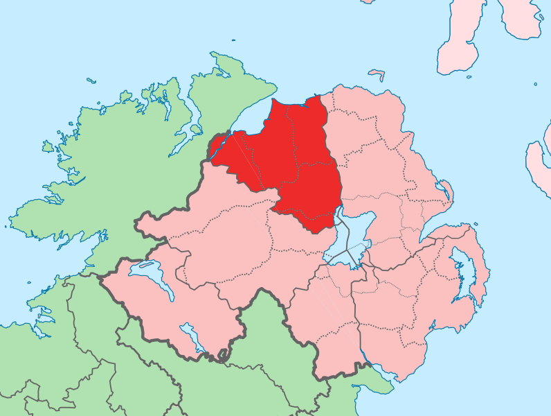
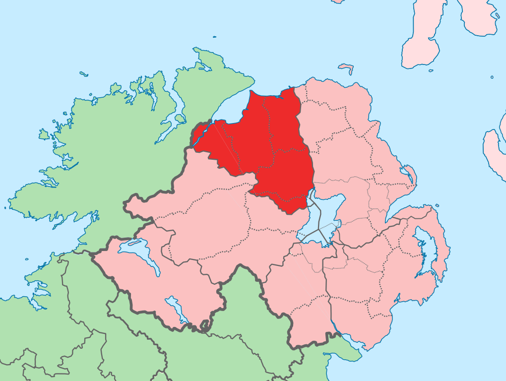
English: The island of Ireland, showing international border between Ireland and Northern Ireland, traditional provinces, traditional counties, and local authority areas in Ireland and Northern Ireland. |
| 날짜 | (UTC) |
| 출처 | |
| 저자 |
|
| 이 그림은 수정된 그림으로, 원래 그림에서 디지털 변환이 이루어진 그림입니다. 수정 사항 : Added colours to distinguish county in focus. 원래의 그림 : Island of Ireland location map.svg:
|
나는 아래 작품의 저작권자로서, 이 저작물을 다음과 같은 라이선스로 배포합니다:
이 파일은 크리에이티브 커먼즈 저작자표시-동일조건변경허락 3.0 Unported 라이선스로 배포됩니다.
- 이용자는 다음의 권리를 갖습니다:
- 공유 및 이용 – 저작물의 복제, 배포, 전시, 공연 및 공중송신
- 재창작 – 저작물의 개작, 수정, 2차적저작물 창작
- 다음과 같은 조건을 따라야 합니다:
- 저작자표시 – 적절한 저작자 표시를 제공하고, 라이센스에 대한 링크를 제공하고, 변경사항이 있는지를 표시해야 합니다. 당신은 합리적인 방식으로 표시할 수 있지만, 어떤 방식으로든 사용권 허가자가 당신 또는 당신의 사용을 지지하는 방식으로 표시할 수 없습니다.
- 동일조건변경허락 – 만약 당신이 이 저작물을 리믹스 또는 변형하거나 이 저작물을 기반으로 제작하는 경우, 당신은 당신의 기여물을 원저작물과 동일하거나 호환 가능한 라이선스에 따라 배포하여야 합니다.
기존 올리기 기록
This image is a derivative work of the following images:
- File:Island_of_Ireland_location_map.svg licensed with Cc-by-sa-3.0
- 2010-03-06T20:43:33Z Rannpháirtí anaithnid 1450x1807 (679207 Bytes) Fix incorrectly coloured isands.
- 2010-03-03T22:19:29Z Rannpháirtí anaithnid 1450x1807 (679744 Bytes) {{Information |Description={{de|Positionskarte von [[:de:Irland|Irland]]}} Quadratische Plattkarte, N-S-Streckung 170 %. Geographische Begrenzung der Karte: * N: 55.6° N * S: 51.2° N * W: 11.0° W * O: 5.0° W {{en|Location
Uploaded with derivativeFX
파일 역사
날짜/시간 링크를 클릭하면 해당 시간의 파일을 볼 수 있습니다.
| 날짜/시간 | 섬네일 | 크기 | 사용자 | 설명 | |
|---|---|---|---|---|---|
| 현재 | 2010년 7월 19일 (월) 22:14 | | 931 × 701 (826 KB) | Mabuska | another attempt |
| 2010년 7월 19일 (월) 22:07 |  | 931 × 701 (826 KB) | Mabuska | attempt to fix boundary issues | |
| 2010년 7월 19일 (월) 20:36 |  | 934 × 717 (828 KB) | Mabuska | {{Information |Description={{en|The island of Ireland, showing international border between Northern Ireland and Republic of Ireland, traditional provinces, traditional counties, and local authority areas in the Republic of Ireland and Northern Ireland.}} |
이 파일을 사용하는 문서
다음 문서 1개가 이 파일을 사용하고 있습니다:
이 파일을 사용하고 있는 모든 위키의 문서 목록
다음 위키에서 이 파일을 사용하고 있습니다:
- an.wikipedia.org에서 이 파일을 사용하고 있는 문서 목록
- bg.wikipedia.org에서 이 파일을 사용하고 있는 문서 목록
- cs.wikipedia.org에서 이 파일을 사용하고 있는 문서 목록
- de.wikipedia.org에서 이 파일을 사용하고 있는 문서 목록
- en.wikipedia.org에서 이 파일을 사용하고 있는 문서 목록
- Derry
- County Londonderry
- Limavady
- Dungiven
- Sperrins
- Coleraine
- Portstewart
- Moneymore
- Draperstown
- List of Ireland-related topics
- Maghera
- Corick
- Magilligan
- Lough Foyle
- List of places in Northern Ireland
- Magherafelt
- Bogside
- Free Derry Corner
- List of places in County Londonderry
- Ballynahone Bog
- Binevenagh
- Castledawson
- Glenshane Pass
- Drumsurn
- Ballykelly, County Londonderry
- Swatragh
- Castlerock
- Newbuildings
- Ballynagalliagh
- Shantallow
- Eglinton, County Londonderry
- Claudy
- Articlave
- Bellaghy
- Clady, County Londonderry
- Culmore
- Burnfoot, County Londonderry
- Downhill, County Londonderry
- Feeny
- Garvagh
- Greysteel
- Kilrea
- Lettershandoney
- Macosquin
- Strathfoyle
- Tobermore
이 파일의 더 많은 사용 내역을 봅니다.