
파일:Hurricane Jova Oct 10 2011 1740Z.jpg

미리 보기 크기: 600 × 600 픽셀 다른 해상도: 240 × 240 픽셀 | 480 × 480 픽셀 | 768 × 768 픽셀 | 1,024 × 1,024 픽셀 | 2,048 × 2,048 픽셀 | 5,760 × 5,760 픽셀
원본 파일 (5,760 × 5,760 픽셀, 파일 크기: 4.18 MB, MIME 종류: image/jpeg)
파일 설명
| 설명 |
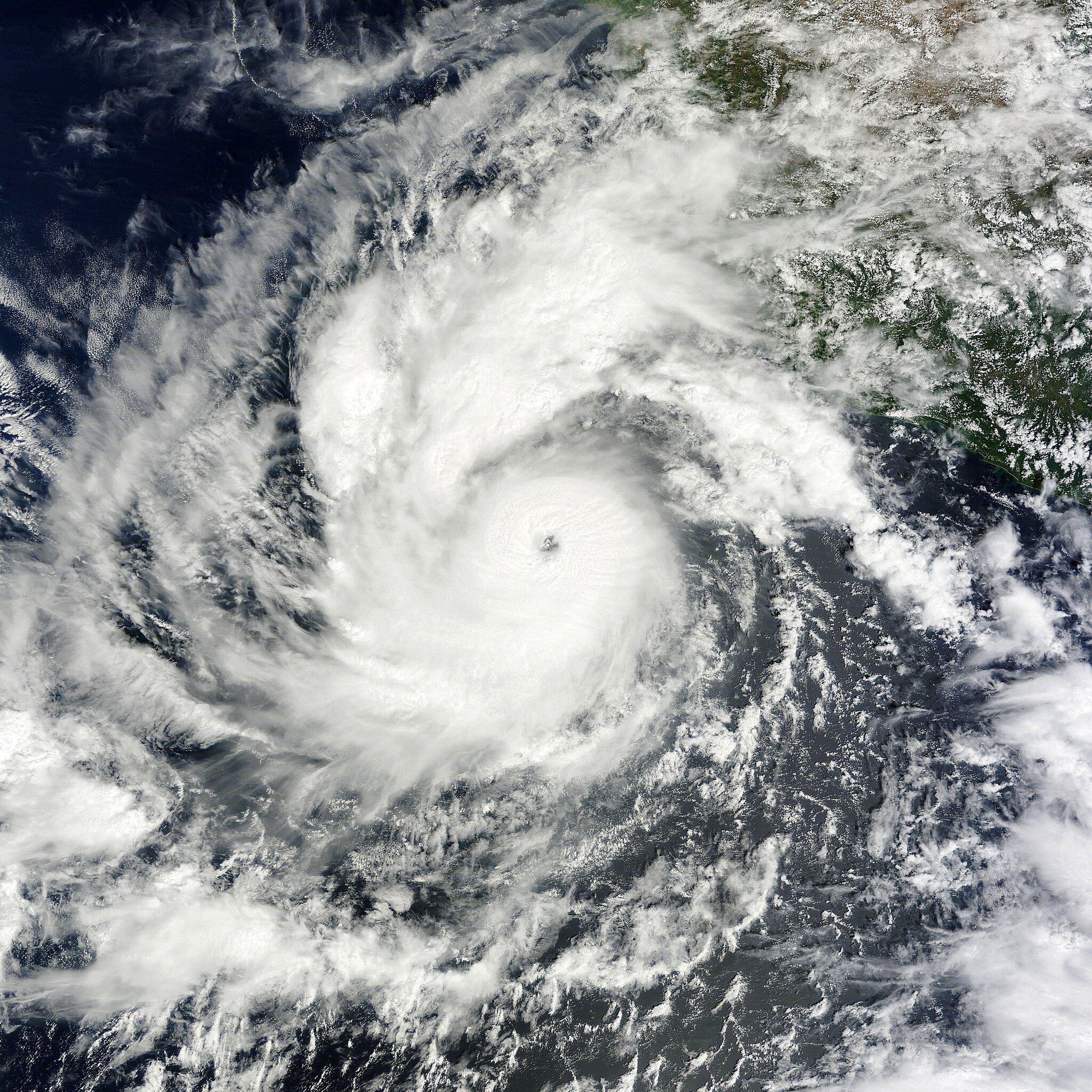
English: On October 6, 2011, a tropical depression over the eastern Pacific Ocean strengthened into Tropical Storm Jova. On October 8, it became a hurricane. By 11:00 a.m. Pacific Daylight Time (PDT) on October 10, 2011, the U.S. National Hurricane Center (NHC) reported that Jova was a Category 3 storm headed for the southwestern coast of Mexico.
The Moderate Resolution Imaging Spectroradiometer (MODIS) on NASA’s Terra satellite captured this natural-color image at 10:40 a.m. Pacific Daylight Time on October 10, 2011. Jova sports the spiral shape and distinct eye characteristic of strong storms. In the northeast quadrant, the storm’s clouds graze the coast of Mexico. As of 11:00 a.m. PDT on October 10, Jova had maximum sustained winds of 125 miles (205 kilometers) per hour, and was located roughly 220 miles (255 kilometers) southwest of Manzanillo, Mexico. A hurricane warning was in effect from Punta San Telmo north to Cabo Corrientes, and a tropical storm warning was in effect for Lazaro Cardenas north to Punta San Telmo. The NHC stated that the storm could become a Category 4 hurricane before making landfall on October 11. |
| 날짜 | |
| 출처 | http://earthobservatory.nasa.gov/NaturalHazards/view.php?id=73873 |
| 저자 | NASA image courtesy MODIS Rapid Response Team, Goddard Space Flight Center. Caption by Michon Scott. |
라이선스
| 이 파일은 NASA에서 제작하였으므로 퍼블릭 도메인입니다. NASA의 저작권 정책에 따르면 NASA의 자료는 명시하지 않는 이상 저작권의 보호를 받지 않습니다. (Template:PD-USGov, 또는 NASA 저작권 정책 문서, JPL 그림 사용 정책을 참고하세요.) | ||
 |
주의사항:
|
파일 역사
날짜/시간 링크를 클릭하면 해당 시간의 파일을 볼 수 있습니다.
| 날짜/시간 | 섬네일 | 크기 | 사용자 | 설명 | |
|---|---|---|---|---|---|
| 현재 | 2019년 1월 7일 (월) 06:45 | | 5,760 × 5,760 (4.18 MB) | David Levy | cropped |
| 2011년 10월 11일 (화) 05:59 |  | 5,760 × 6,000 (4.67 MB) | Supportstorm | {{Information |Description ={{en|1=Hurricane Jova on October 10, 2011}} |Source =http://lance-modis.eosdis.nasa.gov/wms/?zoom=5&lat=19.20117&lon=-105.74414&layers=B0000FFFFFFT&datum1=10/10/2011 |Author =NASA, MODIS Rapid Response System |
이 파일을 사용하는 문서
다음 문서 1개가 이 파일을 사용하고 있습니다:
이 파일을 사용하고 있는 모든 위키의 문서 목록
다음 위키에서 이 파일을 사용하고 있습니다:
- de.wikipedia.org에서 이 파일을 사용하고 있는 문서 목록
- en.wikipedia.org에서 이 파일을 사용하고 있는 문서 목록
- zh.wikipedia.org에서 이 파일을 사용하고 있는 문서 목록