
파일:Hampshire UK location map.svg

SVG 파일의 PNG 형식의 미리보기 크기: 704 × 599 픽셀. 다른 해상도: 282 × 240 픽셀 | 564 × 480 픽셀 | 902 × 768 픽셀 | 1,203 × 1,024 픽셀 | 2,406 × 2,048 픽셀 | 1,425 × 1,213 픽셀
원본 파일 (SVG 파일, 실제 크기 1,425 × 1,213 픽셀, 파일 크기: 2.35 MB)
| 설명 |
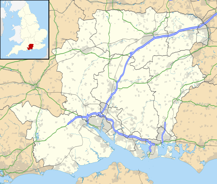
Map of Hampshire, UK with the following information shown:
Equirectangular map projection on WGS 84 datum, with N/S stretched 155% Geographic limits:
|
| 날짜 | |
| 출처 |
|
| 저자 | Nilfanion, created using Ordnance Survey data |
| 저작권 (이 파일을 인용하기) |
이 파일은 크리에이티브 커먼즈 저작자표시-동일조건변경허락 3.0 Unported 라이선스로 배포됩니다. 저작자표시: Contains Ordnance Survey data © Crown copyright and database right
|
| 다른 버전 | File:Hampshire UK district map (blank).svg - Blank map |
.svg)
파일 역사
날짜/시간 링크를 클릭하면 해당 시간의 파일을 볼 수 있습니다.
| 날짜/시간 | 섬네일 | 크기 | 사용자 | 설명 | |
|---|---|---|---|---|---|
| 현재 | 2010년 9월 27일 (월) 03:55 | | 1,425 × 1,213 (2.35 MB) | Nilfanion | {{Information |Description=Map of Hampshire, UK with the following information shown: *Administrative borders *Coastline, lakes and rivers *Roads and railways *Urban areas Equirectangular map projection on WGS 84 datum, with N/S stretched |
이 파일을 사용하는 문서
다음 문서 1개가 이 파일을 사용하고 있습니다:
이 파일을 사용하고 있는 모든 위키의 문서 목록
다음 위키에서 이 파일을 사용하고 있습니다:
- ar.wikipedia.org에서 이 파일을 사용하고 있는 문서 목록
- bg.wikipedia.org에서 이 파일을 사용하고 있는 문서 목록
- ceb.wikipedia.org에서 이 파일을 사용하고 있는 문서 목록
- en.wikipedia.org에서 이 파일을 사용하고 있는 문서 목록
- Emsworth
- Hayling Island
- Hampshire
- Waterlooville
- Winchester
- Beaulieu, Hampshire
- Southsea
- Domus Dei
- Winchester Cathedral
- Romsey Abbey
- Calleva Atrebatum
- Tadley
- National Motor Museum, Beaulieu
- Wickham, Hampshire
- Romsey
- Little London, Tadley, Hampshire
- Lovedean
- Farnborough, Hampshire
- Fleet, Hampshire
- Church Crookham
- Blackbushe Airport
- Havant
- Nursling
- Fordingbridge
- Southampton Airport
- Fareham
- Whale Island, Hampshire
- Basingstoke
- Aldershot
- Eastleigh
- Alton, Hampshire
- Andover, Hampshire
- Lymington
- Portchester
- Ringwood, Hampshire
- Yateley
- Chawton
- New Milton
- Brockenhurst
- Bishop's Waltham
- Portchester Castle
- Hythe, Hampshire
- Portsea Island
- RAF Odiham
- University of Portsmouth
- Stratfield Saye House
이 파일의 더 많은 사용 내역을 봅니다.