
파일:Flint River in Flint MIchigan.jpg
미리 보기 크기: 800 × 529 픽셀 다른 해상도: 320 × 211 픽셀 | 640 × 423 픽셀 | 1,024 × 677 픽셀 | 1,500 × 991 픽셀
원본 파일 (1,500 × 991 픽셀, 파일 크기: 479 KB, MIME 종류: image/jpeg)
| 설명 |
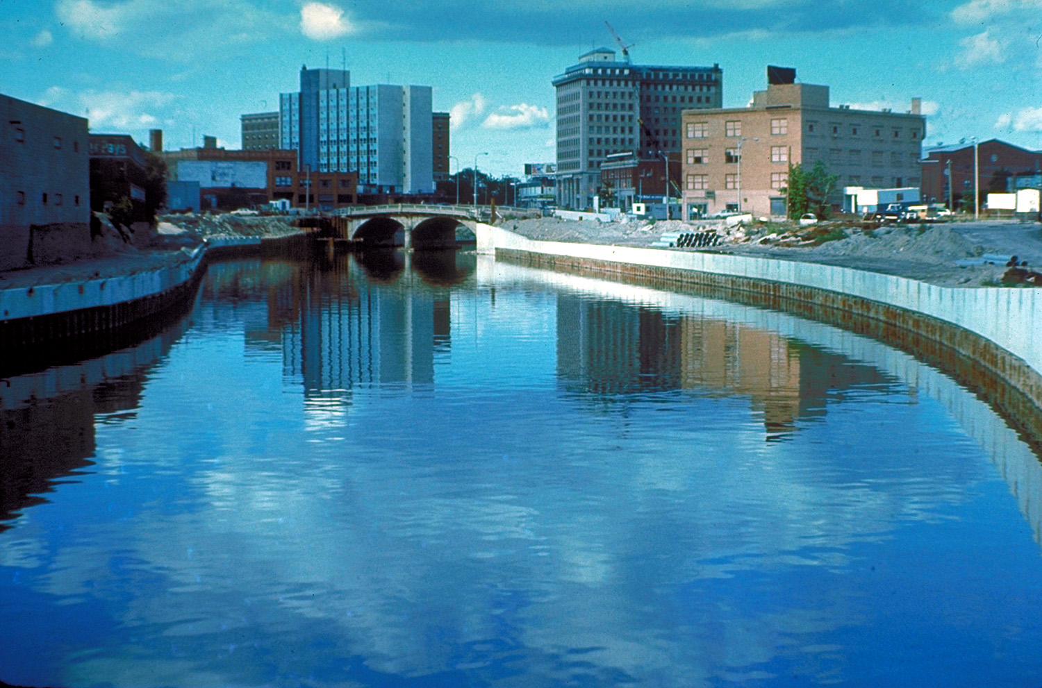
English: The Flint River in Flint, Michigan, USA, in the late 1970s during a U.S. Army Corps of Engineers flood control project, Taken from approximately halfway between the Grand Traverse Street bridge and Beach-Garland Street bridge, looking east. To the right in the distance is the former IMA Auditorium, later part of AutoWorld, demolished in 1997 to make way for an expansion of UM-Flint. The Northbank Center, to the right of the upper center of the photograph, is also now part of UM-Flint. |
|||
| 날짜 | 1979년경 | |||
| 출처 |
U.S. Army Corps of Engineers Digital Visual Library Image page Image description page Digital Visual Library home page |
|||
| 저자 | U.S. Army Corps of Engineers, photographer not specified or unknown | |||
| 저작권 (이 파일을 인용하기) |
|
|||
| 장소 | Flint, Michigan, USA |
| 카메라 위치 | | 이 지역의 다른 사진을 보기: OpenStreetMap |
|---|
파일 역사
날짜/시간 링크를 클릭하면 해당 시간의 파일을 볼 수 있습니다.
| 날짜/시간 | 섬네일 | 크기 | 사용자 | 설명 | |
|---|---|---|---|---|---|
| 현재 | 2007년 3월 29일 (목) 10:50 | | 1,500 × 991 (479 KB) | DanMS | {{Information | Description = {{en|The Flint River in Flint, Michigan, USA. The U.S. Army Corps of Engineers has constructed a flood control project in the city.}} | Source = U.S. Army Corps of Engineers Digital Visual Library<br />[http://imag |
이 파일을 사용하는 문서
다음 문서 1개가 이 파일을 사용하고 있습니다:
이 파일을 사용하고 있는 모든 위키의 문서 목록
다음 위키에서 이 파일을 사용하고 있습니다:
- br.wikipedia.org에서 이 파일을 사용하고 있는 문서 목록
- en.wikipedia.org에서 이 파일을 사용하고 있는 문서 목록
- eo.wikipedia.org에서 이 파일을 사용하고 있는 문서 목록
- es.wikipedia.org에서 이 파일을 사용하고 있는 문서 목록
- fa.wikipedia.org에서 이 파일을 사용하고 있는 문서 목록
- fr.wikipedia.org에서 이 파일을 사용하고 있는 문서 목록
- it.wikipedia.org에서 이 파일을 사용하고 있는 문서 목록
- lb.wikipedia.org에서 이 파일을 사용하고 있는 문서 목록
- mk.wikipedia.org에서 이 파일을 사용하고 있는 문서 목록
- oc.wikipedia.org에서 이 파일을 사용하고 있는 문서 목록
- ru.wikipedia.org에서 이 파일을 사용하고 있는 문서 목록
- sh.wikipedia.org에서 이 파일을 사용하고 있는 문서 목록
- sr.wikipedia.org에서 이 파일을 사용하고 있는 문서 목록