파일:Elymnias hypermnestra male by kadavoor.jpg

문서 내용이 다른 언어로는 지원되지 않습니다.
위키백과, 우리 모두의 백과사전.

원본 파일(2,560 × 1,920 픽셀, 파일 크기: 1.89 MB, MIME 종류: image/jpeg)

설명
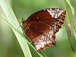
English: Elymnias caudata, Tailed Palmfly, is a species of satyrid butterfly found in South Asia.

This butterfly species is dimorphic, males and females do not look alike. Males exhibit black colored upperside forewings with small blue patches and reddish brown color on upperside hindwings, while the females mimic butterfly species of the genus Danaus.

Taken at Kadavoor, Kerala, India.
Français : Un Elymnias hypermnestra caudata mâle des Ghâts occidentaux sur une feuille de cocotier, hôte habituel de sa larve.
മലയാളം: തെങ്ങോലയിൽ ഇരിക്കുന്ന ഓലക്കണ്ടൻ ആൺശലഭം. എറണാകുളം ജില്ലയിലെ കടവൂര് നിന്നുമെടുത്ത ചിത്രം.
날짜
출처 자작
저자 Jeevan Jose, Kerala, India
저작권
(이 파일을 인용하기)
I, Jeevan Jose, Kerala, India은(는) 아래 작품의 저작권자로서, 해당 저작물을 다음과 같은 라이선스로 배포합니다:
Creative Commons CC-Zero 이 파일은 크리에이티브 커먼즈 CC0 1.0 보편적 퍼블릭 도메인 귀속에 따라 이용할 수 있습니다.
저작물에 본 권리증서를 첨부한 자는 법률에서 허용하는 범위 내에서 저작인접권 및 관련된 모든 권리들을 포함하여 저작권법에 따라 전 세계적으로 해당 저작물에 대해 자신이 갖는 일체의 권리를 포기함으로써 저작물을 퍼블릭 도메인으로 양도하였습니다. 저작권자의 허락을 구하지 않아도 이 저작물을 상업적인 목적을 포함하여 모든 목적으로 복제, 수정·변경, 배포, 공연·실연할 수 있습니다.

Exceptions, Limitations, and Disclaimer of Warranties
Exceptions and Limitations:
  • Non-copyright restrictions:
  • Jurisdiction and legality of content: Publication of this media may be in violation of the laws of the country or jurisdiction from where you are viewing this information. I do not encourage the violation of any laws, and cannot be responsible for any violations of such laws, should you link to this media or use, reproduce or republish it.

Disclaimer of Warranties and Limitation of Liability:

  • I, the Licensor, to the extent possible, offer the Licensed Material as-is and as-available, and makes no representations or warranties of any kind concerning the Licensed Material, whether express, implied, statutory, or other. This includes, without limitation, warranties of title, merchantability, fitness for a particular purpose, non-infringement, absence of latent or other defects, accuracy, or the presence or absence of errors, whether or not known or discoverable.
  • Read the full legal code. The human-readable deed is a summary of, but not a replacement for, the legal code. It does not explain everything you need to know before using the licensed material. This deed highlights only some of the key features and terms of the actual license. It is not a license and has no legal value. You should carefully review all of the terms and conditions of the actual license before using the licensed material.
  • I can't offer you any legal advice. See the General Disclaimer, Terms of Use and Reuser's Guide for more information. Please seek a professional advice for the avoidance of doubt, where exceptions and limitations apply to your use, and this Public License does not apply.
  • The disclaimer of warranties and limitation of liability provided above shall be interpreted in a manner that, to the extent possible, most closely approximates an absolute disclaimer and waiver of all liability.

Note: To the extent possible, I, the Licensor waives the right to collect royalties from you for the exercise of the licensed rights, whether directly or through a collecting society under any voluntary, like Wikimedia. In all other cases I, the Licensor expressly reserves the right to collect such royalties. So feel free to mail or talk to me for an unprocessed media file or to get waived any of the restrictions stated above.

Thanks: Thanks for make use of my works; it is always appreciated.

An example on how to reuse this media:
© 2012 Jee & Rani Nature Photography (CC0 1.0)
다른 버전
카메라 위치10° 00′ 10.73″ N, 76° 44′ 00.52″ E Kartographer map based on OpenStreetMap.이 지역의 다른 사진을 보기: OpenStreetMapinfo

수상

Featured 모습
Quality 그림
Quality 그림

위키미디어 공용

이 파일은 위키미디어 공용 (알찬 그림)에서 알찬 이미지였으며 최우수 이미지 중 하나로 여겨집니다.
이 파일은 고화질 이미지 지침을 따르고 있는 고화질 이미지입니다.

비슷한 품질의 이미지를 알맞은 라이선스로 배포할 수 있다면, 파일을 올린 후에 저작권 태그를 붙여서 후보로 등록 해주세요.

This image was selected as picture of the day on Bengali Wikipedia.

설명

이 파일이 나타내는 바에 대한 한 줄 설명을 추가합니다

10°0'10.732"N, 76°44'0.521"E

0.008

f-number 영어

5.6

86.4 밀리미터

ISO speed 영어

400

파일 역사

날짜/시간 링크를 클릭하면 해당 시간의 파일을 볼 수 있습니다.

날짜/시간섬네일크기사용자설명
현재2012년 10월 11일 (목) 16:482012년 10월 11일 (목) 16:48 판의 섬네일2,560 × 1,920 (1.89 MB)JkadavoorUser created page with UploadWizard

다음 문서 1개가 이 파일을 사용하고 있습니다:

이 파일을 사용하고 있는 모든 위키의 문서 목록

다음 위키에서 이 파일을 사용하고 있습니다:

메타데이터