
파일:1997 Red River Flood Grand Forks.jpg
미리 보기 크기: 757 × 600 픽셀 다른 해상도: 303 × 240 픽셀 | 606 × 480 픽셀 | 970 × 768 픽셀 | 1,280 × 1,014 픽셀 | 1,500 × 1,188 픽셀
원본 파일 (1,500 × 1,188 픽셀, 파일 크기: 812 KB, MIME 종류: image/jpeg)
| 설명 |
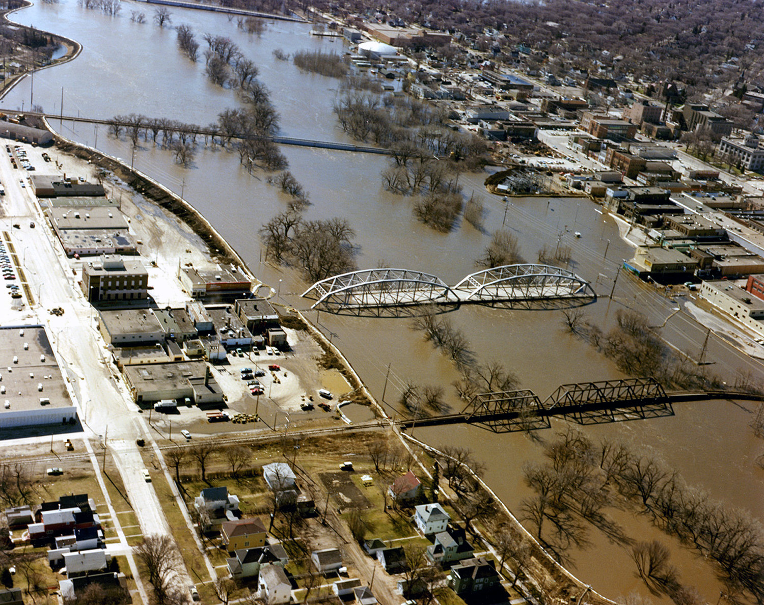
English: The Red River in flood in April or May 1997 in Grand Forks, North Dakota and East Grand Forks, Minnesota. |
|||
| 날짜 | ||||
| 출처 |
U.S. Army Corps of Engineers Digital Visual Library Image page Image description page Digital Visual Library home page |
|||
| 저자 | Ken Gardner, U.S. Army Corps of Engineers | |||
| 저작권 (이 파일을 인용하기) |
|
|||
| 장소 | Grand Forks, North Dakota and East Grand Forks, Minnesota, USA |
| 카메라 위치 | | 이 지역의 다른 사진을 보기: OpenStreetMap |
|---|
파일 역사
날짜/시간 링크를 클릭하면 해당 시간의 파일을 볼 수 있습니다.
| 날짜/시간 | 섬네일 | 크기 | 사용자 | 설명 | |
|---|---|---|---|---|---|
| 현재 | 2016년 12월 5일 (월) 12:21 | | 1,500 × 1,188 (812 KB) | HopsonRoad | Improve color balance. |
| 2007년 4월 8일 (일) 03:52 |  | 1,500 × 1,188 (795 KB) | DanMS | {{Information | Description = {{en|The Red River in flood in April or May of 1997 in Grand Forks, North Dakota and East Grand Forks, Minnesota.}} | Source = U.S. Army Corps of Engineers Digital Visual Library<br />[http://images.usace.army.mil/ |
이 파일을 사용하는 문서
다음 문서 1개가 이 파일을 사용하고 있습니다:
이 파일을 사용하고 있는 모든 위키의 문서 목록
다음 위키에서 이 파일을 사용하고 있습니다:
- en.wikipedia.org에서 이 파일을 사용하고 있는 문서 목록
- es.wikipedia.org에서 이 파일을 사용하고 있는 문서 목록
- fo.wikipedia.org에서 이 파일을 사용하고 있는 문서 목록
- fr.wikipedia.org에서 이 파일을 사용하고 있는 문서 목록
- ja.wikipedia.org에서 이 파일을 사용하고 있는 문서 목록
- oc.wikipedia.org에서 이 파일을 사용하고 있는 문서 목록