
파일:Position of Waikato Region.png
최대 해상도입니다.
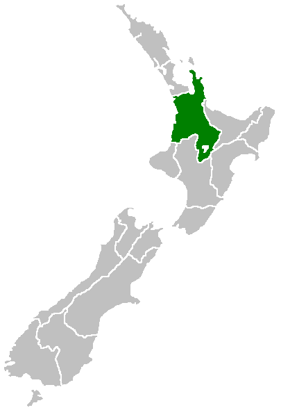
Position_of_Waikato_Region.png (405 × 590 픽셀, 파일 크기: 7 KB, MIME 종류: image/png)

|
이 그림 파일은 벡터 SVG 형식으로 다시 만들어야 합니다. SVG의 장점에 대해서는 여기(영어)를 참고해 주십시오. 만약 이 그림의 SVG 버전이 이미 존재한다면 이 틀을 {{vector version available|새 파일 이름.svg}}으로 대체해 주십시오.
|
Region of New Zealand, position on the map (source:English Wiki)
| |
이 작품은 위키미디어 공용의 Furius 사용자가 퍼블릭 도메인으로 공개한 작품입니다. 이 공개 선언은 전세계적으로 유효합니다. 만약 저작권의 포기가 법률적으로 가능하지 않은 경우, |
파일 역사
날짜/시간 링크를 클릭하면 해당 시간의 파일을 볼 수 있습니다.
| 날짜/시간 | 섬네일 | 크기 | 사용자 | 설명 | |
|---|---|---|---|---|---|
| 현재 | 2005년 4월 27일 (수) 16:41 | | 405 × 590 (7 KB) | Domie~commonswiki | Region of New Zealand, position on the map (source:English Wiki) {{PD}} Category:Maps of New Zealand |
이 파일을 사용하는 문서
다음 문서 2개가 이 파일을 사용하고 있습니다:
이 파일을 사용하고 있는 모든 위키의 문서 목록
다음 위키에서 이 파일을 사용하고 있습니다:
- en.wikipedia.org에서 이 파일을 사용하고 있는 문서 목록
- Mamaku Ranges
- Cape Colville
- Motukawao Islands
- Coromandel Range
- Slipper Island
- Lake Maraetai
- Lake Arapuni
- Lake Waikare
- Mangateparu
- Māhoenui
- Ōhakuri Dam
- Template:Waikato-geo-stub
- Huntly Power Station
- Lady Knox Geyser
- Horseshoe Lake (New Zealand)
- Lake Rotopounamu
- Awakino
- Kārewa / Gannet Island
- Waihi Village
- Hauauru ma raki
- Te Huka Power Station
- Portal:Monarchy
- Te Rapa cogeneration
- Te Mihi Power Station
- Wairakei Power Station
- Te Uku Wind Farm
- Aratiatia Power Station
- Ohaaki Power Station
- Poihipi Power Station
- Rotokawa Power Station
- Horahora Power Station
- Karāpiro Power Station
- Nga Awa Purua Power Station
- Madonna Falls
- Ben Lomond (Waikato)
- Tongariro Power Scheme
- Atiamuri Power Station
- Maraetai Power Station
- Arapuni Power Station
- Meremere Power Station
- Whakamaru Dam
- Wairere Falls
- Seabird Coast
- Ngatamariki Power Station
- Non-sovereign monarchy
- Whitianga Festival of Speed
- List of localities in Waikato
- Waikato County
- Hamilton Town Belt
- Grandview Heights, New Zealand
이 파일의 더 많은 사용 내역을 봅니다.