
파일:Pedra Branca Map.svg

SVG 파일의 PNG 형식의 미리보기 크기: 800 × 487 픽셀. 다른 해상도: 320 × 195 픽셀 | 640 × 390 픽셀 | 1,024 × 624 픽셀 | 1,280 × 779 픽셀 | 2,560 × 1,559 픽셀 | 3,478 × 2,118 픽셀
원본 파일 (SVG 파일, 실제 크기 3,478 × 2,118 픽셀, 파일 크기: 230 KB)
파일 설명
| 설명 |
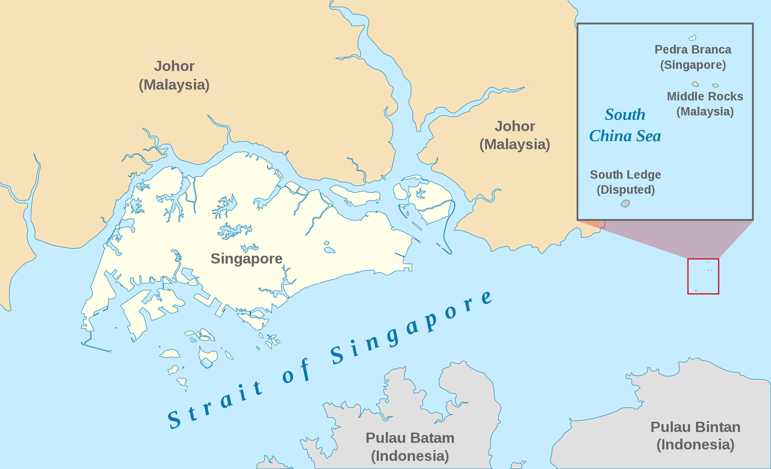
English: A map showing the approximate location of the island of Pedra Branca, which is under the sovereignty of Singapore, at the eastern end of the Singapore Strait where it meets the South China Sea. Near it are the maritime features Middle Rocks (under Malaysian sovereignty) and South Ledge, and the coasts of Johor, Malaysia, and Bintan, Indonesia. |
| 날짜 | |
| 출처 | Self-made, modified from Image:Singapore Outline.svg. |
| 저자 | Jappalang. |
| 저작권 (이 파일을 인용하기) |
PD-Self. |
라이선스
| 나는 이 작품의 저작권자로서, 이 작품을 퍼블릭 도메인으로 모두에게 공개합니다. 이 공개 선언은 전 세계적으로 유효합니다. 만약 저작권의 포기가 법률적으로 가능하지 않은 경우, 나는 이 작품을 법적으로 허용되는 한도 내에서 누구나 자유롭게 어떤 목적으로도 제한없이 사용할 수 있도록 허용합니다. |
파일 역사
날짜/시간 링크를 클릭하면 해당 시간의 파일을 볼 수 있습니다.
| 날짜/시간 | 섬네일 | 크기 | 사용자 | 설명 | |
|---|---|---|---|---|---|
| 현재 | 2021년 1월 13일 (수) 15:27 | | 3,478 × 2,118 (230 KB) | Seloloving | recoloured to Wikipedia map colour style |
| 2020년 2월 9일 (일) 18:59 |  | 3,478 × 2,118 (219 KB) | *angys* | File uploaded using svgtranslate tool (https://tools.wmflabs.org/svgtranslate/). Added translation for zh. | |
| 2017년 10월 22일 (일) 23:36 |  | 3,478 × 2,118 (208 KB) | Seloloving | Fixed spelling error with "Enlargement" | |
| 2017년 10월 22일 (일) 23:34 |  | 3,478 × 2,118 (208 KB) | Seloloving | Recolored claimant states to a more neutral colour. Shifted the Insert Map further up and added note to clarify its actual location. Changed fonts and colours to align with Wikipedia Map guidelines. | |
| 2014년 5월 25일 (일) 04:42 |  | 3,261 × 1,986 (194 KB) | Seloloving | Fixed text rendering. Fixed map. | |
| 2014년 5월 4일 (일) 14:36 |  | 3,261 × 1,986 (276 KB) | Seloloving | Fixed Johor's shape. | |
| 2014년 5월 4일 (일) 14:24 |  | 3,261 × 1,986 (274 KB) | Seloloving | Fixed font problems. | |
| 2014년 5월 4일 (일) 14:20 |  | 3,261 × 1,986 (273 KB) | Seloloving | Fixed problems. | |
| 2014년 5월 4일 (일) 14:12 |  | 3,261 × 1,986 (282 KB) | Seloloving | Fixed geography of the islands. | |
| 2008년 9월 30일 (화) 13:05 |  | 3,261 × 1,986 (396 KB) | Jappalang | "South Lodge" corrected to "South Ledge" |
이 파일을 사용하는 문서
다음 문서 1개가 이 파일을 사용하고 있습니다:
이 파일을 사용하고 있는 모든 위키의 문서 목록
다음 위키에서 이 파일을 사용하고 있습니다:
- de.wikipedia.org에서 이 파일을 사용하고 있는 문서 목록
- en.wikipedia.org에서 이 파일을 사용하고 있는 문서 목록
- es.wikipedia.org에서 이 파일을 사용하고 있는 문서 목록
- fr.wikipedia.org에서 이 파일을 사용하고 있는 문서 목록
- he.wikipedia.org에서 이 파일을 사용하고 있는 문서 목록
- id.wikipedia.org에서 이 파일을 사용하고 있는 문서 목록
- it.wikipedia.org에서 이 파일을 사용하고 있는 문서 목록
- ja.wikipedia.org에서 이 파일을 사용하고 있는 문서 목록
- mdf.wikipedia.org에서 이 파일을 사용하고 있는 문서 목록
- ms.wikipedia.org에서 이 파일을 사용하고 있는 문서 목록
- pt.wikipedia.org에서 이 파일을 사용하고 있는 문서 목록
- ru.wikipedia.org에서 이 파일을 사용하고 있는 문서 목록
- ta.wikipedia.org에서 이 파일을 사용하고 있는 문서 목록
- th.wikipedia.org에서 이 파일을 사용하고 있는 문서 목록
- vi.wikipedia.org에서 이 파일을 사용하고 있는 문서 목록
- zh.wikipedia.org에서 이 파일을 사용하고 있는 문서 목록