
파일:Melor 02 nov 2003 0220Z.jpg
미리 보기 크기: 800 × 600 픽셀 다른 해상도: 320 × 240 픽셀 | 640 × 480 픽셀 | 1,024 × 768 픽셀 | 1,280 × 960 픽셀 | 2,560 × 1,920 픽셀 | 4,800 × 3,600 픽셀
원본 파일 (4,800 × 3,600 픽셀, 파일 크기: 2.45 MB, MIME 종류: image/jpeg)
파일 설명
| 설명 |
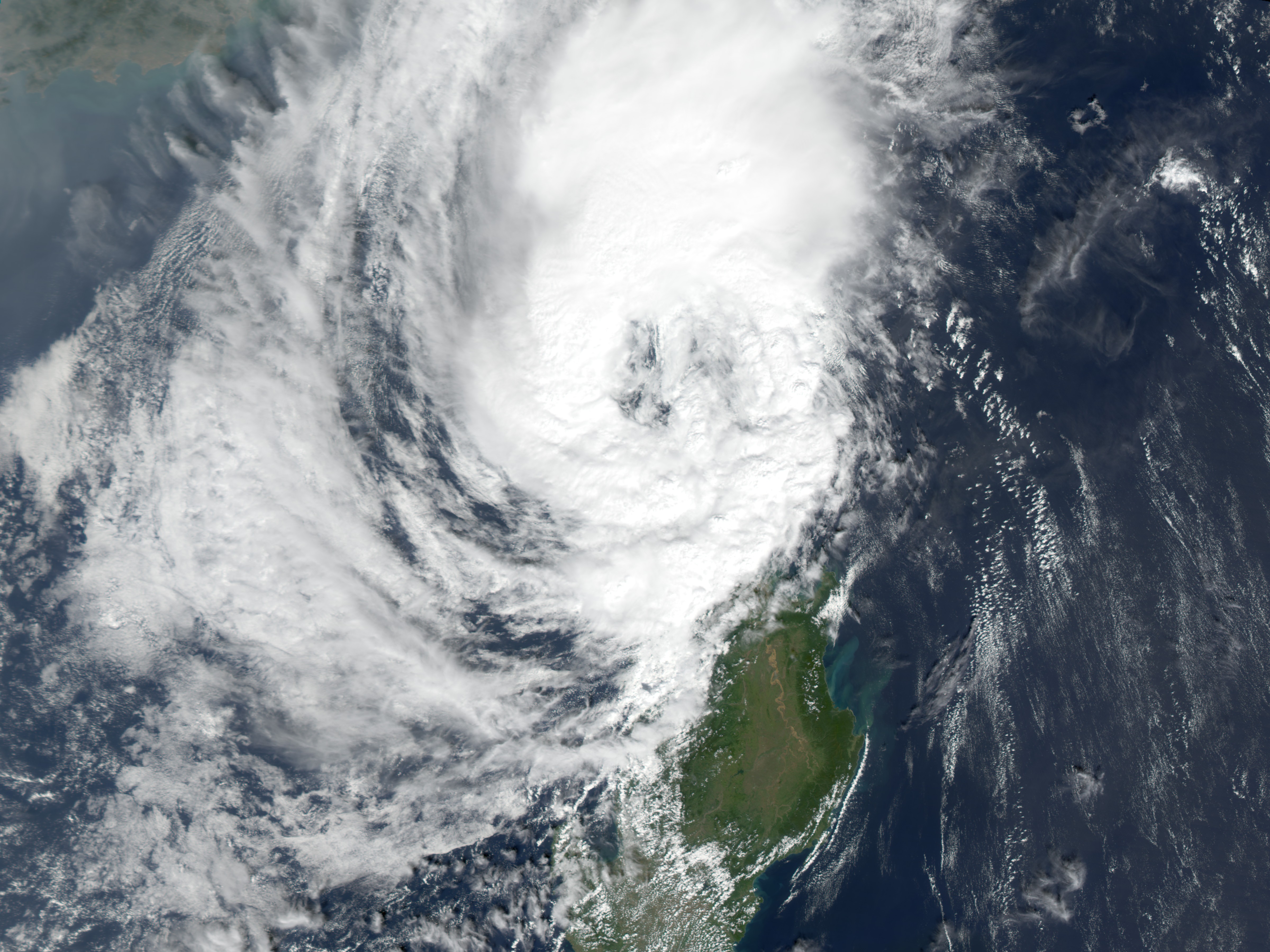
Typhoon Melor swept through the northern Philippines on November 1, 2003, bringing 85 mile-per-hour winds and up to six inches of rain to the northeastern shores of Luzon. The Moderate Resolution Imaging Spectroradiometer (MODIS) on the Terra satellite captured this image of the storm leaving the island on November 2, 2003. Flooding can clearly be seen in its wake. The Cargayan River, swollen and muddy with the storm’s run-off, is shown in the inset. According to news reports, at least four people died in the floods. The high resolution image provided above is at MODIS’ maximum spatial resolution of 250 meters per pixel. |
|||||
| 날짜 | ||||||
| 출처 | http://earthobservatory.nasa.gov/NaturalHazards/natural_hazards_v2.php3?img_id=11831 | |||||
| 저자 | Image courtesy Jesse Allen, based on data from the MODIS Rapid Response Team at NASA GSFC | |||||
| 저작권 (이 파일을 인용하기) |
|

파일 역사
날짜/시간 링크를 클릭하면 해당 시간의 파일을 볼 수 있습니다.
| 날짜/시간 | 섬네일 | 크기 | 사용자 | 설명 | |
|---|---|---|---|---|---|
| 현재 | 2006년 11월 28일 (화) 00:11 | | 4,800 × 3,600 (2.45 MB) | Good kitty | == Summary == {{Information |Description=Typhoon Melor swept through the northern Philippines on November 1, 2003, bringing 85 mile-per-hour winds and up to six inches of rain to the northeastern shores of Luzon. The Moderate Resolution Imaging Spectrorad |
이 파일을 사용하는 문서
이 파일을 사용하는 문서가 없습니다.