
파일:Lake Malawi seen from orbit.jpg
미리 보기 크기: 459 × 599 픽셀 다른 해상도: 184 × 240 픽셀 | 367 × 480 픽셀 | 588 × 768 픽셀 | 784 × 1,024 픽셀 | 1,568 × 2,048 픽셀 | 2,778 × 3,628 픽셀
원본 파일 (2,778 × 3,628 픽셀, 파일 크기: 3.24 MB, MIME 종류: image/jpeg)
파일 설명
| 설명 |
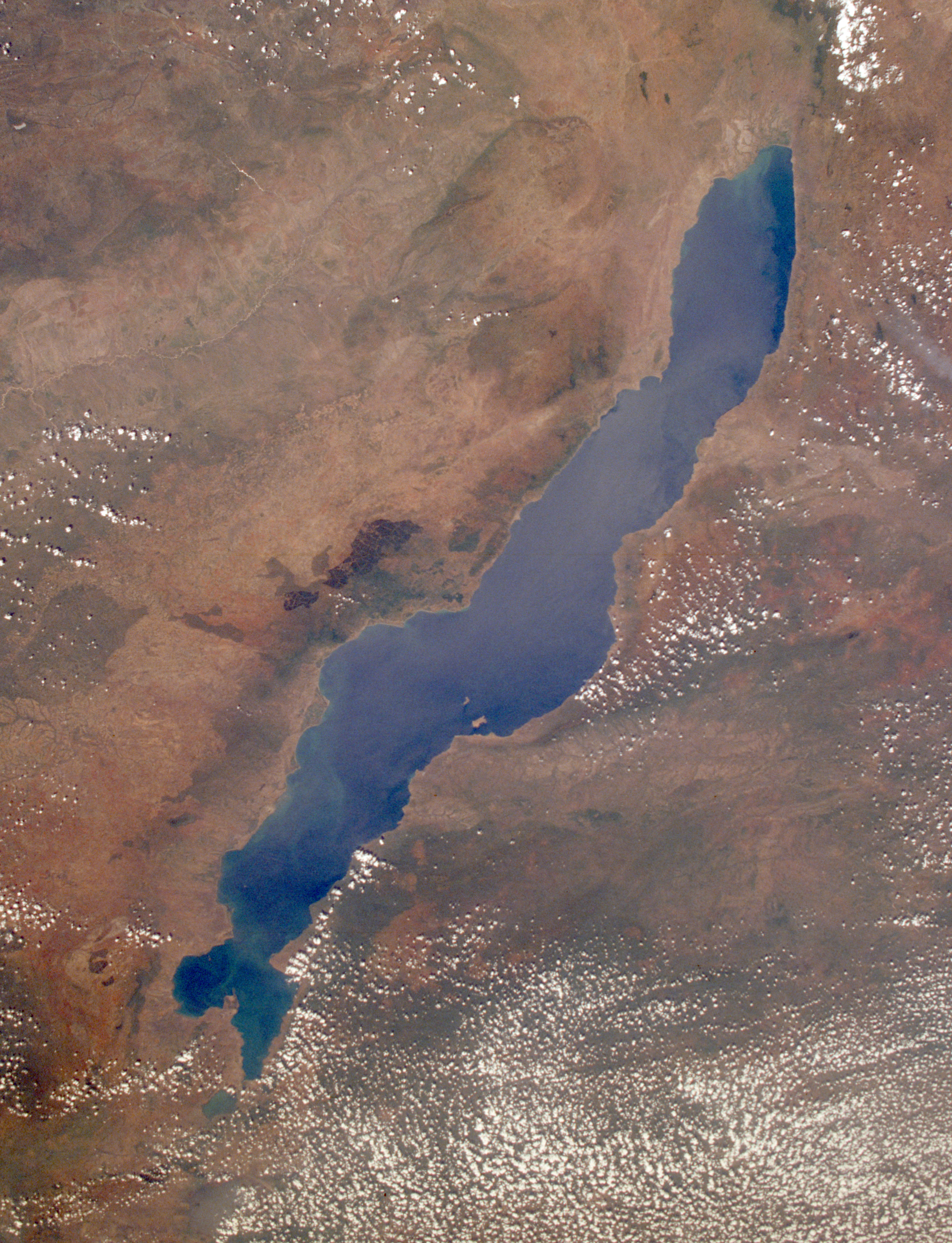
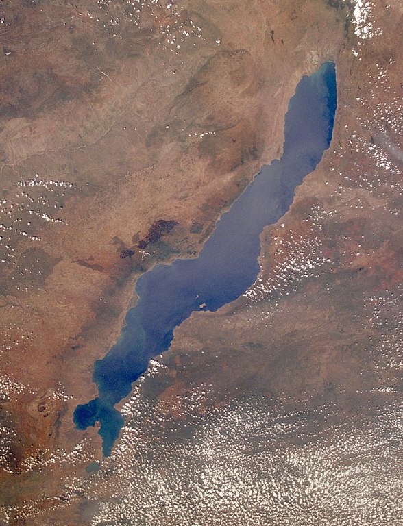
English: Leverkusen in Germany, photographed by astronauts aboard the Space Shuttle. Original image courtesy of the Image Analysis Laboratory, NASA Johnson Space Center (eol.jsc.nasa.gov). Image ID: STS061-75-48. Image cropped, sharpened and gamma-corrected.
|
| 날짜 | 촬영 날짜: 1998년 12월 3일, 09:49:31 UTC |
| 출처 | https://eol.jsc.nasa.gov/SearchPhotos/photo.pl?mission=STS061&roll=75&frame=48 |
| 저자 | National Aeronautics and Space Administration (NASA) |
| 다른 버전 |

This image or video was catalogued by Johnson Space Center of the United States National Aeronautics and Space Administration (NASA) under Photo ID: STS061-75-48. This tag does not indicate the copyright status of the attached work. A normal copyright tag is still required. See Commons:Licensing. Other languages:
|
라이선스
This file is in the public domain in the United States because it was created by the Image Science & Analysis Laboratory, of the NASA Johnson Space Center. NASA copyright policy states that "NASA material is not protected by copyright unless noted". (NASA media use guidelines or Conditions of Use of Astronaut Photographs).
Photo source: STS061-75-48.
|
기존 올리기 기록
Uploaded to en wiki by User:Worldtraveller; moved here by User:Tintazul. Full original description follows.
파일 역사
날짜/시간 링크를 클릭하면 해당 시간의 파일을 볼 수 있습니다.
| 날짜/시간 | 섬네일 | 크기 | 사용자 | 설명 | |
|---|---|---|---|---|---|
| 현재 | 2019년 8월 31일 (토) 04:17 | | 2,778 × 3,628 (3.24 MB) | Ras67 | high resolution, cropped and rotated from NASA's original TIFF |
| 2005년 11월 4일 (금) 21:27 |  | 768 × 1,000 (271 KB) | Tintazul | ''Uploaded to en wiki by User:Worldtraveller; moved here by User:Tintazul. Full original description follows.'' Lake Malawi in Africa, photographed by astronauts aboard the Space Shuttle. Original image courtesy of the Image Analysis Laboratory, |
이 파일을 사용하는 문서
다음 문서 1개가 이 파일을 사용하고 있습니다:
이 파일을 사용하고 있는 모든 위키의 문서 목록
다음 위키에서 이 파일을 사용하고 있습니다:
- af.wikipedia.org에서 이 파일을 사용하고 있는 문서 목록
- als.wikipedia.org에서 이 파일을 사용하고 있는 문서 목록
- ar.wikipedia.org에서 이 파일을 사용하고 있는 문서 목록
- arz.wikipedia.org에서 이 파일을 사용하고 있는 문서 목록
- az.wikipedia.org에서 이 파일을 사용하고 있는 문서 목록
- ba.wikipedia.org에서 이 파일을 사용하고 있는 문서 목록
- be-tarask.wikipedia.org에서 이 파일을 사용하고 있는 문서 목록
- be.wikipedia.org에서 이 파일을 사용하고 있는 문서 목록
- bg.wikipedia.org에서 이 파일을 사용하고 있는 문서 목록
- Dimidiochromis compressiceps
- Labeotropheus trewavasae
- Labidochromis caeruleus
- Maylandia aurora
- Maylandia barlowi
- Maylandia benetos
- Maylandia callainos
- Maylandia chrysomallos
- Maylandia elegans
- Maylandia emmiltos
- Maylandia hajomaylandi
- Maylandia heteropicta
- Maylandia mbenjii
- Maylandia melabranchion
- Maylandia phaeos
- Maylandia pursa
- Maylandia pyrsonotos
- Maylandia thapsinogen
- Melanochromis parallelus
- Nimbochromis linni
- Nimbochromis polystigma
- Otopharynx brooksi
- Otopharynx lithobates
- Otopharynx tetrastigma
- Placidochromis electra
- Placidochromis johnstoni
- Placidochromis phenochilus
- Protomelas spilonotus
이 파일의 더 많은 사용 내역을 봅니다.