
파일:Gallapagos Islands 1684.jpg
미리 보기 크기: 548 × 600 픽셀 다른 해상도: 219 × 240 픽셀 | 438 × 480 픽셀 | 701 × 768 픽셀 | 935 × 1,024 픽셀 | 1,845 × 2,020 픽셀
원본 파일 (1,845 × 2,020 픽셀, 파일 크기: 335 KB, MIME 종류: image/jpeg)
파일 설명
| 설명 |
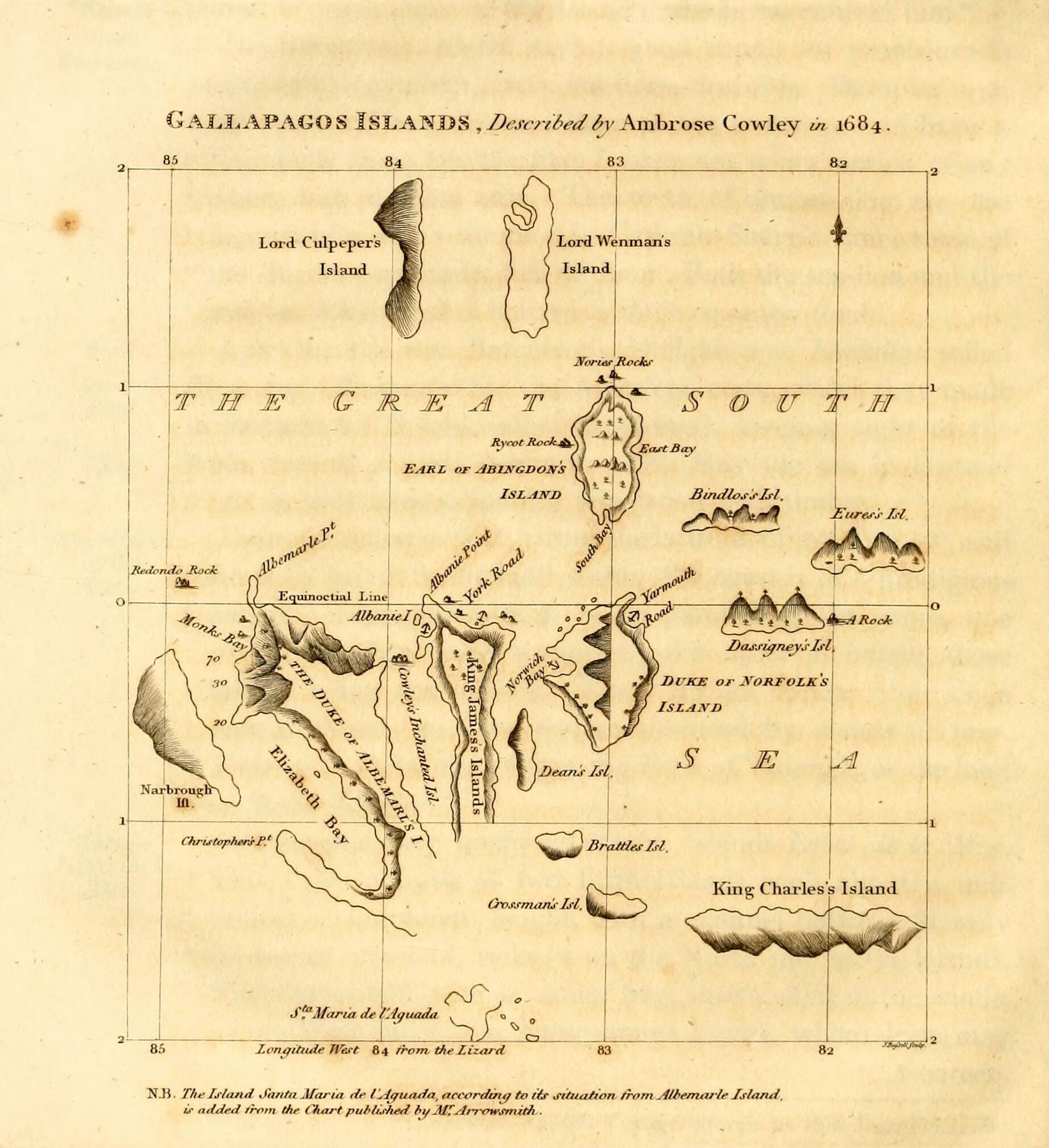
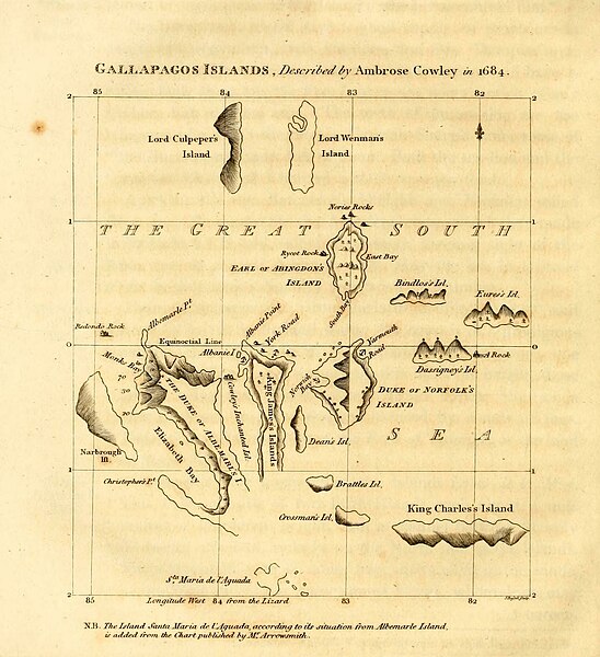
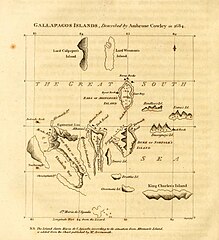
English: Galapagos Islands, described by Ambrose Cowley in 1684.
|
| 날짜 | 1816, revision of a 1684 map |
| 출처 | James Burney's A Chronological History of the Discoveries in the South Sea or Pacific Ocean, Vol. IV, p. 145. |
| 저자 | John Russell, based on an map by William Ambrosia Cowley with influence from Emanuel Bowen and William Arrowsmith's separate revisions |
라이선스
This media file is in the public domain in the United States. This applies to U.S. works where the copyright has expired, often because its first publication occurred prior to January 1, 1929, and if not then due to lack of notice or renewal. See this page for further explanation.
|
 | |
 |
This image might not be in the public domain outside of the United States; this especially applies in the countries and areas that do not apply the rule of the shorter term for US works, such as Canada, Mainland China (not Hong Kong or Macao), Germany, Mexico, and Switzerland. The creator and year of publication are essential information and must be provided. See Wikipedia:Public domain and Wikipedia:Copyrights for more details.
|
| 주석 | 이 이미지에는 주석이 있습니다: 공용에서 주석을 보기 |
파일 역사
날짜/시간 링크를 클릭하면 해당 시간의 파일을 볼 수 있습니다.
| 날짜/시간 | 섬네일 | 크기 | 사용자 | 설명 | |
|---|---|---|---|---|---|
| 현재 | 2023년 5월 12일 (금) 06:17 | | 1,845 × 2,020 (335 KB) | LlywelynII | Cropped using CropTool to the size of the actual map pasted onto the book page. |
| 2023년 5월 12일 (금) 06:13 |  | 2,148 × 2,892 (437 KB) | LlywelynII | Much higher quality version from archive.org copy of the work | |
| 2023년 5월 12일 (금) 05:10 |  | 672 × 845 (413 KB) | LlywelynII | Reverted to version as of 18:11, 11 November 2010 (UTC) These are completely different maps from different sources and the original shouldn't've been replaced. | |
| 2012년 9월 26일 (수) 04:12 |  | 2,357 × 3,831 (10.46 MB) | Jojagal | Mapa de las Islas Galápagos según el Capitán Cowley (1684) - AHG | |
| 2010년 11월 12일 (금) 03:11 |  | 672 × 845 (413 KB) | Alcmaeonid | {{Information |Description={{en|1=Map of the Galapagos Islands as described by Ambrose Cowlev in 1684.}} |Source=A chronological history of the discoveries in the South Sea or Pacific Ocean ; illustrated with charts volume 4 |Author=James Burney |Date=180 |
이 파일을 사용하는 문서
다음 문서 1개가 이 파일을 사용하고 있습니다:
이 파일을 사용하고 있는 모든 위키의 문서 목록
다음 위키에서 이 파일을 사용하고 있습니다:
- ast.wikipedia.org에서 이 파일을 사용하고 있는 문서 목록
- de.wikipedia.org에서 이 파일을 사용하고 있는 문서 목록
- en.wikipedia.org에서 이 파일을 사용하고 있는 문서 목록
- es.wikipedia.org에서 이 파일을 사용하고 있는 문서 목록
- fi.wikipedia.org에서 이 파일을 사용하고 있는 문서 목록
- fr.wikipedia.org에서 이 파일을 사용하고 있는 문서 목록
- mk.wikipedia.org에서 이 파일을 사용하고 있는 문서 목록
- pl.wikipedia.org에서 이 파일을 사용하고 있는 문서 목록
- stq.wikipedia.org에서 이 파일을 사용하고 있는 문서 목록
- zh.wikipedia.org에서 이 파일을 사용하고 있는 문서 목록